
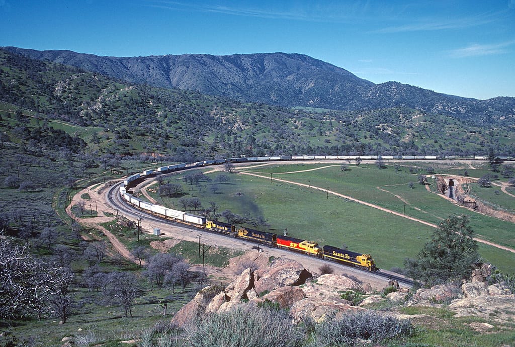
Tehachapi Loop
A 0.73-mile railroad spiral where trains cross over themselves gaining 77 feet in elevation — one of the most famous railfan destinations in the world.
Photos
+4 more photos
Trainspotting Experience
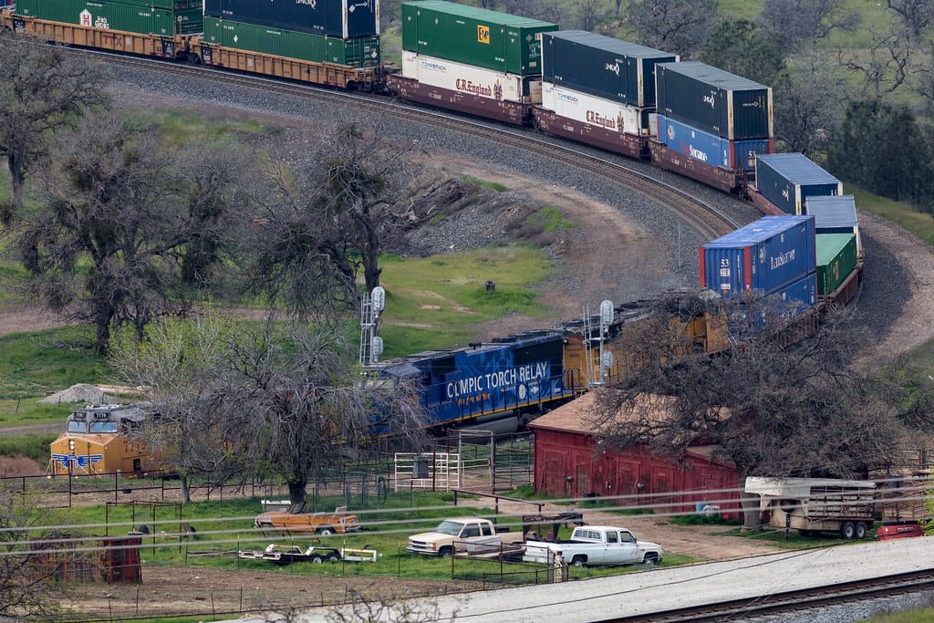
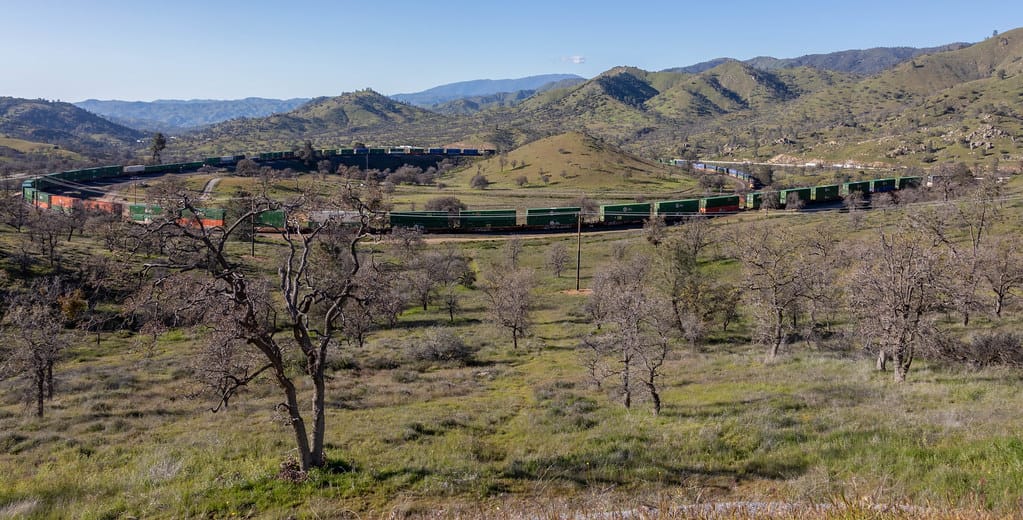
A typical visit rewards you with frequent, slow-to-moderate-speed trains laboring uphill at 10–20 mph and descending with dynamic brakes humming. Popular viewing points line the public shoulder along Woodford-Tehachapi Road and the dirt pull-off near the Loop Overlook sign. From these elevated perches you can watch an entire 6,000- to 8,000-foot consist snake around the loop, locomotives appearing above their own caboose-length of rear cars. Expect deep exhaust chuffs, flange squeal on tight curvature, and echoing horns across the basin. Because the grade is continuous, crews often add mid-train distributed power, giving railfans multiple sets of locomotives to admire. Nighttime visits reveal headlight beams carving the curve and red marker lights trailing below the bridge.
Landscape, Setting & Local Atmosphere
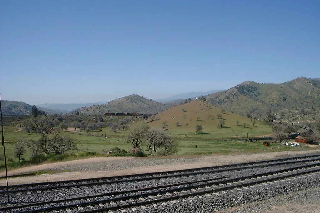
Set at roughly 4,000 feet above sea level, the Loop sits in the rain-shadow transition between the Mojave Desert and the green Kern County valleys. Rolling golden grasslands, scattered juniper, and gray pinyon pines blanket the dry hills, while spring brings pockets of wildflowers. The surrounding ridges frame wide blue skies and provide natural amphitheater acoustics for the locomotives. Summers are warm and breezy, often in the 80s °F, with crisp, clear light; winter can bring occasional dustings of snow and dramatic clouds. The rural tone is peaceful—aside from the railroad action—punctuated by distant cattle bells and the rustle of high-desert wind.
Type & Frequency of Train Activity
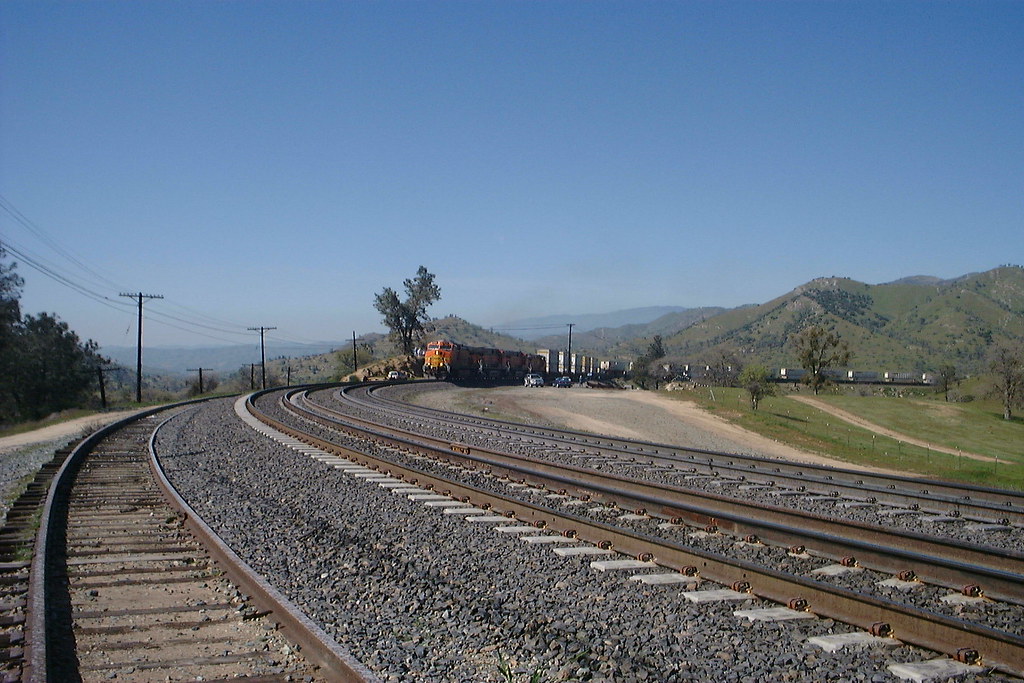
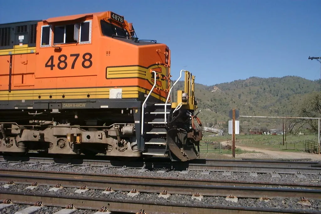
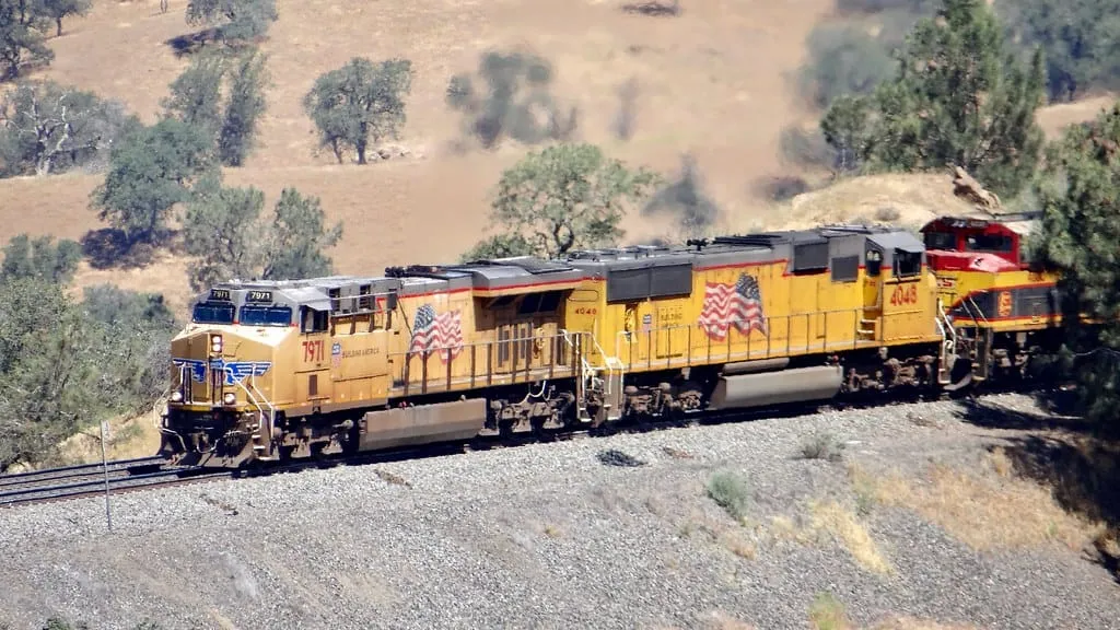
The Tehachapi Loop is part of Union Pacific’s Mojave Subdivision; BNSF Railway holds long-standing trackage rights, so both companies’ power is common. No scheduled passenger service uses the line, though special excursions or detours have appeared on rare occasions. Daily volume typically ranges from 30 to 40 trains, peaking during daylight hours yet steady through the night. Traffic is a mix of long-haul intermodal, hotshot merchandise, unit grain, and heavy manifest freights. Train length often exceeds 100 cars, with six to eight locomotives distributed front, middle, and rear on the heaviest drags.
Best Angles for Photos & What Railfans Enjoy Most
• Loop Overlook: From the pull-off just above the tunnel portal, photographers capture the classic over-under shot where the lead units cross the tail end 77 feet below.
• High Ridge: A short, legally accessible hike up the public hillside west of the road grants a wide panorama, perfect for sunrise backlighting and long-lens compression of the entire spiral.
• East S-Curve: Farther along the road, a downhill bend offers front-lit afternoon views of trains exiting the loop and stretching toward Marcel siding.
Golden-hour light (about 1 hour after sunrise and before sunset) bathes the ochre grass and rust-red locomotives, while midday’s high sun reduces harsh shadows inside the cut. Railfans prize the ability to frame both locomotive sets in one photo and to capture exhaust plumes rising against a clear sky.
Historical or Cultural Relevance
Completed in 1876 by Southern Pacific chief engineer William Hood, the Loop solved the challenge of gaining 77 feet in elevation within limited right-of-way. Its 0.73-mile circumference quickly became an engineering landmark and, in 1998, earned designation as a National Historic Civil Engineering Landmark. During World War II, the line served as a strategic corridor for troop and materiel movements to Pacific ports. Nearby, the town of Tehachapi maintains a strong railroad identity, celebrated each August during its Tehachapi Mountain Festival with model layouts and depot tours.
What Makes This Spot Different
Unlike flatland hot spots where speed is the draw, Tehachapi’s allure lies in visible physics: locomotives battling gravity on a world-famous spiral only large enough for a single train to wrap around itself. The constant grade ensures dramatic sound and extended viewing time, while the open terrain offers unobstructed sightlines without fences or urban clutter. Few places let you witness modern distributed-power freights reenacting a 19th-century engineering solution in virtually the same setting as when it opened.
Frequently Asked Questions
QHow often do trains come through the Tehachapi Loop?
The line averages about 36 freight trains per day, running 24/7. During a typical daytime visit, you can expect to wait roughly 20 minutes to an hour between trains.
QIs there an admission fee to see the Tehachapi Loop?
No. Access to the viewing platform on Woodford-Tehachapi Road is completely free, and parking is also free.
QDo passenger trains use the Tehachapi Loop?
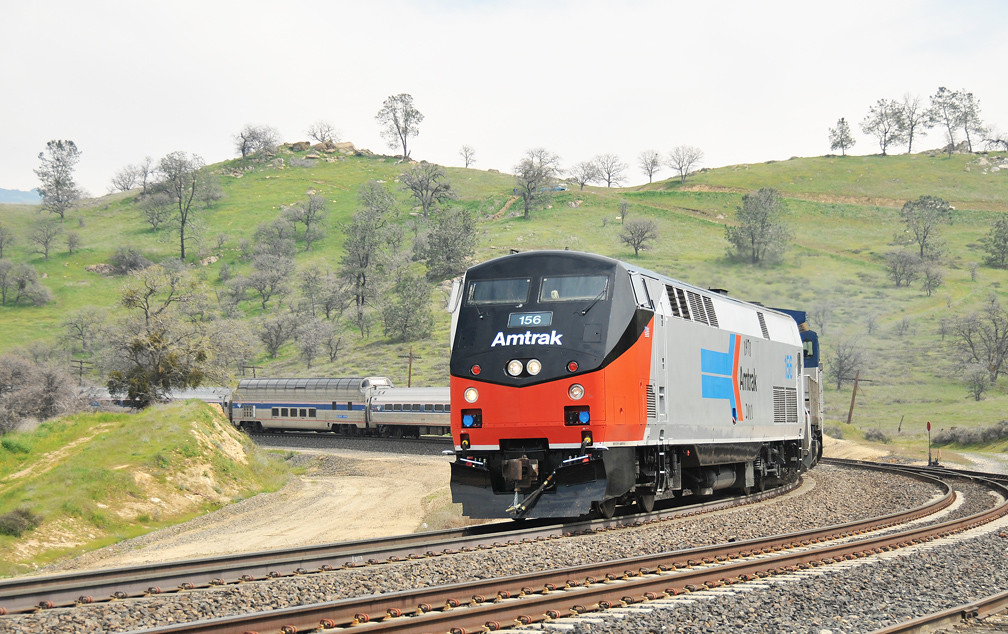
Not regularly. Union Pacific bars scheduled passenger service on this line. Amtrak's Coast Starlight may use it as an occasional detour when its normal route through the Grapevine is closed, but this is rare.
QWhat railroads operate on the Tehachapi Loop?
The line is owned by Union Pacific Railroad (Mojave Subdivision). BNSF Railway also operates trains here under longstanding trackage rights dating back to 1899 when it was the Atchison, Topeka & Santa Fe Railway.
QHow do I get to the Tehachapi Loop viewing platform?
From Highway 58, take the Keene exit and turn onto Woodford-Tehachapi Road. Follow the signs for about 3 miles to the overlook. Do not use Broome Road even if Google Maps suggests it — it is a private gated road.
Safety Tips
Stay well clear of the active railroad tracks at all times. Woodford-Tehachapi Road is narrow and winding with no shoulder in many places — pull fully off the road when stopping. Trains are quieter than you expect on approach and move faster downhill. Bring sun protection, water, and sturdy footwear if hiking the hillside trails. Cell service can be spotty in the canyon. Watch for rattlesnakes in warmer months when hiking off the paved areas.
Seasonal Information
Spring (March–May) brings wildflowers across the golden hills and mild temperatures in the 60s–70s °F — arguably the most photogenic season. Summer offers long daylight hours but can reach the high 90s °F; bring water and sun protection. Fall delivers crisp air and warm afternoon light. Winter occasionally dusts the hills with snow for dramatic photos, though temperatures can dip into the 30s °F and wind chill on the exposed hillside is real.
Nearby Attractions
10 miles / 16 km
Railroad artifacts collection and working antique signal garden. Viewing deck and picnic tables right alongside the mainline. Open Thu–Mon, 11 AM–4 PM. Free admission.
3 miles / 5 km
National Park Service site with visitor center, memorial gardens, and gravesite of labor leader César Chávez. Free admission.
10 miles / 16 km
Dramatic 180° curve with wide-angle views of trains navigating the canyon. Accessible via the Caliente exit off Highway 58.
External Links
informative
informative
informative
informative
Looking for more spots? Browse the complete list of train spotting locations.
Quick Information
Country
USA
Region
California
City
Keene
Spot Type
Curve/Loop
Best Times
Trains run around the clock, but daylight hours offer the best experience. Morning (sunrise to about 10 AM) provides warm golden light from the east, ideal for photography. Expect to wait 20 minutes to an hour between trains. The viewing platform is accessible 24/7.
Visit Duration
1-3 hours
Cost
Free access and free parking
Train Activity
Train Types
Frequency
Approximately 36 freight trains per day on average, making it one of the busiest single-track mainlines in the United States. Traffic runs 24/7 but peaks during daylight hours.
Access & Amenities
Parking
Available (Free)
Shelter
Not available
Restrooms
Not available