


SpotatrainSpotatrain
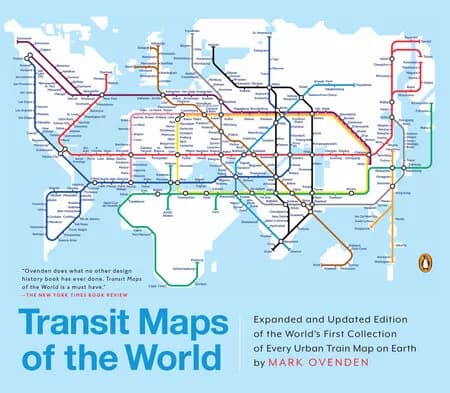
Cover of Transit Maps of the World by Mark Ovenden showing a world map drawn as a subway diagram

Image: Penguin Random House · source

Railway books

Transit Maps of the World

Penguin · Mid-range

Mark Ovenden's expanded edition collects historical and current rapid-transit maps in 176 pages.

Check price on Amazon (affiliate link, opens Amazon in a new tab)

As an Amazon Associate I earn from qualifying purchases. How we pick our gear

We have not tested it ourselves: strengths and weaknesses below come from the tests cited.

Why Railfans Carry It

Anyone who rides subways, light rail or streetcars knows the pull of a good system map. The publisher says this collection traces the cartographic history of mass transit and includes rare and historic maps, diagrams and photographs, some available for the first time since their original publication. The description names subway, light rail and streetcar maps from New York to Nizhny Novgorod. For a railfan who collects maps or likes to see how a network was drawn, it puts hundreds of systems in one place. The publisher page also quotes press comments: the New York Times is quoted saying no other design history book has done what this one does, and the Seattle Times is quoted calling the maps almost works of art that can kindle a memory of a past trip or a dream of a future journey.

In the Field

This is an armchair book for browsing. The description presents it as a collection of maps, so it works as a reference to flip through before a trip to a city with a metro, or as a coffee-table item; the publisher itself calls it a coffee-table essential. According to the publisher, this edition has thirty-six more pages than before, 250 city maps revised from previous editions and listings for almost a thousand systems in total. It is not a route planner and does not replace the current map of the system a traveler is using. The cover itself draws the world map in the style of a subway diagram, a visual cue to the content.

Strengths and Weaknesses

Strengths

  • Historical and current maps in one volume
  • Expanded with thirty-six more pages than the earlier edition
  • 250 city maps revised, listings for almost a thousand systems
  • Author is a transport historian and design consultant

Weaknesses

  • Maps date from when the book was prepared, so it cannot stand in for a live system map
  • Urban rapid transit is the topic; mainline and heritage railways are outside the description
  • Only 176 pages, shared among a thousand listed systems

Key Specifications

Transit Maps of the World — key specifications
SpecificationValue
Pages176
AuthorMark Ovenden
FormatPaperback, expanded and updated edition
ISBN-100143128493
ISBN-139780143128496
PublishedNov 3, 2015
PublisherPenguin (Penguin Random House)

Who It’s For

Gift givers and railfans with an interest in urban transit and graphic design. The publisher calls it the graphic designer's bible and the transport enthusiast's dream collection.

Alternatives

Train by Tom Zoellner offers a narrative of long-distance rail rather than maps. Blood, Iron, and Gold by Christian Wolmar is a history of railroads around the globe without the visual focus.

As an Amazon Associate I earn from qualifying purchases. How we pick our gear

Compare all railway books.