

Railfan field guide
How to Scout a Train Spot Before You Go
Seven checks you can do from home, worked through on a real location — so you arrive knowing where to stand, how busy the line is and which side is lit.
The method and the links on this page were checked in September 2026. The figures in the boxes are live, read from the same data as our spot pages.
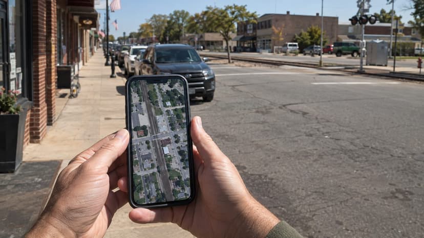
- checks, in the order that saves the most time
- 7
- from your sofa, before you start the car
- 15 min
- train counts, light and timetables for the worked example
- Live
The Short Version
A wasted trip almost always comes down to one of four things you could have known before leaving: there was nowhere public to stand, the line was quieter than you thought, the sun was in your lens, or a fence, a tree line or a parked freight blocked the view.
Every one of those can be checked from a sofa in about fifteen minutes. This guide does it step by step on Ashland, Virginia — a town where a busy double-track main line runs down the middle of the main street — using the same tools that sit on every spot page of this site. Then it hands you two famous locations to try on your own.
Find It on the Map, Then Turn On the Layers
Start wide. A pin on a blank map tells you nothing; a pin on a map that draws the railway lines, the other spots and the live cams around it tells you most of what you need. Use the layer button on the map below to switch them on, and the base-map selector to change the background.
- Which railroad, and how many lines? One line through town is a different day out from a junction where two railroads cross.
- Is there a live cam on it? An orange marker means you can watch the place before you go — step 06.
- What else is within a short drive? A second spot ten minutes away saves a slow afternoon.
What Ashland shows: a single corridor running almost due north–south through the centre of town, with the Amtrak station on it and a live cam pointed at it. No junction, no yard — every train uses the same two tracks, so one position covers all of the traffic.
Read the Satellite View for Public Ground
Now zoom in and switch to satellite. You are looking for three things, in this order:
- Ground that is clearly public — a sidewalk, a park, a station platform open to the public, a road overpass with a footway. The track, the ballast and the strip beside it belong to the railroad, fenced or not.
- Somewhere legal to leave the car — marked street parking or a public lot, not a gravel pull-off beside the rails.
- What stands between you and the track — tree lines, buildings, parked rail cars on a siding.
What Ashland shows: the two tracks run between two parallel streets, with sidewalks on both sides and marked pedestrian crossings every block. That is about as good as public access gets: you can stand on a sidewalk on either side of the line. Parking is the other half of the answer, and the town settles it: parking in downtown Ashland is free, on the street or in the public lots. Our safety guide explains how to tell public ground from railroad property when the picture is less obvious.
Walk It in Street View
Satellite imagery flattens everything. Street View gives you the height of the fence, the pole in the middle of your frame and the sign that says the lot is private. Drop in on the road beside the tracks — a panorama placed on the rails almost never exists — and check:
- the sight line in both directions, and how far you can see a train coming;
- fences, signal masts, poles and wires that would cut through the picture;
- posted signs — parking limits, private property, no trespassing;
- the capture date shown in the viewer. Imagery several years old can be out of date.
Walk around this spot
Street View from the road beside the tracks — look for trains, access and parking before you go.
Loads imagery from Google · Satellite view © Esri
Try it on this view
The viewer opens at the England Street crossing, looking north along the two tracks that run through the middle of town. Drag to look around, click the arrows to move along the street, and answer four questions:
- Where does the public sidewalk end? Follow the railings beside the tracks.
- Which masts and crossing signals would stand between you and a northbound train?
- Turn around: is the view to the south as open as the view to the north?
- What is the capture date, and does the season match your visit?
How Busy Is the Line? Read the Official Count
Freight railroads publish no timetables, but in the United States one official number is public. Every public grade crossing has a DOT inventory number on its blue emergency sign, and the Federal Railroad Administration records, for each one, the number of daytime (6 AM to 6 PM) and nighttime through trains the railroad reports. Spot pages on this site show the count from the nearest crossing; this is the box for Ashland, live:
Through trains per day
30reported to the FRA
Daytime
21
6 AM – 6 PM
≈ 1 every 34 min
Nighttime
9
6 PM – 6 AM
≈ 1 every 80 min
Reported by the railroad for FRA grade crossing 860459F, at this spot (FRA inventory, July 2026). An estimate, not a schedule — crossings on this line within 5 km report 23 to 30.
The count comes from crossing 860459F on England Street — a few steps from the pin.
Read the figure for what it is: an estimate the railroad files and updates every few years, not a schedule. It counts through trains only, and it says nothing about when they run. Ashland shows why you should read it as a floor rather than a promise: the town's own railroad park project speaks of more than 40 trains a day through the centre of town. Divide the daytime number by twelve for a rough trains-per-hour, then let step 06 tell you whether today matches. The tracking guide explains the FRA inventory in full. Outside the United States there is no equivalent public count: rely on the live cam and on published passenger timetables.
Which Side Is Lit? Match the Track to the Sun
The rule is simple: keep the sun behind you and the side of the train facing you is lit. So you need two facts — which way the track runs, and where the sun will be at the hour you plan to stand there.
- Track running north–south: stand on the east side in the morning, the west side in the afternoon.
- Track running east–west: in the northern hemisphere the south side is lit for most of the day; the north side only early and late in summer.
- Around midday the sun is high and the light is flat on any line — a good hour for lunch, a poor one for photographs.
Try it — Ashland, today
Move the slider to see where the sun is.
Weather & light
Sun times calculated for this spot’s coordinates.
What Ashland shows: measured between its crossings, the line runs about13° east of due north. Morning visitors want the east sidewalk, afternoon visitors the west one. The photography guide goes further into golden hour and weather.
Watch the Live Cam Before You Drive
Nothing beats looking at the place as it is right now. If a live railcam covers the location, watch it for twenty minutes at the hour you plan to visit. You will see how often trains really pass, from which direction, how fast, where the shadows fall — and whether the street is closed for a festival that day. Ashland has one: Ashland Train Day, a street festival held each April, which is either the best or the worst day of the year to visit, depending on what you came for.
No camera at your location? Look for one further along the same line: browse all live train cams on the map. A train passing a camera thirty miles up the line is a train heading your way.
Note the Passenger Trains, Then Pack
Freight is a matter of patience; passenger trains keep appointments. Whatever else happens, the trains in a published timetable will pass — which makes them the guaranteed photographs of your visit. Spot pages list the passenger services that run past each location, built from the operators' official timetable files:
Passenger trains on this line
- Train 52, to LortonDaily7 – 8 AMrough estimate: no stop within 50 km
- Train 53, to SanfordDaily5 – 6 PMrough estimate: no stop within 50 km
- Train 80, to New YorkWeekends≈ 2:28 PMestimated from Richmond Staples Mill Road Amtrak Station, 16 km
- Train 80, to New YorkMon, Tue, Wed and Thu · changed Sep 25≈ 2:38 PMestimated from Richmond Staples Mill Road Amtrak Station, 16 km
- Train 79, to CharlotteDaily≈ 3:04 PMestimated from Richmond Staples Mill Road Amtrak Station, 16 km
- Train 40, to ChicagoDaily≈ 1:03 PMestimated from Richmond Staples Mill Road Amtrak Station, 16 km
- Train 41, to MiamiDaily≈ 3:46 PMestimated from Richmond Staples Mill Road Amtrak Station, 16 km
- Train 86, to New YorkWeekdays6:07 AMarrives Ashland Amtrak, 100 m away
- Train 164, to New YorkWeekends6:11 AMarrives Ashland Amtrak, 100 m away
- Train 65, to Newport NewsWeekends · changed Sep 198:47 AMdeparts Ashland Amtrak, 100 m away
- Train 67, to Newport NewsWeekdays9:08 AMdeparts Ashland Amtrak, 100 m away
- Train 94, to BostonWeekdays11:20 AMarrives Ashland Amtrak, 100 m away
- Train 155, to NorfolkWeekends3:07 PMdeparts Ashland Amtrak, 100 m away
- Train 138, to New YorkWeekdays3:22 PMarrives Ashland Amtrak, 100 m away
- Train 158, to New YorkWeekends3:27 PMarrives Ashland Amtrak, 100 m away
- Train 95, to NorfolkWeekdays≈ 4:35 PMestimated from Richmond Staples Mill Road Amtrak Station, 16 km
- Train 124, to PhiladelphiaWeekends5:47 PMarrives Ashland Amtrak, 100 m away
- Train 186, to PhiladelphiaWeekdays5:47 PMarrives Ashland Amtrak, 100 m away
- Train 125, to Newport NewsWeekdays5:49 PMdeparts Ashland Amtrak, 100 m away
- Train 128, to New YorkWeekends6:33 PMarrives Ashland Amtrak, 100 m away
- Train 99, to Newport NewsWeekends7:00 PMdeparts Ashland Amtrak, 100 m away
- Train 93, to NorfolkWeekdays7:56 PMdeparts Ashland Amtrak, 100 m away
- Train 87, to NorfolkWeekends8:54 PMdeparts Ashland Amtrak, 100 m away
- Train 89, to SavannahDaily≈ 2:43 PMestimated from Richmond Staples Mill Road Amtrak Station, 16 km
- Train 90, to New YorkDaily≈ 4:52 PMestimated from Richmond Staples Mill Road Amtrak Station, 16 km
- Train 98, to New YorkDaily≈ 4:02 AMestimated from Richmond Staples Mill Road Amtrak Station, 16 km
- Train 97, to MiamiDaily≈ 9:27 PMestimated from Richmond Staples Mill Road Amtrak Station, 16 km
Tap a train for its times.
Scheduled times from Amtrak’s official timetable, updated September 19, 2026 — trains often run late. Estimated times are worked out along the line from the nearest scheduled stop.
Before you leave the house
Now Try It Yourself
Ashland is an easy case: flat, public, busy. Run the same seven checks on two famous locations that are harder to read, and see what changes.
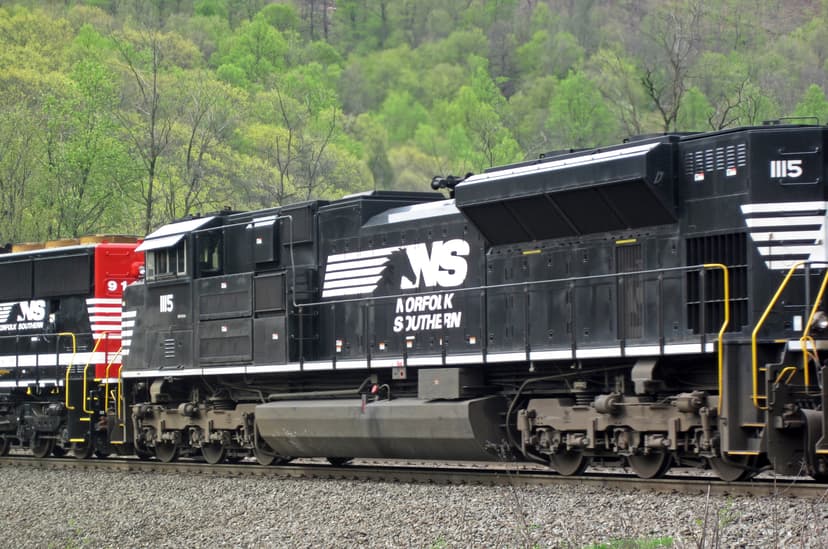
Horseshoe Curve
Pennsylvania, United States
A managed viewing site rather than a roadside: step 02 turns into checking opening hours and the entrance. The nearest public crossing is more than a kilometre away, so treat its train count as indicative.
Photo: James St. John · Attribution License
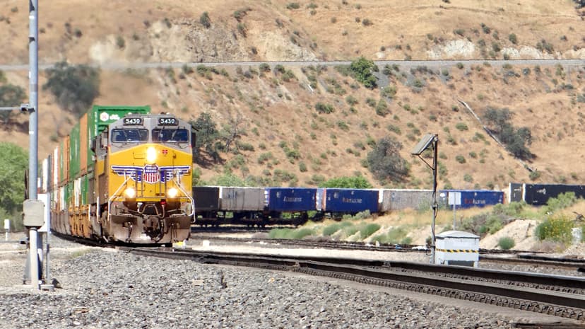
Tehachapi Loop
California, United States
Rural and hilly: the satellite and Street View steps matter most here, to find the public overlook and the road that reaches it. No passenger trains — step 07 is freight only.
Photo: Clay Gilliland
Or pick any of the spotting locations on the map →
Frequently Asked Questions
How do I find a good trainspotting location?
Start from a map that shows railway lines and known spots, then check four things from home: that there is public ground with a view of the track, that you can park legally, that the line is busy enough to be worth the trip, and that the light will be on the side you plan to stand. This guide works through each check on a real location.
How can I tell how many trains pass a location?
In the United States, look up the nearest public grade crossing in the FRA Crossing Inventory: it lists the railroad-reported number of daytime (6 AM to 6 PM) and nighttime through trains. These are estimates filed by the railroad, not a timetable. Spot pages on Spotatrain show the nearest FRA crossing and its counts for most US locations.
Is it legal to watch trains from the side of the road?
Watching and photographing trains from public property — a sidewalk, a park, a public station platform, a road overpass with a sidewalk — is legal in the United States, Canada and the United Kingdom. The track, the ballast and the ground beside it belong to the railroad, fenced or not. Our safety guide covers the rules by country.
How do I know which side of the track will be in the sun?
Find the direction the track runs on the map, then check the sun’s direction for your date and time. On a line running north–south, the east side is lit in the morning and the west side in the afternoon. On a line running east–west, the south side is lit for most of the day in the northern hemisphere.
Can I trust Street View to show what a spot looks like today?
Only partly. Street View imagery can be several years old, and the capture date is shown in the viewer. Trees grow, fences go up and buildings change. Use it to understand the layout and the sight lines, then confirm with a live railcam or recent photos when they exist.