Spotting Location
Fostoria (Texas)
A ghost town railfan stop on the BNSF Conroe Subdivision in East Texas, where the former Foster Lumber Company town once thrived. Freight trains roll through the piney woods on the old Atchison, Topeka & Santa Fe mainline between Somerville and Silsbee.
Updated
Photos
No photos yet — be the first to share one!
Trainspotting Experience
Fostoria is a ghost town in Montgomery County, located at the intersection of the BNSF Conroe Subdivision and State Highway 105, roughly 17 miles east of Conroe. There is no town left to speak of — only scattered concrete foundations from the old lumber mill, a cemetery, and the railroad itself. The crossing at SH 105 is the primary vantage point, where the single-track BNSF mainline crosses the highway at grade. Railfans can pull off onto the highway shoulder, though space is limited and care is needed given the two-lane road traffic.
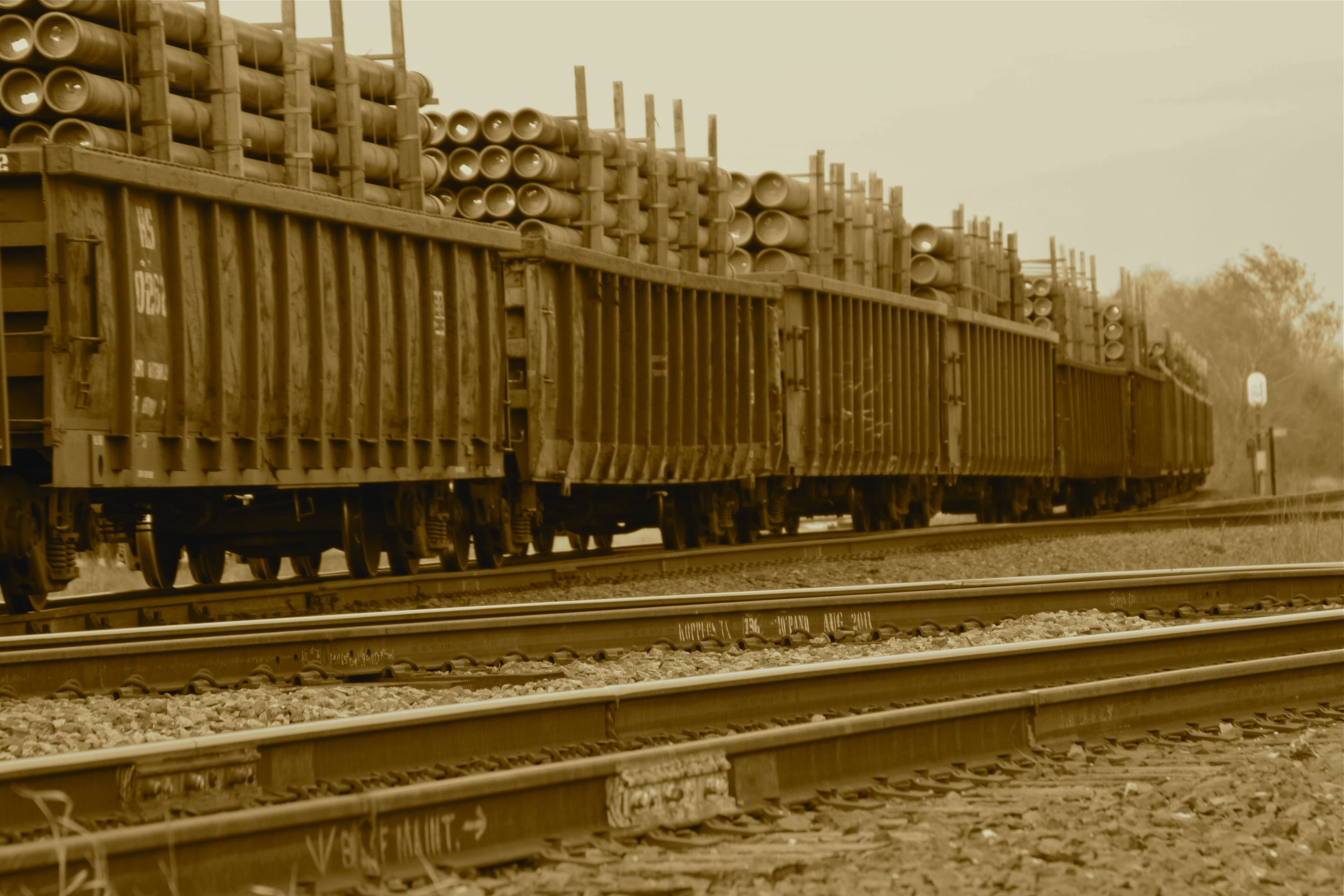
This is strictly a freight-only line. All traffic is BNSF operating on the former Atchison, Topeka & Santa Fe corridor that connects Somerville (to the west) with Silsbee (to the east, near Beaumont). According to BNSF timetable data, trains of 100 tons or more are limited to 49 MPH on this subdivision. The line was briefly leased to Timber Rock Railroad (a Watco short line) from 2004 to 2006, but BNSF reclaimed operations in October 2006 as Gulf Coast rail traffic increased.
Fostoria is a spot for railfans who appreciate solitude and historical atmosphere over high train counts. The isolation means you may wait a while between trains, but when one does appear, the experience is immersive — a lone freight threading through dense East Texas pine forest with nothing but birdsong and cicadas between movements.
Landscape, Setting & Local Atmosphere
The landscape around Fostoria is classic East Texas piney woods — dense stands of loblolly and shortleaf pine line the railroad corridor, with sweetgum and oak mixed in. The terrain is flat to gently rolling, typical of the western edge of the Big Thicket region. Humidity runs high most of the year, and afternoon thunderstorms from the Gulf of Mexico can develop quickly during spring and summer months.
The ghost town atmosphere adds a distinctive layer to the experience. Walking the area near the old mill site east of the tracks, you can still find concrete foundations half-buried under pine needles — remnants of what was once a major lumber operation employing hundreds of workers. The Fostoria Cemetery, accessible via a service road south of the railroad tracks, is one of the few maintained features of the former community. The overall mood is quiet and somewhat haunting: a working railroad corridor cutting through the ruins of a vanished company town.
Type & Frequency of Train Activity
The BNSF Conroe Subdivision is a single-track freight corridor running approximately 100 miles from Somerville to Silsbee. All traffic is freight — there is no Amtrak or commuter service on this line. BNSF is the primary operator. The subdivision handles manifest freight, aggregates, and other commodity trains moving between central Texas connections at Somerville and the Beaumont/Port Arthur industrial corridor to the east.
Specific daily train counts for this subdivision are not publicly documented, and traffic levels can vary significantly. The line's importance was underscored when BNSF reclaimed it from short-line lessee Timber Rock Railroad in 2006, citing increasing Gulf Coast traffic demands. Radio monitoring is possible on BNSF Channel 85 (the assigned frequency for the Silsbee-to-Somerville corridor). Patience is advisable — this is not a high-density mainline like the BNSF Southern Transcon, but the trains that do pass are typically full-length freight consists.
Best Angles for Photos & What Railfans Enjoy Most
The SH 105 grade crossing provides the most accessible vantage point. For trains approaching from the east, morning light favors shooting from the south side of the highway crossing. Afternoon light shifts to the north side. The pine-lined corridor creates a natural framing effect that works well with telephoto lenses — approaching headlights visible through the tree-lined cuts can produce dramatic compositions.
The terrain is flat, so there are no elevated vantage points nearby. Most photography will be at rail level from the highway crossing area. The lack of structures, power lines, and urban clutter means clean backgrounds are easy to achieve. Wide-angle shots capturing the train against the forested corridor convey the isolation of the setting effectively. Be aware that vegetation encroachment along the right-of-way can change sight lines seasonally.
Historical or Cultural Relevance
Fostoria's railroad history is inseparable from the lumber industry that created the town. The area was originally called Clinesburg, after an early mill owner. In 1901, the Foster Lumber Company of Kansas City, Missouri — operated by seven Foster brothers who ran 24 retail lumber yards — purchased the mill, and the settlement was renamed Fostoria in 1903.
The railroad connection was essential to the operation. The Gulf, Colorado & Santa Fe Railway (a subsidiary of the Atchison, Topeka & Santa Fe, now BNSF) provided the mainline link. Additionally, 25 miles of tramway track connected the mill with the Santa Fe at Fostoria and with the Houston East & West Texas Railway at Midline, feeding logs from the surrounding forest to the mill.
At its peak, the Foster Lumber Company mill processed over 35 million board feet of lumber annually, making it one of the largest Southern pine operations in the United States. In 1941, annual production was still 20 million board feet. The mill finally closed in July 1957, though the surrounding second-growth timber was reportedly still plentiful. The town rapidly declined afterward — by the 1980s, only scattered dwellings, the cemetery, a pumping station, and a radio tower remained.
What Makes This Spot Different
Fostoria occupies a rare niche among railfan locations: an active freight mainline running through a genuine Texas ghost town. While most trainspotting locations are defined by their infrastructure — yards, junctions, or stations — Fostoria is defined by what's gone. The mill foundations, the cemetery, and the vanished community make this a spot where railroad history and local history overlap completely.
The BNSF Conroe Subdivision itself has an interesting operational footnote: it was one of several lines BNSF leased to Timber Rock Railroad in 2004, only to reclaim it just two years later when Gulf Coast traffic demands exceeded what a short-line operation could handle. For railfans interested in the economics of American railroading — how lines shift between Class I and short-line operation depending on traffic levels — Fostoria sits on a line that illustrates this dynamic directly.
The spot shares its name with the far more famous Fostoria, Ohio (home of the Iron Triangle railfan park), which can cause confusion. The two locations could not be more different: Ohio's Fostoria sees 80+ trains daily across three diamond crossings; Texas's Fostoria is a solitary ghost town on a single-track freight line.
Frequently Asked Questions
QIs Fostoria, Texas the same as the famous Fostoria trainspotting spot?
No. The well-known Fostoria Iron Triangle railfan park is in Fostoria, Ohio. Fostoria, Texas is a ghost town in Montgomery County on the BNSF Conroe Subdivision — a very different and much quieter experience.
QWhat trains run through Fostoria, Texas?
Only BNSF freight trains. The Conroe Subdivision handles manifest freight, aggregates, and commodity trains. There is no passenger service on this line.
QIs there anything left of the town?
Very little. Concrete foundations from the Foster Lumber Company mill can be found in the woods east of the tracks, and the Fostoria Cemetery is accessible south of the railroad. No commercial buildings or services remain.
QAre there any facilities at the spot?
No. Fostoria has no parking lot, restrooms, shelter, or services of any kind. The nearest town with amenities is Cleveland, Texas, approximately 10 miles to the east on SH 105.
QHow do I get to Fostoria?
Take State Highway 105 east from Conroe for approximately 17 miles. The railroad crossing is at the intersection of SH 105 and the BNSF tracks. The area is marked on some maps as Fostoria, though there is no signage for the former town.
Safety Tips
This is a remote rural location with no cell service guarantee. Let someone know your plans before visiting. The SH 105 crossing sees regular highway traffic on a two-lane road — stay well clear of the travel lanes when parked. Watch for snakes in warm months. Carry water and sun protection.
Seasonal Information
Spring and fall provide the best balance of comfortable weather and photographic light. Summer (June-September) brings extreme heat, high humidity, and frequent afternoon thunderstorms. Winter temperatures rarely drop below freezing but overcast skies are common. The pine forest stays green year-round.
Nearby Lodging
Find places to stay near Fostoria (Texas).
This lodging map is provided by Stay22, a third-party service that may set cookies. It loads only with your consent.
Accommodation results are provided by Stay22; we may earn a commission on bookings made through this map.
Nearby Attractions
0.3 miles / 0.5 km
Historic cemetery from the lumber company era, one of the few surviving remnants of the ghost town. Contains graves of mill workers and their families dating back to the early 1900s.
9.3 miles / 15 km
Over 163,000 acres of pine and hardwood forest with hiking (including the 128-mile Lone Star Hiking Trail), camping at three developed campgrounds, fishing, and the Big Creek Scenic Area.
12.4 miles / 20 km
A developed recreation area within Sam Houston National Forest offering camping, swimming, fishing, and hiking trails through the piney woods.
99.4 miles / 160 km
Heritage railroad offering a 25-mile round-trip excursion through the East Texas piney woods between Palestine and Rusk, pulled by historic steam and diesel locomotives.
34.2 miles / 55 km
Historic shopping district north of Houston with over 100 local businesses, antique shops, and restaurants in preserved 19th-century buildings.
Official Resources
Related on Spotatrain
Spots Near Fostoria
Rosenberg Junction
Historic railroad junction where UP's Glidden Subdivision, BNSF's Galveston Subdivision, and CPKC's Rosenberg Subdivision converge at an at-grade diamond. Adjacent to the Rosenberg Railroad Museum featuring preserved Tower 17, the last manned interlocking tower in Texas.
Flatonia (Railfan Tower)
Purpose-built railfan observation pavilion at the diamond crossing of Union Pacific's Giddings and Cuervo Subdivisions in Flatonia, Texas. Tower 3, the original interlocking tower (1902-1996), is preserved nearby in the Rail Park.
Temple (BNSF/UP Crossing)
A major railroad junction in Central Texas where BNSF and Union Pacific lines cross at the historic Tower 24 diamond. The adjacent Temple Railroad & Heritage Museum, housed in the 1911 Santa Fe depot, makes this one of the most railfan-friendly spots in the state.
Waco (BNSF/UP)
Downtown Waco sits on Union Pacific's former Katy Railroad main line, where UP freight and BNSF trains with trackage rights roll through this historic Texas crossroads between the Dallas-Fort Worth metroplex and the Gulf Coast.
Shreveport (KCS/UP)
Major CPKC (former KCS) hub and Union Pacific junction in northwest Louisiana, where five rail corridors converge around the 257-acre Deramus Yard — one of the busiest freight junctions in the South with 40+ trains daily.
Lafayette (Louisiana)
Downtown Lafayette's Rosa Parks Transportation Center sits on BNSF's Lafayette Subdivision, offering close-up views of UP and BNSF freight trains plus tri-weekly Amtrak Sunset Limited service — all in the heart of Cajun Country.
More Spots in Texas
Dallas Union Station
Historic 1916 Beaux-Arts station where DART light rail, TRE commuter trains, Amtrak's Texas Eagle, and UP/BNSF freight share tracks in downtown Dallas.
Tower 55 (Fort Worth)
Tower 55 is the busiest railroad diamond interlocking in the United States outside of Chicago, where BNSF's triple-track north–south main meets Union Pacific's double-track east–west corridor at six grade-level diamond crossings. With roughly 100 trains per day from UP, BNSF, FWWR, Trinity Rail Express, and Amtrak, this Fort Worth junction delivers near-constant rail action from public sidewalks steps away from the interlocking.
Saginaw (UP/BNSF)
Saginaw sits at the junction of three railroad lines—two BNSF subdivisions and one Union Pacific—making it one of North Texas's premier railfan destinations with roughly 40–60 trains daily and a historic depot serving as the viewing base.
Laredo International Railway Bridge (Puente Negro)
North America's busiest rail border crossing, where CPKC freight trains crawl across the Rio Grande between Laredo, TX and Nuevo Laredo, Mexico on the historic Puente Negro — now doubled with a second span opened in 2025.
Amarillo (BNSF/UP)
Major BNSF junction where six subdivisions converge on the Southern Transcon. Crew change point with up to 100+ trains daily, four main tracks, and rich fallen-flag heritage from Santa Fe, Fort Worth & Denver, and Rock Island railroads.
Dalhart (Rail Crossing)
A classic Texas Panhandle railroad junction where BNSF's Dalhart Subdivision crosses Union Pacific's former Golden State Route at grade, with two active yards and crew-change operations in the heart of XIT Ranch country.
Related Experiences
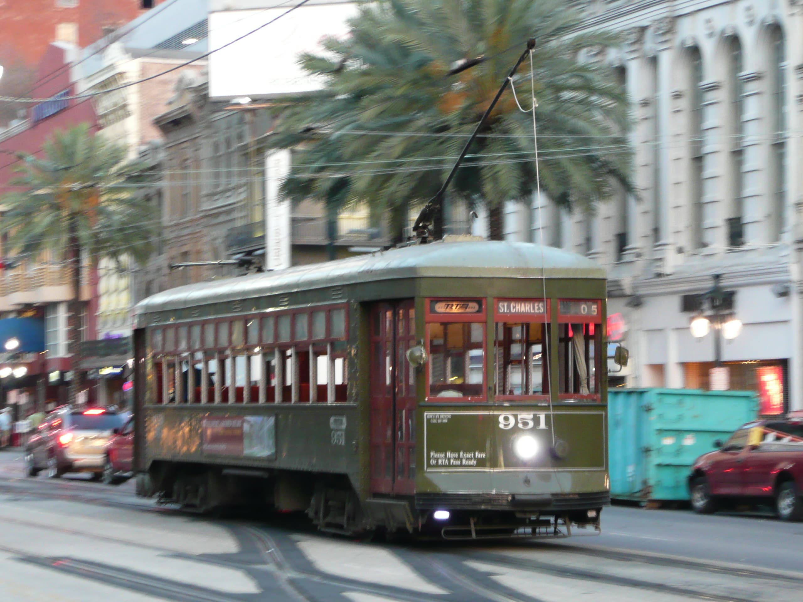
St. Charles Streetcar Line
The world's oldest continuously operating streetcar line, running historic 1923-24 green Perley Thomas cars 6 miles up St. Charles Avenue.

TrainTastic
World's largest model railroad museum: 50,000 sq ft of interactive layouts, ~2M LEGO bricks and ride-on trains in Gulfport, MS.
National Museum of Transportation
St. Louis museum with 70+ historic locomotives, including Union Pacific Big Boy 4006, across a 42-acre rail yard.
Related Journeys & Mega-Projects

California Zephyr
Chicago to San Francisco across the Rockies and Sierra Nevada

Cumbres & Toltec Scenic Railroad
America's longest and highest authentic steam railroad

Grand Canyon Railway
A 65-mile heritage train journey from Williams, Arizona to the South Rim of the Grand Canyon
Help improve this page
Spotted something out of date or incorrect? Let our community know.
Looking for more spots? Browse the complete list of train spotting locations.
Quick Information
Country
United States
Region
Texas
City
Fostoria
Spot Type
Rural Crossing
Best Times
Daylight hours recommended. The area is remote with no lighting or facilities. Morning and late afternoon tend to produce the best photographic light through the pine canopy.
Visit Duration
30 minutes to 2 hours
Cost
Free — open roadside location
Train Activity
Train Types
Frequency
Freight-only line; exact daily count unconfirmed but the BNSF Conroe Subdivision handles through freight between Somerville and Silsbee
Access & Amenities
Parking
Not available
Shelter
Not available
Restrooms
Not available