Spotting Location
Vincennes (Rail Crossing)
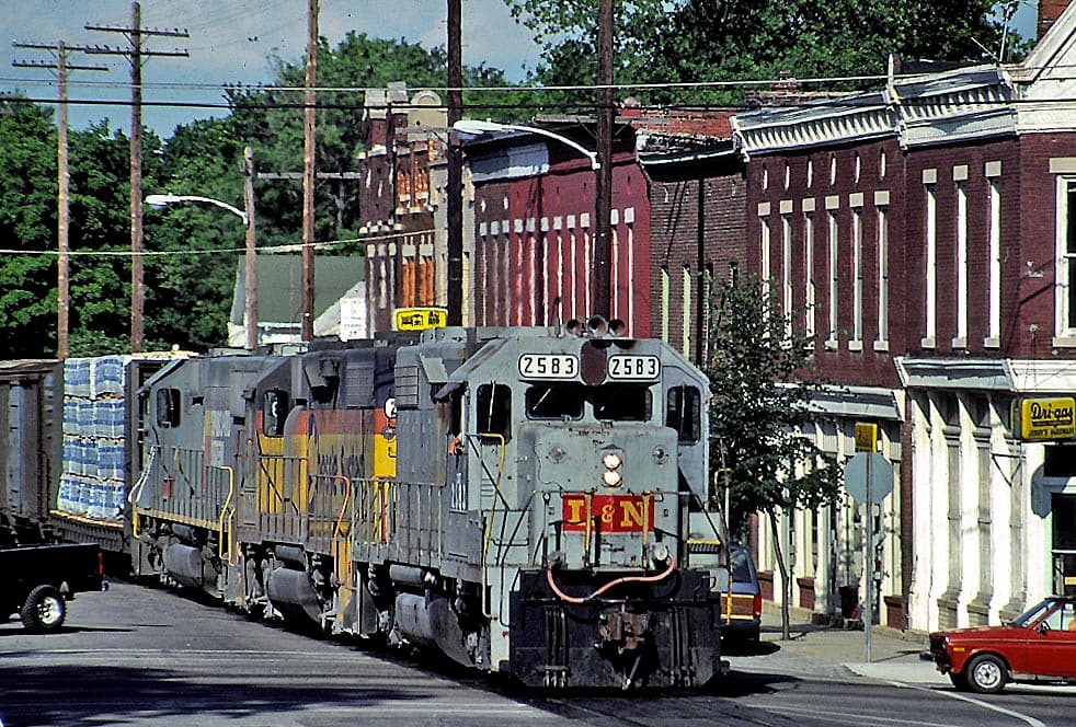
Two CSX lines — the Illinois and CE&D subdivisions — meet at the Vincennes Interlocking diamond crossing. Trains slow to 25 mph through downtown, giving railfans close-range views of coal drags, intermodals, and local freights.
Updated
Photos
No photos yet — be the first to share one!
Trainspotting Experience
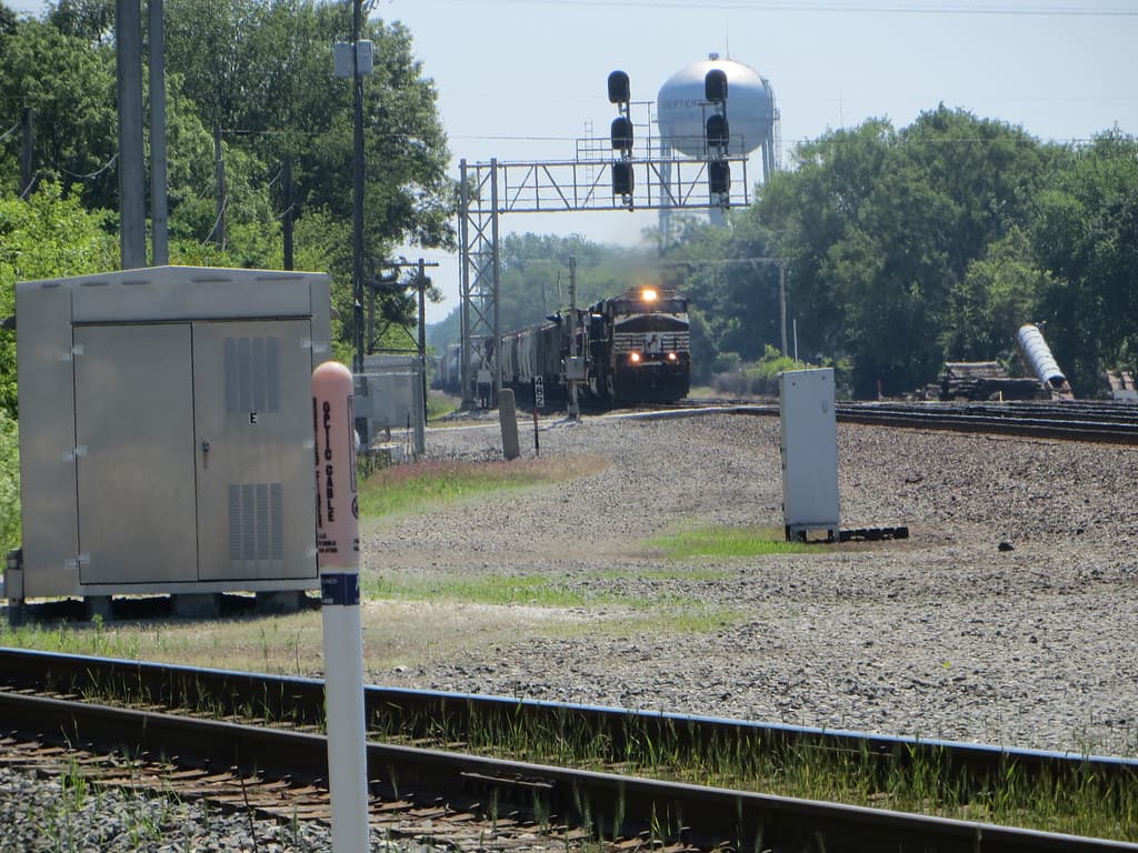
Standing at a downtown Vincennes grade crossing, you are watching two CSX corridors at once. The east-west Illinois Subdivision (former B&O St. Louis mainline) intersects the north-south CE&D Subdivision (former Chicago & Eastern Illinois) at the Vincennes Interlocking, MP 188.5. A 25 mph speed restriction applies from MP 189.3 to MP 186.0, so trains are visible for a sustained period — useful for reading car numbers and photographing long cuts of rolling stock. The CE&D is double track through town; the Illinois Subdivision is single track with a 2,900-foot south-side siding at the interlocking. City-installed live cameras at several crossings (Hart Street, Main Street, Washington Street, 15th Street, St. Clair Street, and 2nd Street & Niblack) stream to the InterFact app, letting you monitor crossing activity before arriving. Street parking is available on side streets within a short walk of most crossings. The downtown setting puts coffee shops and restaurants close by for longer waits between trains.
Landscape, Setting & Local Atmosphere
Vincennes sits on the eastern bank of the Wabash River, just over a mile from the riverfront where the Illinois Subdivision crosses on a through truss bridge at MP 189.34. The terrain is flat floodplain — open sky in every direction, with no hillside or embankment blocking sightlines along the right-of-way. Mature trees line residential side streets flanking the tracks, providing shade in summer. The character is small Midwestern city: early 20th-century brick storefronts, grain elevators visible on the eastern horizon, and the rhythm of crossing bells punctuating daily life. On quiet mornings, a loaded coal drag from Oaktown rumbling south on the CE&D or a west-running Illinois Sub manifest clearing the diamond provides the kind of unfiltered industrial railroading increasingly rare on Class I freight corridors.
Type & Frequency of Train Activity
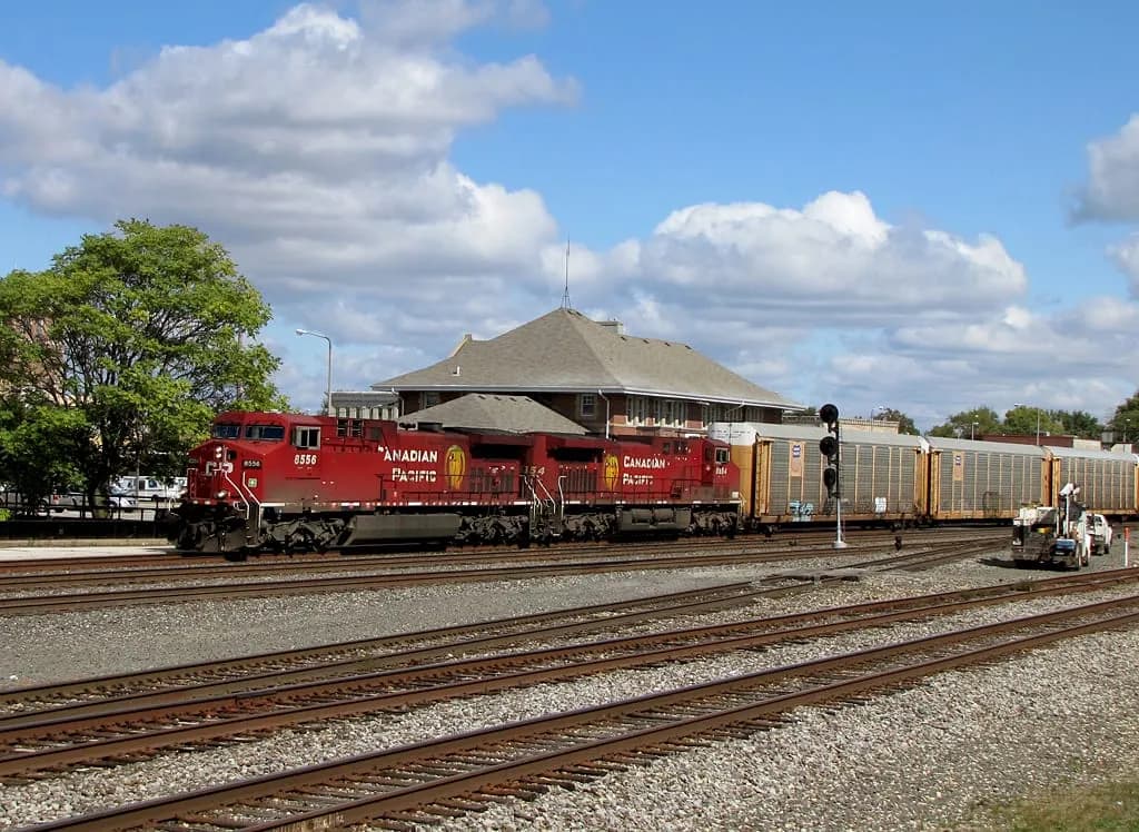
The CE&D Subdivision is the busier of the two lines through Vincennes, carrying coal trains originating at Sunrise Coal's Oaktown, Indiana loading facility and heading south to Howell Yard in Evansville. Trains are designated R (loaded, running south), C (returning north from Evansville), or E (empties heading back to the mine). CSX hot intermodal trains I025 and I028 also operate on the CE&D, providing container and trailer-on-flatcar traffic between Chicago and the Southeast. On the Illinois Subdivision, the CSX L364 local serves industrial customers between Vincennes and Washington, Indiana, swapping cars at CE&D connections. All trains through the Vincennes Interlocking are subject to a 25 mph speed restriction, producing extended observation windows. No scheduled Amtrak service currently operates through Vincennes, though CSX detour moves have historically routed passenger equipment through the city.
Best Angles for Photos & What Railfans Enjoy Most
The most productive positions are alongside the downtown grade crossings. For northbound CE&D movements, stand on the east side of the tracks during morning hours (roughly 8 a.m. to noon) to keep the sun behind you. Southbound CE&D trains photograph well from the west side in late afternoon. Illinois Subdivision traffic moving west toward the Wabash River bridge frames nicely with the setting sun. A standard zoom (70–200mm) handles most approach shots from street level; a wider angle (24–50mm) captures the interlocking environment with multiple tracks and signal masts in frame. At night, long exposures under the grade-crossing strobe lights produce sharp silhouettes against a dark sky; sidewalks throughout the flat downtown grid provide stable tripod placement. Use the InterFact app to time arrivals — the city's live crossing cameras let you confirm a train is actively occupying a crossing before driving over.
Historical or Cultural Relevance
Rail came to Vincennes when the Evansville & Illinois Railroad was chartered on January 2, 1849, to connect Evansville with Vincennes — a 53-mile route completed by 1853. Through successive mergers the corridor became part of the Chicago & Eastern Illinois Railroad (C&EI), formally named on March 8, 1881. The C&EI established Alice Yard in Vincennes as a key freight classification and interchange point, and the railroad's Alice Yard designation persists in local CSX operations references today. After Missouri Pacific absorbed C&EI the line eventually passed to CSX, which designates it the CE&D Subdivision. The cross-town east-west corridor traces a separate lineage: the former B&O St. Louis mainline, which crosses the Wabash River on a through truss bridge at MP 189.34 and is now the CSX Illinois Subdivision. At the Vincennes Interlocking (MP 188.5), these two historic routes meet at a signaled flat diamond crossing. Less than a mile west, George Rogers Clark's 1779 capture of Fort Sackville made Vincennes a pivotal American Revolution site — the same strategic geography that anchored military importance made it a natural railroad crossroads in the 19th century.
What Makes This Spot Different
Vincennes provides access to a genuine railroad diamond crossing — the Vincennes Interlocking at MP 188.5 — where two distinct CSX subdivision histories converge in a downtown setting with no fences or restricted access. The 25 mph slow zone applies to all movements through the interlocking, so even long coal drags and double-stacked intermodal trains pass at a photogenic, unhurried pace. Adding practical value, the City of Vincennes has installed live-streaming cameras at multiple downtown grade crossings, accessible free via the InterFact app — a tool that lets railfans confirm train presence before driving to the crossing. The convergence of former B&O and former C&EI infrastructure under a single Class I operator at an urban, publicly accessible diamond is uncommon on the North American freight network.
Frequently Asked Questions
QWhich railroad operates through Vincennes?
CSX Transportation operates both lines through Vincennes. The east-west Illinois Subdivision (former B&O St. Louis mainline) and the north-south CE&D Subdivision (former Chicago & Eastern Illinois to Evansville) intersect at the Vincennes Interlocking, MP 188.5.
QWhat types of trains can I expect to see?
The CE&D Subdivision carries coal trains from Sunrise Coal's Oaktown, Indiana facility south to Howell Yard in Evansville, plus intermodal trains I025 and I028. The Illinois Subdivision sees the CSX L364 local freight serving industries between Vincennes and Washington, Indiana.
QHow fast do trains pass through town?
All trains are subject to a 25 mph speed restriction through Vincennes from milepost 189.3 to 186.0, giving railfans a sustained, close-range observation window — a significant advantage over open-road spotting locations.
QIs there a way to check if a train is at a crossing before I drive over?
Yes. The City of Vincennes has installed live-streaming cameras at several downtown crossings including Hart Street, Main Street, Washington Street, 15th Street, St. Clair Street, and 2nd Street & Niblack. Create a free account at InterFact (interfact.net) and select Vincennes to access the feeds.
QIs there parking near the railroad crossings?
Street parking is available on side streets throughout downtown Vincennes near the grade crossings. No dedicated railfan parking exists, but the urban grid provides convenient on-street options within walking distance of the tracks.
Seasonal Information
Spring and fall are the most comfortable seasons for extended trackside visits in Vincennes. Winter's cold air makes diesel exhaust steam highly visible from a distance, and bare deciduous trees open sightlines along the right-of-way. Summer evenings deliver a useful golden-hour window for westward photography as the sun drops toward the Wabash River. The flat terrain means wind can be a factor in winter; a warm layer is advisable for prolonged waits.
Nearby Lodging
Find places to stay near Vincennes (Rail Crossing).
This lodging map is provided by Stay22, a third-party service that may set cookies. It loads only with your consent.
Accommodation results are provided by Stay22; we may earn a commission on bookings made through this map.
Nearby Attractions
0.7 miles / 1.2 km
A national park at 401 S 2nd St commemorating the 1779 capture of Fort Sackville, a turning point of the American Revolution. The rotunda memorial and visitor center sit on the original fort site on the banks of the Wabash River, just blocks from the rail crossing.
0.9 miles / 1.5 km
The federal-style mansion built in 1804 for future U.S. President William Henry Harrison, then governor of Indiana Territory. Now a National Historic Landmark open for guided tours, it offers a window into early 19th-century frontier life and Vincennes' political history.
2.2 miles / 3.5 km
A large private collection of military vehicles, uniforms, and artifacts spanning from the Civil War to the present, located in Vincennes. One of the most comprehensive military museums in Indiana.
0.6 miles / 1 km
A museum dedicated to Vincennes-born comedian and artist Red Skelton (1913–1997), featuring his paintings, costumes, and memorabilia. Located in downtown Vincennes near the railroad corridor.
34.8 miles / 56 km
Located in Terre Haute, roughly 56 km north of Vincennes, this museum preserves the Haley interlocking tower next to the active CSX main line. Includes two cabooses, a Pullman troop sleeper, and a GE 45-ton switcher. Train viewing platform alongside live CSX traffic. Open Saturdays and Sundays 1–4 p.m., May through October.
Official Resources
Related on Spotatrain
Spots Near Vincennes
Terre Haute (Haley Tower)
The Wabash Valley Railroad Museum preserves Haley Tower, a brick interlocking tower built in 1898 where three historic railways crossed in downtown Terre Haute. A dedicated viewing platform sits directly beside the active CSX St. Louis Line junction.
Salem (CN/UP Crossing)
A busy Class I railroad diamond in Salem, Illinois, where Canadian National's former Illinois Central main line crosses Union Pacific's Mount Vernon Subdivision. Salem Yard remains an active UP crew change point with roughly 200 employees.
Decatur (Crossroads)
The WABIC Diamond in Decatur marks where Norfolk Southern's east-west main line crosses Canadian National's former Illinois Central Peoria Subdivision. Named for the historic WABash-Illinois Central crossing, this flat-angle diamond sits beside the 1901 Wabash Depot and sees steady NS freight traffic daily.
La Grange (Street Running)
Famous for being one of the last places in America where freight trains run directly down Main Street. CSX's LCL Subdivision sends 10-20 trains daily through downtown La Grange, Kentucky, at just 10 mph.
Frankfort (NS/CSX)
A rare at-grade diamond where Norfolk Southern's former Nickel Plate Road lines cross CSX's Frankfort Secondary Subdivision in downtown Frankfort, Indiana. Features the famous "Christmas Tree" crossing signal, a historic NKP coal tower still bearing its original herald, and multiple legal viewing positions within walking distance.
Lafayette (Crossing)
Downtown Lafayette sits at the junction of Norfolk Southern's former Wabash mainline and CSX's former Monon line, with 20-25 daily freight trains plus Amtrak's Cardinal three days per week. The historic Big Four Depot and Riehle Plaza provide legal, accessible viewing.
More Spots in Indiana
Chesterton (Porter Junction)
One of the Midwest's best-known rail junctions, where Norfolk Southern's busy Chicago Line meets Amtrak's Michigan Line and CSX's Grand Rapids Sub. Approximately 75–100 trains daily, including 14 Amtrak services.
Michigan City (Street Running)
Historic location where South Shore Line trains ran directly down 11th Street for over a century (1908–2022). Now a modern double-track commuter rail corridor with a new station, still offering close-up views of NICTD electric trains and CSS freight operations.
Elkhart (NYC Main & Museum)
A premier Midwest railfan destination combining live Norfolk Southern mainline action with the National New York Central Railroad Museum. Located at the Amtrak station in downtown Elkhart, Indiana, with approximately 40 trains per day on the ex-NYC Chicago Line.
Related Experiences
National Museum of Transportation
St. Louis museum with 70+ historic locomotives, including Union Pacific Big Boy 4006, across a 42-acre rail yard.
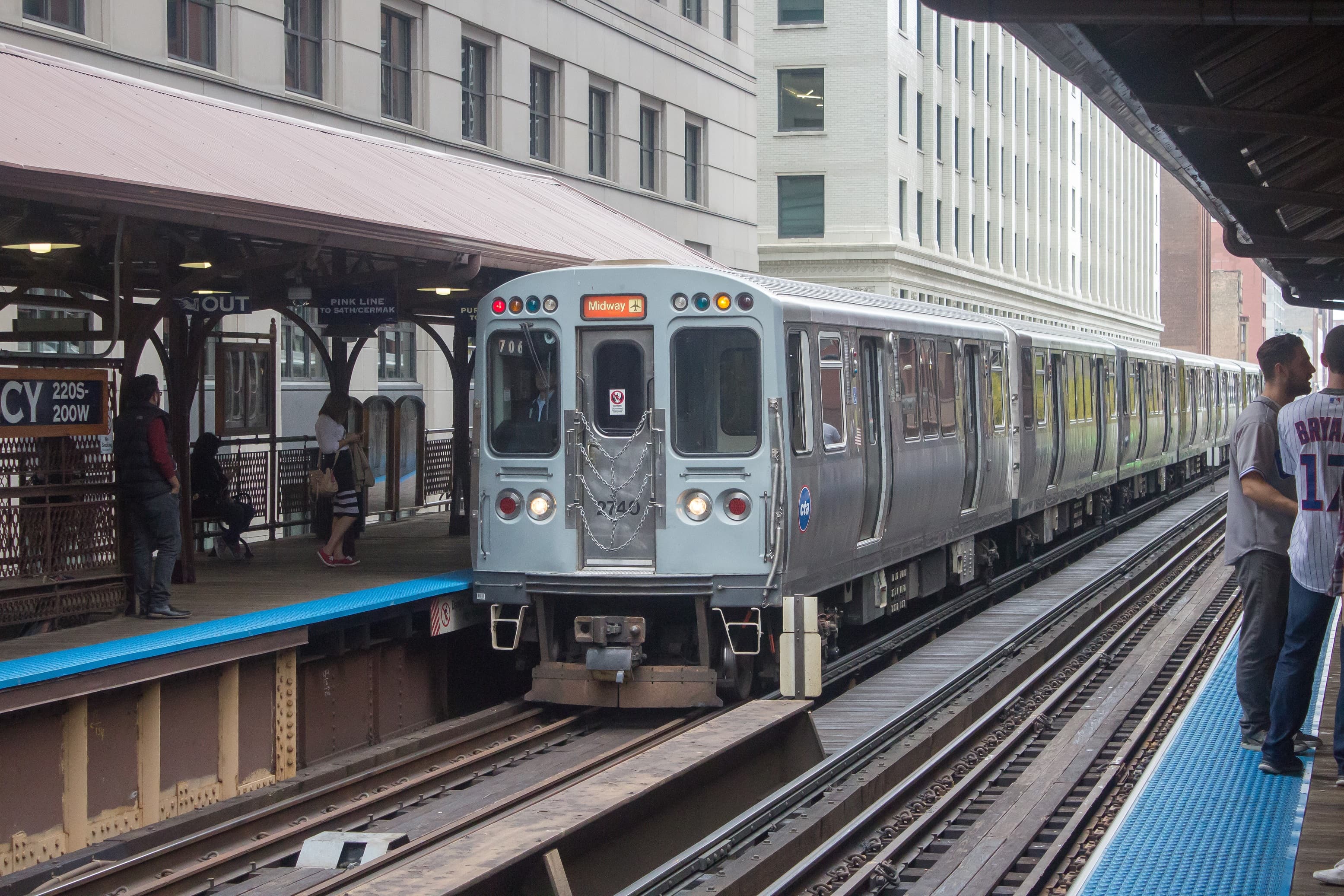
Chicago “L” (Orange Line)
An elevated Chicago “L” train line looping through downtown on viaducts, offering railfans sweeping views of the city’s skyscrapers like the Willis Tower.
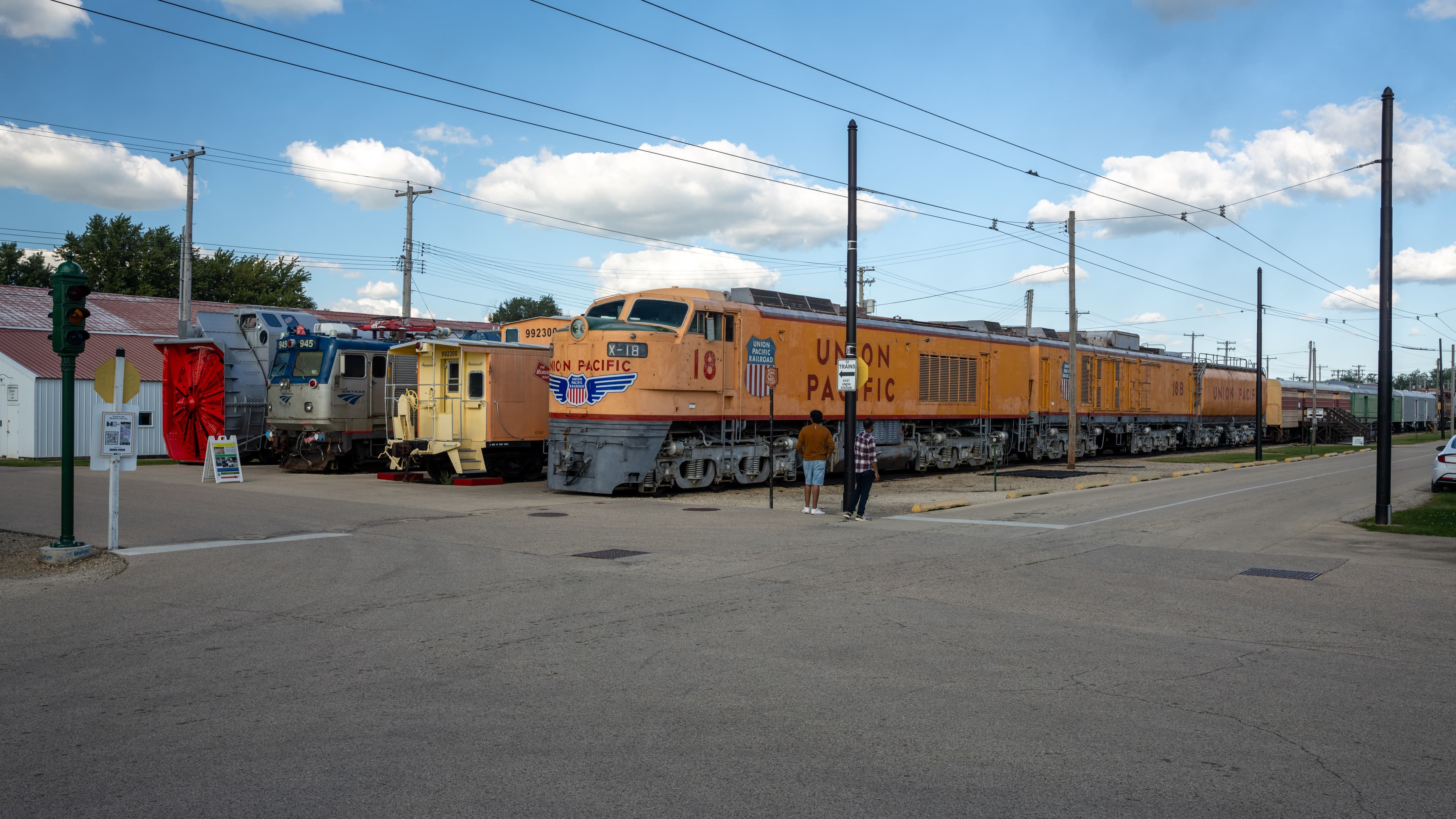
Illinois Railway Museum
The largest railroad museum in the U.S., offering vintage steam, diesel and electric train rides across a sprawling site near Chicago.
Related Journeys & Mega-Projects

California Zephyr
Chicago to San Francisco across the Rockies and Sierra Nevada

Strasburg Rail Road
America's oldest continuously operating standard-gauge railroad — a 45-minute steam ride through Amish farmland.

Mount Washington Cog Railway
World's first mountain-climbing cog railway — 1869, 37.41% grade, climbs to 6,288 ft
Help improve this page
Spotted something out of date or incorrect? Let our community know.
Looking for more spots? Browse the complete list of train spotting locations.
Quick Information
Country
United States
Region
Indiana
City
Vincennes
Spot Type
Urban Crossing
Best Times
Morning hours for eastward light on northbound CE&D trains; late afternoon for southbound movements catching western sun. Weekdays are best for the L364 local freight serving industries between Vincennes and Washington, Indiana.
Visit Duration
1–3 hours
Cost
Free — public downtown grade crossings
Train Activity
Train Types
Frequency
Moderate through-freight on the CE&D Subdivision (coal, intermodal); local freight on the Illinois Subdivision via the CSX L364 local. All movements restricted to 25 mph through town.
Access & Amenities
Parking
Available
Shelter
Not available
Restrooms
Not available