

Spotting Location
Big 10 Curve (Arvada)
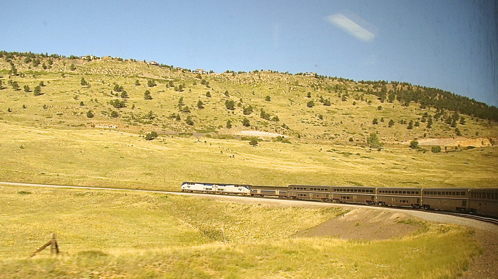
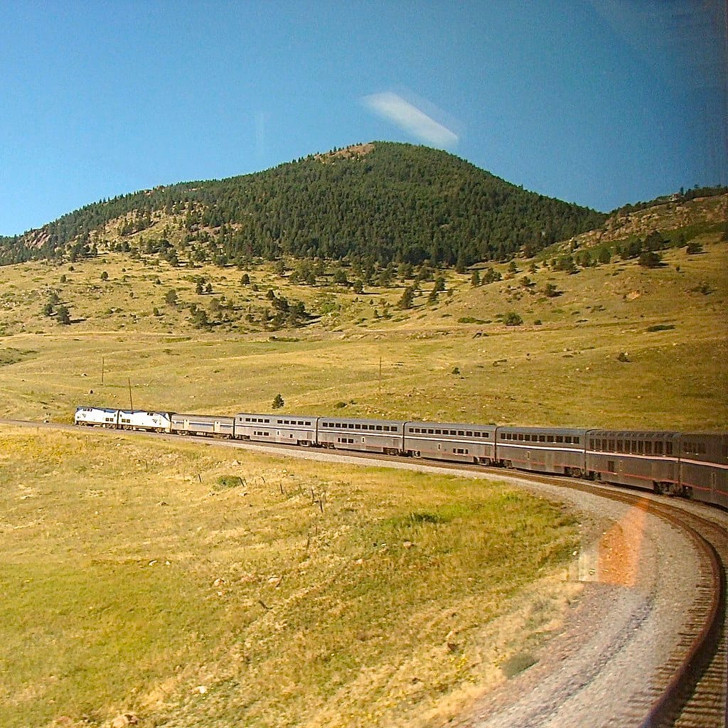
A 270-degree, 10-degree curve on Union Pacific's Moffat Tunnel Subdivision near Arvada, Colorado, featuring a unique hopper-car windbreak installed by the D&RGW in the early 1970s. About 6 trains daily including Amtrak's California Zephyr.
Arvada, Colorado, United States
Plan your visit
Coordinates: 39.854503, -105.251639
- Parking
- Free
- Shelter
- None
- Restrooms
- None
Parking: Free — informal pull-offs along Blue Mountain Road
- Best times
- The westbound California Zephyr passes around 8:45 AM when on time; the eastbound arrives around 5:30 PM. BNSF and UP manifests run at variable times. The seasonal Rocky Mountaineer departs westbound around 9:40 AM (Apr-Oct, Sun/Wed). For photography, morning light favors eastbound shots with the Denver skyline as backdrop.
- Duration
- 1-3 hours
- Cost
- Free access. No parking fees.
Where to stand, park and take a break
Before you go — access is not guaranteed
Photo positions show where photographers have stood, not places we have visited. Some may be on private or railway property. Stay on public land and never cross fences, tracks or “No Trespassing” signs: being on railroad property is illegal and dangerous. Parking and restrooms come from official and map sources.
Read our trainspotting safety, law & etiquette guide →Tap a symbol on the map for details.
Photo spot near MP 19.7, Moffat Tunnel Subdivision
120 m north-west of the spot pin
Line in view: UP Moffat Tunnel Subdivision
Open in Google MapsPhoto spot near MP 20.0, Moffat Tunnel Subdivision
220 m east of the spot pin
Line in view: UP Moffat Tunnel Subdivision
Open in Google MapsPhoto spot near MP 18.1, Moffat Tunnel Subdivision
760 m north of the spot pin
Line in view: UP Moffat Tunnel Subdivision
Open in Google MapsPhoto spot near MP 18.6, Moffat Tunnel Subdivision
950 m north-west of the spot pin
Line in view: UP Moffat Tunnel Subdivision
Open in Google MapsPhoto spot near MP 20.8, Moffat Tunnel Subdivision
960 m west of the spot pin
Line in view: UP Moffat Tunnel Subdivision
Open in Google MapsPhoto spot near MP 17.6, Moffat Tunnel Subdivision
1.1 km north-east of the spot pin
Line in view: UP Moffat Tunnel Subdivision
Open in Google MapsPhoto spot near MP 18.9, Moffat Tunnel Subdivision
1.2 km north-west of the spot pin
Line in view: UP Moffat Tunnel Subdivision
Open in Google MapsPhoto spot near Blue Mountain Road
2.7 km north-west of the spot pin
Line in view: UP Moffat Tunnel Subdivision
Open in Google MapsPhoto spot on Blue Mountain Drive
2.9 km north-west of the spot pin
Line in view: UP Moffat Tunnel Subdivision
Open in Google Maps
Take this spot with you — every point in your GPS app, even without signal.
Weather & light
Sun times calculated for this spot’s coordinates.
Seasons
Spring and fall offer the most comfortable conditions with mild temperatures and lower wind risk. Summer provides long daylight hours but afternoon thunderstorms are common along the Front Range — these can produce dramatic cloud backdrops but also lightning danger on the exposed overlook. Winter visits require warm layers and wind protection; chinook winds can exceed 70 mph and snow squalls sweep through rapidly. The Winter Park Express ski train adds extra movements from January through March (Fri-Sun). The Rocky Mountaineer runs April through October (Wed/Sun westbound, Tue/Fri eastbound), adding two seasonal passenger trains.
Safety
Big Ten Curve is on an active Union Pacific main line — stay well clear of the tracks at all times. The Blue Mountain Road grade crossing has no gates and requires extra caution. High winds are a serious hazard at this exposed location; gusts exceeding 70 mph have been recorded, strong enough to derail trains. Rattlesnakes are present in the scrubland during warmer months. There is limited cell coverage in some areas. The terrain is uneven with loose rock on the hillside trails — wear sturdy footwear. Lightning is a concern during summer afternoon thunderstorms, especially on the exposed ridge above the curve.
Trains here
Through trains per day
7reported to the FRA
Daytime
4
6 AM – 6 PM
≈ 1 every 3 h
Nighttime
3
6 PM – 6 AM
≈ 1 every 4 h
Reported by the railroad for FRA grade crossing 920499V, 660 m from this spot (FRA inventory, July 2026). An estimate, not a schedule — crossings on this line within 5 km report 4 to 7.
- Railroad
Union Pacific, Amtrak — Moffat Tunnel Subdivision (MP 17.4)
- Track at the crossing
- 1 main track · 30 mph timetable speed
Train types
What runs here
As of mid-2023, the Moffat Tunnel Subdivision through Big Ten Curve averages about six train movements per 24-hour period. The daily fixtures are Amtrak's California Zephyr: Train #5 westbound passes around 8:45 AM and Train #6 eastbound around 5:30 PM when on schedule. BNSF operates a nearly daily manifest in each direction between Denver and Provo, Utah (symbols HDENPVO and HPVODEN), running under trackage rights over UP. Union Pacific runs its own manifest between Denver and Grand Junction (MNYGJ/MGJNY) roughly three times per week, though these often move in darkness.
Seasonal passenger extras include the Rocky Mountaineer (April through October, running westbound Sunday/Wednesday around 9:40 AM, eastbound Tuesday/Friday around 5:00 PM) and Amtrak's Winter Park Express ski train (Friday through Sunday, January through March, westbound around 7:45 AM, eastbound around 5:30 PM). Random unit trains — oil, frac sand, and coal — add sporadic extra movements. UP's West Local serves an aggregate plant on the Rocky Flats Industrial Lead spur roughly every third Wednesday.
Passenger trains on this line
- Train 5, to EmeryvilleDaily · changed Oct 5–6≈ 9:25 AMestimated from Denver, 32 km
- Train 6, to ChicagoDaily≈ 5:30 PMestimated from Denver, 32 km
Scheduled times from Amtrak’s official timetable, updated October 5, 2026 — trains often run late. Estimated times are worked out along the line from the nearest scheduled stop.
On the line here
FRA / NTAD — crossing inventory Jul 21, 2026 · rail yards (FRA / NTAD)
Watch this spot live
A railway webcam covers this location — see what is running right now.
- Watch live
Arvada (Colorado)
The Big 10 Curve, where the Front Range climb begins
Photos & videos

 Loco Steve
Attribution License
Dr Bob Hall
Attribution-ShareAlike License
Dr Bob Hall
Attribution-ShareAlike License
Swipe to see all 3 photos
Best angles for photos
The classic elevated shot is from the hillside above Blue Mountain Road, where the full arc of Big Ten Curve fits into a wide-angle frame (24-35 mm range). From this vantage, you can capture trains wrapping the curve with the hopper-car windbreak visible inside the arc and the Denver skyline on the horizon. Morning light illuminates eastbound trains head-on against the city backdrop; afternoon light creates dramatic sidelit compositions on westbound climbers.
For telephoto work (100-400 mm), the Blue Mountain Road grade crossing itself offers close-up angles on trains entering and exiting the curve, with the hopper cars providing a unique foreground element. A hiking trail on the adjacent ridge — the same trail used by photographer Mike Danneman and historically by Ralph Parsons for Robert LaMassena's book "Colorado's Mountain Railroads" — provides an overhead perspective looking down on Tunnel 1's east portal. From there, late afternoon and sunset light paints the sandstone and locomotive exhaust in warm tones.
Note that Tunnel 1, at 366 feet long, has a quirk: the west portal is actually geographically east of the east portal due to the extreme curvature, making for unusual compositions as trains emerge heading north after entering heading east.
The full guide
Trainspotting Experience
Big Ten Curve sits on Union Pacific's Moffat Tunnel Subdivision at approximately milepost 20-21, where the single-track main line wraps 270 degrees around a small mesa to gain elevation on the climb from the Denver suburbs into the Front Range foothills. The best public vantage point is from Blue Mountain Road, which crosses the tracks at grade just west of Eisele siding and provides an elevated overlook above the curve. From here, you can watch westbound trains approach from Rocky siding, negotiate the sweeping S-curve through Little Ten and Big Ten, and continue climbing toward Tunnel 1 and the tunnel district beyond.
Train speeds are slow through this section — the constant 2% grade means freights are working hard uphill and using dynamic brakes downhill. UP issues 10 mph slow orders through Big Ten during high-wind events. The passing sidings at Rocky (MP 17.4-19.0, 7,330 ft long) and Eisele (MP 20.6-21.8, 5,780 ft long) are both visible from the overlook area, so meets between opposing trains occasionally play out in full view. Radio scanners tuned to 160.455 MHz (the frequency from East Rocky westward) let you follow crew-dispatcher communication in real time.
A Virtual Railfan webcam is positioned on the hillside near MP 21.3, offering a live feed of the curve available to subscribers on the Virtual Railfan website. The camera has pan-tilt-zoom capability operated by moderators.
Landscape, Setting & Local Atmosphere
Big Ten Curve occupies the transition zone where the Colorado Great Plains meet the Front Range foothills, at roughly 7,000-7,200 feet elevation. To the east, the terrain opens into rolling grassland with views of the Denver skyline approximately 15 miles away. To the west and south, red sandstone hogbacks and pine-dotted slopes mark the beginning of the mountain climb. The curve itself wraps around a low mesa just south of the former Rocky Flats nuclear weapons site (now the Rocky Flats National Wildlife Refuge).
The signature visual element is the row of roughly two dozen hopper cars permanently parked on a siding inside the curve — filled with cement and dirt, welded to the rails, and painted an earthy tone to blend with the terrain. This windbreak, installed by the Denver & Rio Grande Western between late 1971 and early 1973, stands as a striking and photogenic reminder of the extreme wind conditions here. Chinook winds sweeping off the Continental Divide can exceed 70-90 mph at this exposed location, and on at least two occasions before the windbreak was installed, trains were literally blown off the tracks. The surrounding vegetation is high-plains scrub typical of the Colorado Piedmont at this elevation.
Historical or Cultural Relevance
Construction of the line began in December 1902 under David H. Moffat's Denver, Northwestern & Pacific Railway (DNW&P), with Chief Engineer H.A. Sumner facing the challenge of gaining over 4,000 feet of elevation in 50 miles while keeping grades at or below 2%. The direct route between Rocky and Coal Creek Canyon needed to rise roughly 300-350 feet across only 3,300 feet of horizontal distance — an impossible 9% grade for a railroad. Sumner's solution was Big Ten Curve: by stretching the route to approximately 3 miles (16,500 feet of track) through a series of 10-degree curves, he reduced the average grade to 1.8%.
The DNW&P was reorganized as the Denver & Salt Lake Railway in 1913 after Moffat's death in 1911. The D&SL was acquired by the Denver & Rio Grande Western in 1931, which built the Dotsero Cutoff in 1934 to finally connect Denver directly with Salt Lake City via the 6.2-mile Moffat Tunnel (completed 1927). The D&RGW was absorbed by Southern Pacific in 1988 and subsequently by Union Pacific in 1996.
The hopper-car windbreak was installed between December 1971 and early 1973 by the D&RGW after repeated wind-related derailments — including a November 1971 incident where high winds blew auto rack cars off the tracks at Big Ten. About two dozen hoppers with old-style journal boxes were filled with cement and dirt, dragged onto a purpose-built siding track, welded in place, and painted to blend with the terrain. They remain in place today, one of the most recognizable and photographed features on any American railroad.
What Makes This Spot Different
Big Ten Curve is one of the most accessible mountain railroading locations in the American West — roughly 30 minutes from downtown Denver by car, yet offering the full spectacle of trains fighting a 2% grade through 270 degrees of curvature at the foot of the Rocky Mountains. The hopper-car windbreak is a feature found nowhere else on a North American railroad: a permanent train-on-a-track serving as infrastructure rather than rolling stock. The curve's geometry means that from a single elevated vantage point, you can see a long train simultaneously head-on, broadside, and tail-end without moving. Six miles of track connect two points only 1.5 miles apart horizontally but displaced 600 feet vertically — a statistic that captures the engineering audacity of David Moffat's railroad.
Frequently Asked Questions
QHow many trains run through Big Ten Curve per day?
As of mid-2023, the line averages about 6 trains per 24 hours. This includes two daily Amtrak California Zephyr movements, nearly daily BNSF manifests, and UP manifests roughly three times per week. Seasonal services and random unit trains add extra movements.
QWhat is the hopper car windbreak at Big Ten Curve?
About two dozen hopper cars filled with cement and dirt were permanently installed on a siding inside the curve by the Denver and Rio Grande Western between 1971 and 1973. They serve as a windbreak to prevent trains from being blown off the tracks by powerful chinook winds that can exceed 70-90 mph.
QHow do I get to Big Ten Curve?
From Denver, take CO Highway 93 north from Golden or south from Boulder. Turn west onto CO Highway 72, then take Blue Mountain Road south to the grade crossing and overlook above the curve. The spot is approximately 15 miles west-northwest of downtown Denver.
QWhen does the California Zephyr pass Big Ten Curve?
The westbound Zephyr (Train #5) typically passes around 8:45 AM and the eastbound (Train #6) around 5:30 PM when running on schedule. Delays are common, so check Amtrak real-time tracker before your visit.
QWhat radio frequency should I scan at Big Ten Curve?
From East Rocky westward (which includes Big Ten Curve), the dispatcher frequency is 160.455 MHz. East of Rocky toward Denver, the frequency is 160.320 MHz.
Help improve this page
Spotted something out of date or incorrect? Let our community know.
Around Arvada
5 places on Spotatrain within 25 km of Arvada — 1 experience, 1 journey, 1 live cam and 2 events.
Spots Near Arvada
More Spots in Colorado
Related Experiences
Related Journeys & Mega-Projects
Nearby attractions
- Colorado Railroad Museum10 miles / 16 km
Premier railroad museum in Golden with over 100 narrow and standard gauge locomotives, passenger cars, a roundhouse, and regular train rides. Essential visit for any railfan in the Denver area.
- Rocky Flats National Wildlife Refuge1.9 miles / 3 km
A 5,237-acre wildlife refuge on the former Rocky Flats nuclear weapons plant buffer zone, directly adjacent to the railroad. Features hiking trails, elk herds, prairie wildlife, and Front Range views.
- White Ranch Park (Jefferson County Open Space)6.2 miles / 10 km
Extensive trail network in the foothills west of Arvada, offering mountain biking, hiking, and views of Golden and the Denver metro area. Access via Highway 93 and Golden Gate Canyon Road.
- Moffat Tunnel West Portal50 miles / 80 km
The western entrance to the 6.2-mile Moffat Tunnel under the Continental Divide, about 50 miles west on the same rail line. A separate Spotatrain spot for watching trains emerge from/enter the tunnel.
- Coors Brewery Tour (Golden)10 miles / 16 km
Free self-guided tour of the world's largest single-site brewery, located in nearby Golden. A popular stop to combine with railroad sightseeing in the area.
Hotels & places to stay near Arvada
Sources & official links
- ColoradoRailfan.com — Big Ten Curve Guidecoloradorailfan.com
- The Railroad Collection — Moffat Tunnel Subdivision Railfan Guidewww.therailroadcollection.com
- ColoradoRailfan.com — Big Ten Train Log & Historycoloradorailfan.com
- Center for Land Use Interpretation — Big Ten Curveclui.org
- Wikipedia — Denver and Salt Lake Railway (Moffat Line)en.wikipedia.org
- Virtual Railfan — Arvada Camera (subscription)virtualrailfan.com
- Flickr Group — Big 10 Curves Coloradowww.flickr.com