Spotting Location
Mance Curve (Sand Patch)
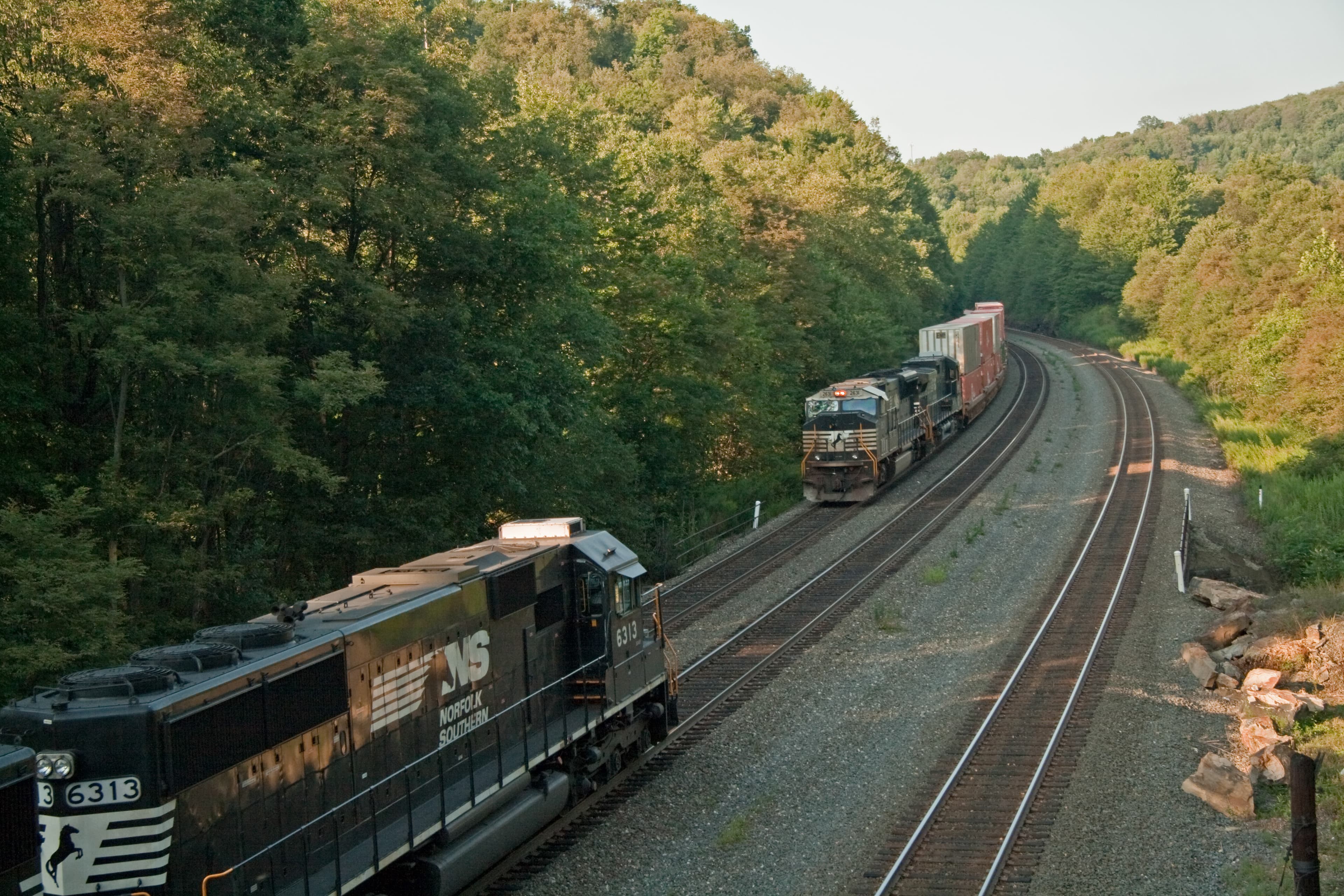
Mance Curve is a 180-degree horseshoe bend on CSX's Keystone Subdivision at Sand Patch Grade in the Allegheny Mountains of Pennsylvania, where approximately 20 freight trains daily climb a 2% grade toward the 2,258-foot summit.
Updated
Photos
No photos yet — be the first to share one!
Trainspotting Experience
The main viewing position at Mance Curve is the public grade crossing where Mance Road intersects the CSX Keystone Subdivision. To find it, enter "Mance Road, Meyersdale, Pennsylvania" into your GPS. From this crossing near the midpoint of the horseshoe, you can watch an entire train appear at one end, sweep around the approximately 180-degree curve, and pass directly in front of you before disappearing toward the Sand Patch summit at 2,258 feet elevation.
The grade here approaches 2%, so eastbound locomotives work at full throttle on the climb, filling the valley with diesel exhaust and deep engine roar. Westbound trains descend under dynamic braking, producing a distinctive howl that carries across the hillside. Expect horn blasts at the crossing and flange squeal on the tight curve radius. Trains move at moderate speed through the bend—slow enough for detailed observation of locomotive consists and car types, but with enough momentum to convey the raw power required to cross the Alleghenies.
CSX Special Agents actively patrol the Sand Patch corridor, and No Trespassing signs are posted at access roads to railroad property. Stay on the public road and crossing at all times. The Mance Road crossing is a legitimate public vantage point—there is no need to venture onto railroad right-of-way for excellent viewing and photography.
Landscape, Setting & Local Atmosphere
Mance Curve sits on the western slope of the Allegheny Mountains at approximately 2,000 feet elevation, below the Sand Patch summit at 2,258 feet. The surrounding terrain is forested ridges and rolling farmland typical of Somerset County, Pennsylvania, with open clearings that provide long sight lines in spring and fall when the hardwoods are bare. Summer brings dense green foliage that can reduce visibility from certain angles but creates lush backdrops. Winter often blankets the scene in snow, highlighting dark rail and shining locomotive headlights against white ground.
Mance itself is an unincorporated community in Northampton Township with a handful of structures, including an old general store and a tree farm that have become familiar background elements in countless railfan photographs. The area retains a deeply rural, undeveloped character—no billboards, no industrial sprawl, just rails curving through forest and farmland. Between trains, the natural quiet of the valley dominates, broken only by wind through the trees and the occasional vehicle on the narrow road.
Type & Frequency of Train Activity
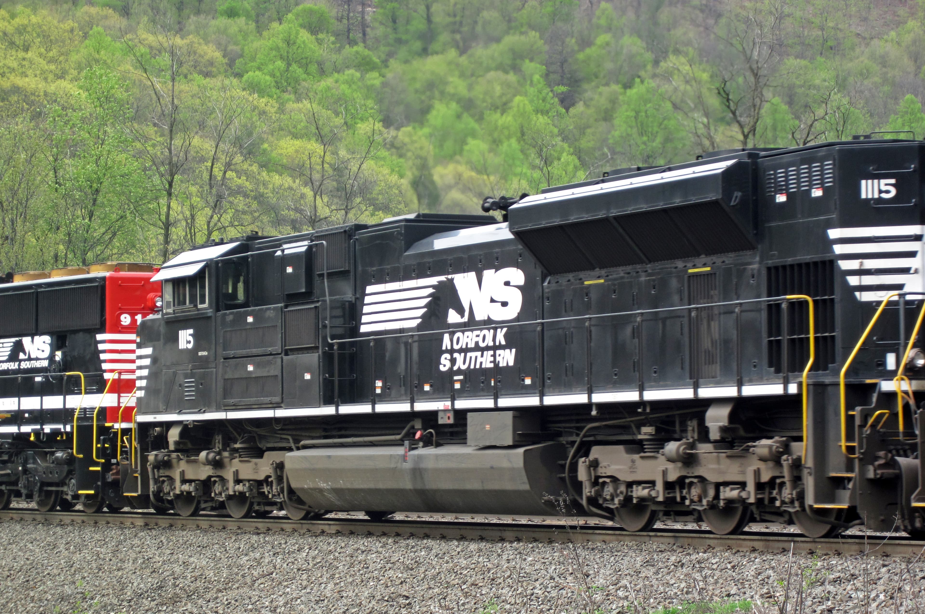
CSX Transportation operates the Keystone Subdivision through Mance Curve as part of its Baltimore-to-Chicago mainline, one of the busiest freight corridors in the eastern United States. The line averages approximately 20 freight trains per day, carrying a diverse traffic mix: unit coal trains from Appalachia, crude oil and ethanol sets, double-stack intermodal containers linking the Midwest with Atlantic ports, and mixed manifest freight hauling steel, chemicals, grain, and auto parts.
Historically, CSX stationed helper locomotives at the base of the grade to push heavy eastbound trains up the 2% climb. In recent years, the railroad has been phasing out dedicated pusher assignments across Sand Patch in favor of distributed power configurations, where additional locomotives are placed mid-train rather than on the rear.
The sole passenger service is Amtrak's daily Capitol Limited (train 30 eastbound, train 29 westbound), operating the Washington–Chicago route via Pittsburgh. Eastbound No. 30 departs Pittsburgh at 5:20 a.m. and passes through the Sand Patch corridor in the early morning hours; the westbound service traverses the grade in the evening. Check Amtrak's current timetable for exact times, as schedules shift seasonally.
Best Angles for Photos & What Railfans Enjoy Most
The classic composition from the inside of the horseshoe curve, just south of the Mance Road crossing, frames the locomotive entering the bend while the tail of the train still hugs the opposite hillside—a dramatic demonstration of train length on a mountain railroad. Morning light from the east illuminates eastbound (uphill) consists well; late afternoon sun favors westbound trains with warm golden light.
A telephoto lens in the 100–200mm range compresses the curve into a striking S-shaped composition, while wider angles (24–35mm) capture the sweeping mountainous terrain surrounding the tracks. A short walk up the embankment on the outside of the horseshoe provides a higher perspective, ideal for capturing the full radius of the curve against the valley floor.
For an alternative vantage, the Foley Overlook at Fairhope—about 5 km south—offers dedicated photography platforms overlooking CSX trains crossing Wills Creek. To reach the overlook, turn south onto the paved road 100 yards east of the Fairhope post office and follow it about 2 miles; the overlook will be on the right. Lighting there is best from mid-morning through early afternoon, once the sun clears the ridgeline. Additional viewpoints include the roadway overpass a mile west of Sand Patch Tunnel.
Historical or Cultural Relevance
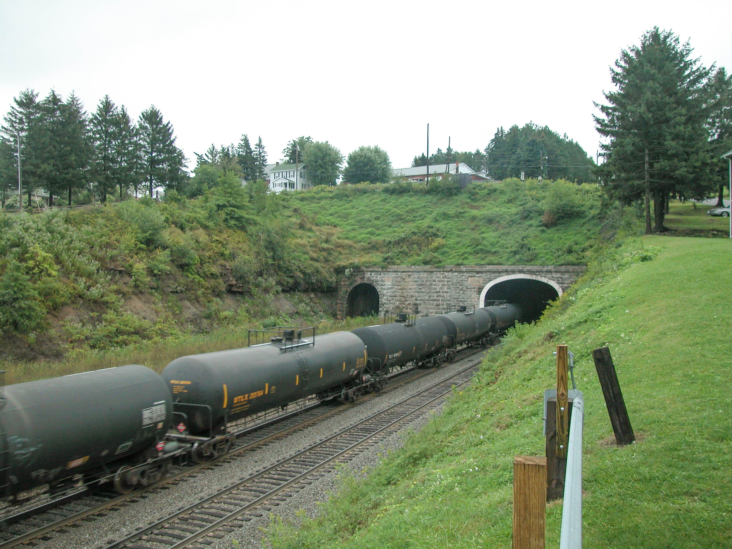
The Sand Patch Grade was built by the Pittsburgh & Connellsville Railroad, authorized in 1853 to extend from Pittsburgh to Cumberland, Maryland, crossing the Allegheny Mountains along the way. Construction of the original Sand Patch Tunnel—4,777 feet long—began in 1854, and the full line through to Cumberland was completed in May 1871. The route became the Pittsburgh Division of the Baltimore & Ohio Railroad, giving the B&O its most efficient mainline crossing of the Alleghenies to reach Pittsburgh and Chicago.
The Mance horseshoe curve was engineered as part of the original alignment to gain elevation rapidly within the confined mountain terrain, where the grade climbs from Cumberland at 627 feet to the summit at 2,258 feet—a rise of over 1,600 feet. A second tunnel, 4,475 feet long and double-tracked, was completed between 1911 and 1913 to handle increasing traffic volumes. The B&O became part of the Chessie System in 1972 and was merged into CSX Transportation in 1987.
Throughout the 20th century, Sand Patch served as a critical wartime freight corridor and a proving ground for increasingly powerful locomotive designs, from steam-era articulateds hauling coal to the modern AC-traction diesels that dominate the line today. Railfans have been photographing this corridor for generations, maintaining an unbroken visual record of American railroading across the Alleghenies.
What Makes This Spot Different
Mance Curve is sometimes called "Pennsylvania's other horseshoe curve," a nod to the more famous Norfolk Southern Horseshoe Curve near Altoona. What distinguishes Mance is the combination of a full 180-degree bend with a 2% grade on a heavily trafficked freight mainline—allowing observers to see an entire train from head to tail without changing position, while hearing the locomotives labor at full power on the climb. Few locations in the eastern United States offer such an unobstructed panoramic view of heavy freight battling a mountain grade.
The remote, undeveloped setting in the Allegheny Mountains preserves a 19th-century feel with minimal modern visual intrusion. The Great Allegheny Passage, a 150-mile rail-trail running from Pittsburgh to Cumberland, passes through the Sand Patch corridor parallel to the active CSX mainline, offering an alternative way to access the area on foot or by bicycle. Nearby railway heritage sites include the Salisbury Viaduct—a 1,908-foot-long, 101-foot-high former Western Maryland Railway bridge now converted to trail use—and the restored 1911 Western Maryland Railroad station in Meyersdale, home to the Meyersdale Area Historical Society and its railroad exhibits.
Frequently Asked Questions
QHow many trains per day pass through Mance Curve?
Approximately 20 CSX freight trains per day, plus Amtrak's Capitol Limited once daily in each direction. Freight traffic includes coal, intermodal, oil, and mixed manifest trains.
QHow do I get to Mance Curve?
Enter Mance Road, Meyersdale, Pennsylvania into your GPS. The viewing location is at the public grade crossing where Mance Road crosses the CSX tracks.
QIs there parking at Mance Curve?
There is no formal parking lot. Railfans typically park along the shoulder of Mance Road near the grade crossing. Be careful not to block the road or crossing.
QCan I walk on the railroad tracks at Mance?
No. CSX Special Agents actively patrol Sand Patch Grade and issue citations. Stay on the public road and grade crossing only. No Trespassing signs are posted at access roads.
QWhat is the Amtrak Capitol Limited schedule through Sand Patch?
Eastbound train 30 departs Pittsburgh at 5:20 a.m. and passes through the Sand Patch area in early morning. Westbound train 29 traverses the grade in the evening. Check Amtrak.com for current schedules.
Safety Tips
Stay on the public road and grade crossing at all times—CSX Special Agents actively patrol the Sand Patch corridor and issue trespassing citations. No Trespassing signs are posted at access roads to railroad property. Trains approach quickly and relatively quietly around the curve; maintain constant awareness when near the tracks. The rural road has no sidewalks or guardrails. Cell phone reception may be limited in the valley. In winter, check road conditions before driving to Mance Road.
Seasonal Information
Spring and fall offer the best combination of comfortable temperatures and clear sight lines through bare hardwoods, making the full curve visible from most angles. Fall foliage in the Alleghenies peaks in October, providing spectacular color backdrops. Summer brings lush green foliage that can obstruct some photography angles but creates dramatic natural framing. Winter often delivers snow scenes with high-contrast compositions—dark locomotives against white ground—though Mance Road can become challenging in icy conditions. The Pennsylvania Maple Festival draws visitors to nearby Meyersdale in late March.
Nearby Lodging
Find places to stay near Mance Curve (Sand Patch).
This lodging map is provided by Stay22, a third-party service that may set cookies. It loads only with your consent.
Accommodation results are provided by Stay22; we may earn a commission on bookings made through this map.
Nearby Attractions
0.3 miles / 0.5 km
150-mile rail-trail from Pittsburgh to Cumberland running parallel to the CSX mainline through Sand Patch. Crushed limestone surface, ideal for cycling and hiking with frequent railroad viewing opportunities.
5 miles / 8 km
Former Western Maryland Railway bridge, 1,908 feet long and 101 feet above the Casselman River Valley. Built in 1912, now converted to trail use on the Great Allegheny Passage with 360-degree panoramic views.
3.7 miles / 6 km
Restored 1911 Western Maryland Railroad station housing railroad exhibits, model train displays, a WM caboose, and local history artifacts. Serves as a Great Allegheny Passage trailhead.
3.1 miles / 5 km
Dedicated railfan photography platforms overlooking CSX trains crossing Wills Creek on the Keystone Subdivision. Best light mid-morning through early afternoon. Access via paved road south of Fairhope post office.
2.5 miles / 4 km
A 910-foot-long curved combination truss bridge and deck plate girder viaduct soaring nearly 100 feet above Flaugherty Creek and the active CSX rail line. Located at GAP mile 29.8.
Official Resources
Related on Spotatrain
Spots Near Fairhope

Cumberland Narrows
Watch CSX freight trains and Western Maryland Scenic Railroad steam excursions pass through a dramatic 1,000-foot-deep water gap in the Allegheny Mountains, where Wills Creek carved a passage between Wills Mountain and Haystack Mountain that has served as a transportation corridor since the 1840s.
Cassandra Railroad Overlook
A 1936 iron bridge spanning three Norfolk Southern main line tracks on the busy Pittsburgh Line in the Allegheny Mountains, offering direct overhead and trackside views of 50-60 daily freight movements plus Amtrak's Pennsylvanian.

Cresson
One of America's premier railfan destinations, Cresson sits atop the Allegheny Mountains on Norfolk Southern's Pittsburgh Line at milepost 251. A dedicated observation platform, helper operations, and 50-70 daily train movements make this small Pennsylvania borough a must-visit for serious railfans.
Gallitzin Tunnels
Three historic tunnels at the summit of the Alleghenies on Norfolk Southern's Pittsburgh Line (MP 248), with 50+ daily trains. Tunnels Park overlooks the west portals from downtown Gallitzin at 2,167 feet elevation.
Horseshoe Curve
America's most famous railroad curve — a 220-degree, three-track bend on Norfolk Southern's Pittsburgh Line, 5 miles west of Altoona. Built 1854, NHL since 1966. Around 50-60 trains daily.
Hagerstown (NS/CSX)
Hagerstown, Maryland's historic "Hub City" where CSX, Norfolk Southern, and Winchester & Western railroads converge. Watch freight operations from multiple vantage points near the downtown shared trackage, adjacent to the Hagerstown Roundhouse Museum.
More Spots in Pennsylvania

Lewistown (NS Main)
Historic 1849 PRR station on Norfolk Southern's Pittsburgh Line — the oldest Amtrak-served station in the U.S. — with 50-70 daily freight trains plus Amtrak's Pennsylvanian.
New Castle (CSX/NS)
A multi-railroad junction in northwest Pennsylvania where CSX, Norfolk Southern, the New Castle Industrial Railroad, and the Buffalo & Pittsburgh Railroad converge along the Shenango River valley. The 1923 Mahoning Avenue Viaduct provides an overhead vantage point, and the 12-mile Stavich Bike Trail runs alongside active CSX trackage.
Enola Yard (Harrisburg)
A historic Norfolk Southern flat-switching yard in East Pennsboro Township, Pennsylvania, stretching four miles along the Susquehanna River. Once the world's largest freight yard, Enola handles roughly 25 trains daily and offers multiple public viewing spots along US 11/15 and nearby bridges.
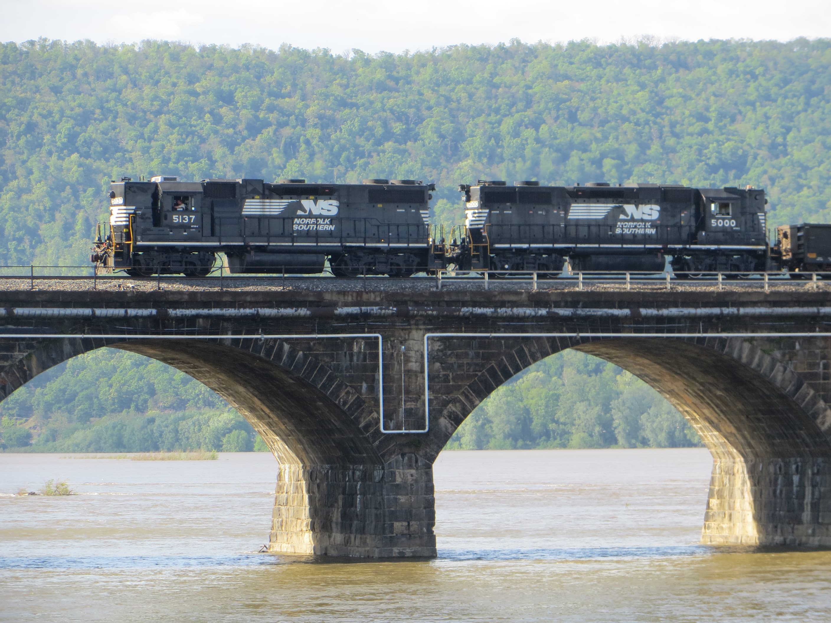
Rockville Bridge
The world's longest stone masonry arch railroad bridge (3,820 ft, 48 arches), built in 1902 by the Pennsylvania Railroad. Carries Norfolk Southern's Pittsburgh Line and Amtrak's Pennsylvanian across the Susquehanna River, with 50-70 freight trains daily.
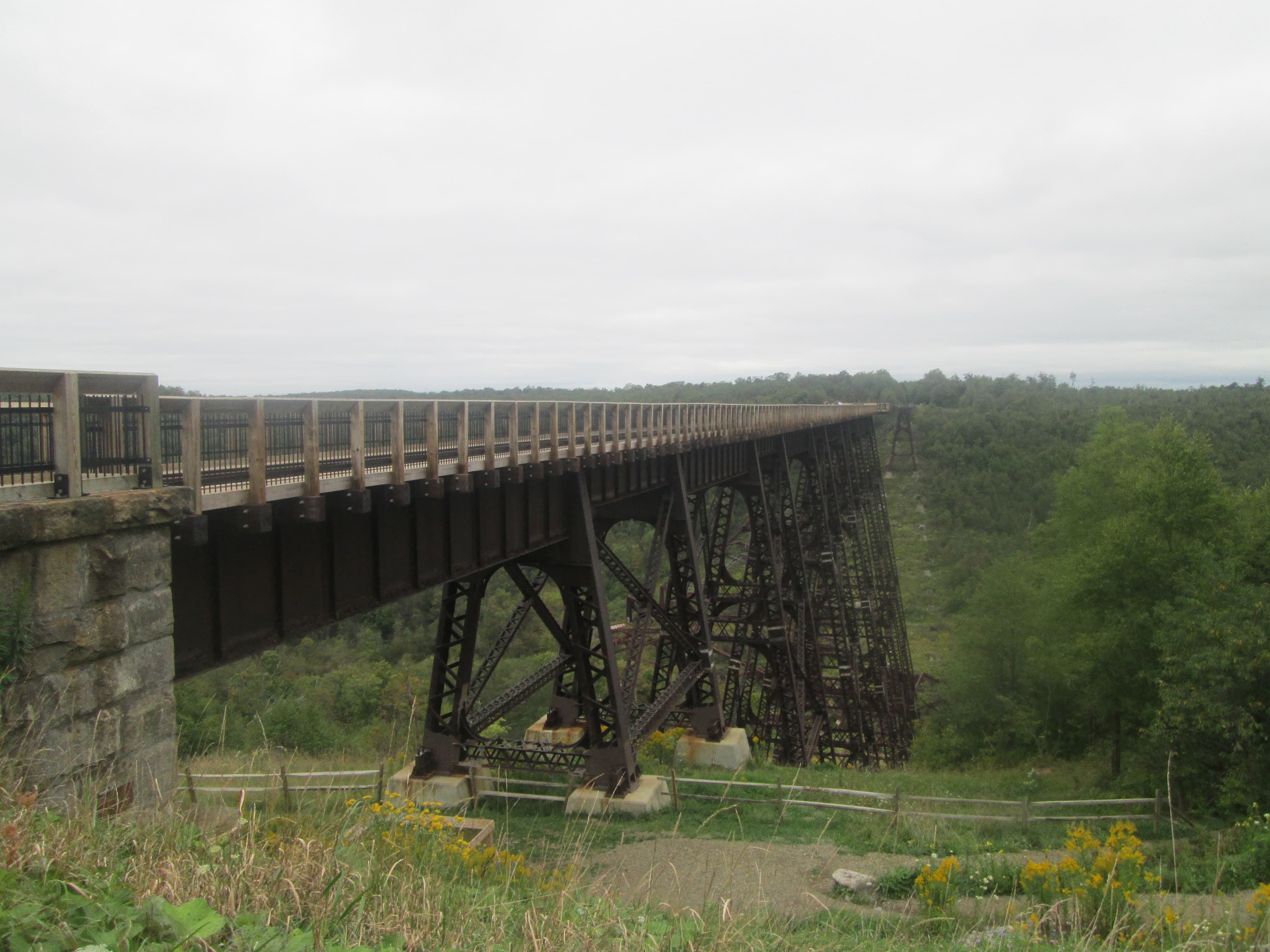
Kinzua Bridge
Completed in 1882 as the world's tallest railroad bridge and engineered by Octave Chanute, Kinzua Viaduct was partially toppled by an F1 tornado in 2003. Its surviving four towers now form a 624-foot skywalk 300 feet above a Pennsylvania gorge.
Macungie Railfan Pavilion
A purpose-built covered railfan pavilion in Macungie, PA, offering trackside views of 30-35 daily Norfolk Southern freight trains on the busy Reading Line between Wyomissing Junction and Bethlehem.
Related Experiences

Horseshoe Curve National Historic Landmark
An 1854 engineering marvel near Altoona where three tracks bend 220 degrees around a mountain, with a trackside train-watching park.
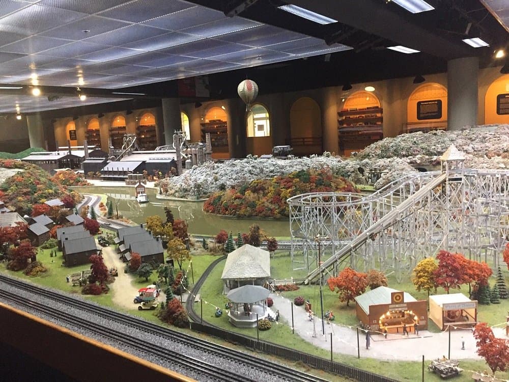
Miniature Railroad & Village at Kamin Science Center
A 100-year-old O-scale model railroad of 1880s–1930s Western Pennsylvania at Pittsburgh's Kamin Science Center.

National Museum of Railroad History & Innovation
America's oldest railroad museum, set in the historic 1884 Baltimore roundhouse on the birthplace site of U.S. railroading.
Related Journeys & Mega-Projects

Strasburg Rail Road
America's oldest continuously operating standard-gauge railroad — a 45-minute steam ride through Amish farmland.

California Zephyr
Chicago to San Francisco across the Rockies and Sierra Nevada

Mount Washington Cog Railway
World's first mountain-climbing cog railway — 1869, 37.41% grade, climbs to 6,288 ft
Help improve this page
Spotted something out of date or incorrect? Let our community know.
Looking for more spots? Browse the complete list of train spotting locations.
Quick Information
Country
United States
Region
Pennsylvania
City
Fairhope
Spot Type
Curve/Loop
Best Times
Daylight hours year-round. Freight traffic runs around the clock but is best observed during daytime. The eastbound Amtrak Capitol Limited passes through in early morning; the westbound in the evening.
Visit Duration
2-4 hours
Cost
Free
Train Activity
Train Types
Frequency
Approximately 20 freight trains per day, plus one daily Amtrak Capitol Limited in each direction
Access & Amenities
Parking
Available (Free — informal roadside parking along Mance Road near the grade crossing. No formal lot.)
Shelter
Not available
Restrooms
Not available