Spotting Location
White Rock (Waterfront BNSF)
A 2.19-km paved promenade on Semiahmoo Bay puts you within metres of the BNSF Bellingham Subdivision single main — carrying approximately 28 trains daily including Amtrak Cascades and heavy BNSF freight — with Mount Baker rising to the south-east as a backdrop.
Updated
Photos
No photos yet — be the first to share one!
Trainspotting Experience
The BNSF Bellingham Subdivision runs a single track directly along the Semiahmoo Bay waterfront in White Rock, separated from the 2.19-kilometre paved promenade by a low concrete retaining wall. The City of White Rock and BNSF have installed 16 safety gates at eight promenade entry points — these form the only barrier between the public walkway and the active main line. The track is operated under CTC (Centralized Traffic Control), and railfans watching the signals at each end of town can anticipate approaching traffic from either direction. With approximately 28 daily movements on a single track, gaps between trains are rarely longer than 30–45 minutes, and often much shorter during peak freight windows. Both northbound and southbound trains navigate a gentle curve as they enter the White Rock waterfront section, allowing clean broadside and three-quarter views from most promenade positions. The closest formal access points are the 1,001 Steps Park at the foot of 15A Avenue (with nearby transit) and stairways at the foot of 24th Avenue. The 470-metre White Rock Pier — Canada's longest pier, opened 1914 — provides an elevated lateral vantage point looking back toward the shoreline for trains passing beneath.
Landscape, Setting & Local Atmosphere
The track hugs the shoreline of Semiahmoo Bay — not the open Pacific — placing trains against open salt water for most of the promenade's length. On clear days, snow-capped Mount Baker (3,286 m / 10,781 ft) rises prominently to the south-east, while the San Juan Islands form a layered silhouette to the south-west. The foreground shifts with the tides: at low water, tidal flats extend toward the international border and wet sand reflects locomotive paint; at high tide, water reaches close to the retaining wall, compressing the scene into a dramatic rail-and-sea composition. Marine Drive runs above and parallel to the promenade, lined with cafés, restaurants, and shops. The 470-metre White Rock Pier juts into the bay near the centre of the waterfront, providing a secondary vantage point with oblique views of passing trains from above. Lighting is best in the morning for northbound (south-east-facing) moves and in late afternoon for southbound trains viewed from the east end. Winter brings dramatic cloud formations and low, diffused light suited to moody colour or black-and-white work; June and July evenings deliver golden-hour windows extending well past 9 PM.
Type & Frequency of Train Activity
The BNSF Bellingham Subdivision — a single-track main line running approximately 191 km (119 miles) from Everett, Washington to Blaine, Washington — carries an estimated 28 trains daily through White Rock. Traffic includes: four Amtrak Cascades trains per day (two northbound toward Vancouver Pacific Central Station, two southbound toward Seattle and Portland), operated with Siemens Charger locomotives; BNSF manifest freight hauling Canadian softwood lumber, paper products, and general merchandise; intermodal stack trains serving Port of Vancouver container traffic; and occasional unit trains of coal and petroleum coke heading north to Roberts Bank export terminal near Delta, BC. The subdivision has been reported at near-capacity utilization since the mid-2000s, so gaps between trains tend to be shorter than railfans accustomed to lower-density lines might expect. Freight trains frequently stretch 8,000–10,000 feet and take two to three minutes to pass a fixed vantage point. All traffic operates under CTC on this territory; no passenger stop exists at White Rock — Amtrak Cascades trains pass through at line speed without stopping.
Best Angles for Photos & What Railfans Enjoy Most
The 2.19-km promenade gives continuous access to the track, but three positions stand out:
Pier base and Museum area: The 1913 Great Northern station (now White Rock Museum & Archives) sits immediately at the foot of the pier, and the track curves gently through this zone. Shooting south-west from near the pier entrance at low tide gives both open water and rail in the same frame, with Mount Baker on clear days. A 24–70 mm lens covers the curve comfortably. Best for northbound trains in the morning.
1,001 Steps Park (foot of 15A Avenue): Descending from Marine Drive gives a slight elevation advantage over passing trains — useful for showing roof detail and context between train and shoreline. The White Rock boulder is occasionally visible in the background. A 70–200 mm lens suits this position well. Access via transit is straightforward from this point.
East promenade (foot of 24th Avenue): The track runs straighter here, enabling telephoto compression — 300–400 mm — with trains set against open water on one side and the seawall on the other. Southbound trains are front-lit in the mid-to-late afternoon.
Fog from Semiahmoo Bay occasionally lingers on early-morning freight moves, creating an atmospheric diffusion layer. The promenade surface is paved and level throughout, making handheld panning viable. For video, the smooth surface allows steady walks alongside passing trains.
Historical or Cultural Relevance
The railway at White Rock traces its origins to James J. Hill's expansion into British Columbia. Hill's first BC line, the New Westminster & Southern Railway, opened 14 February 1891 — the first international rail line west of Winnipeg — connecting the south shore of the Fraser River to the American border at Blaine, Washington. In 1909, the Great Northern Railway rerouted its main line to follow the Semiahmoo Bay shoreline, opening the scenic "sealine route" through White Rock and Crescent Beach to New Westminster. This waterfront alignment directly triggered White Rock's development as a seaside resort. A dedicated station building opened New Year's Day 1913, and by that same year the building also housed Canadian Customs — immigration officers were processing an estimated 15,000 to 18,000 travellers per month through the White Rock port of entry. In White Rock's peak passenger era, four trains a day served the town; the three-car Campers Special ran between Vancouver and Blaine from 1911 to 1925. Passenger service to White Rock ceased in 1975. The 1913 Great Northern station building survives today as the White Rock Museum & Archives, situated directly beside the pier — making it one of the few places in western Canada where railfans can examine a railway's founding infrastructure while simultaneously watching its freight descendants roll past outside.
What Makes This Spot Different
White Rock's 2.19-kilometre promenade offers one of the longest stretches of publicly accessible, unobstructed waterfront rail corridor in western Canada. The entire length places visitors within 10–20 metres of the active BNSF Bellingham Subdivision main, with clear sightlines in both directions. The combination of Amtrak Cascades passenger service and heavy BNSF freight — all framed against open Semiahmoo Bay with Mount Baker visible to the south-east — is rarely matched at a location with this level of pedestrian amenity and transit accessibility. The 1913 Great Northern station at the pier head (now White Rock Museum & Archives) adds a direct historical layer: the building that once processed tens of thousands of cross-border rail travellers per month now stands as a museum while modern BNSF freight rolls past its windows. The White Rock boulder — a 480-tonne glacial erratic on the foreshore — and the 470-metre pier (Canada's longest) complete a setting that rewards both railfans and general visitors, making it one of the most accessible and scenically distinctive railfanning locations in the Lower Mainland.
Frequently Asked Questions
QCan I walk the entire promenade alongside the BNSF tracks?
Yes. The 2.19-km White Rock promenade runs parallel to the BNSF Bellingham Subdivision for its full length, separated by a low concrete retaining wall. The City of White Rock and BNSF have installed 16 safety gates at 8 promenade entry points. The promenade is open 24 hours and paved throughout.
QHow many trains pass through White Rock per day?
Approximately 28 trains daily: four Amtrak Cascades trains (two northbound toward Vancouver, two southbound toward Seattle/Portland) plus an estimated 24 BNSF freight trains including manifest freights, intermodal stack trains, and occasional coal/petroleum coke unit trains heading to Roberts Bank.
QDoes Amtrak stop at White Rock?
No. Amtrak Cascades does not stop at White Rock. The nearest Amtrak stops are Bellingham, WA (Fairhaven Station) to the south and Vancouver, BC (Pacific Central Station) to the north. Trains pass through White Rock at line speed without stopping.
QIs there parking at the White Rock waterfront?
Yes. Pay parking is available along Marine Drive via the PayByPhone app, in effect 24 hours a day. Free parking is available from November 1 to January 31. The promenade is also reachable by transit — White Rock has bus connections from Surrey Central Station on the SkyTrain network.
QWhat is the White Rock Museum, and is it worth visiting for railfans?
The White Rock Museum & Archives is housed in the original 1913 Great Northern Railway station, located right beside the pier. It documents the history of White Rock from its Indigenous heritage through its railway-driven development as a resort town, and holds photographs and artifacts from the Great Northern era. For railfans it is a direct link to the corridor's passenger service history.
QWhat freight does BNSF haul through White Rock?
BNSF freight through White Rock includes Canadian softwood lumber, paper products, and general merchandise (manifest trains); intermodal containers destined for Port of Vancouver; and occasional unit trains of coal and petroleum coke bound for Roberts Bank export terminal near Delta, BC.
Safety Tips
The BNSF Bellingham Subdivision is a high-traffic, CTC-dispatched main line operating 24 hours a day. Always stay on the promenade side of the 16 safety gates; do not cross the gates or approach the track. Trains on a single-track main can come from either direction — do not assume a gap means no train is coming. Amtrak Cascades trains pass through at line speed without stopping; they are quieter than freight trains and can approach quickly. Keep children supervised near all gate openings. At night, the promenade is lit but train sightlines may be shorter — maintain awareness from both directions.
Seasonal Information
Spring/summer (April–September): Peak season for both railfanning and tourism. Long daylight hours — sunset after 9 PM in June — allow extended evening photography sessions. Mount Baker and the San Juan Islands are most visible in clear June and July weather. The promenade is busiest on summer weekends; arrive before 9 AM or use transit (bus connections from Surrey Central SkyTrain station) to avoid parking competition. Wildflower growth along the foreshore adds colour to foreground compositions in May. Fall (October–November): Reduced crowds, dramatic cloud formations, and storm light. The misty, overcast conditions common in October suit moody, high-contrast compositions. Rain gear is practical but most days remain walkable. Train frequency is unaffected by season. Winter (December–March): The quietest season for visitors and occasionally the most dramatic for photography. Storm surf, sea mist, and flat grey water provide strong contrast to brightly painted locomotives. Free waterfront parking is available from November 1 to January 31, significantly reducing costs. Snow is rare in White Rock (maritime climate) but possible. The 1913 Great Northern station / White Rock Museum is typically open year-round.
Nearby Lodging
Find places to stay near White Rock (Waterfront BNSF).
This lodging map is provided by Stay22, a third-party service that may set cookies. It loads only with your consent.
Accommodation results are provided by Stay22; we may earn a commission on bookings made through this map.
Nearby Attractions
0.1 miles / 0.1 km
Housed in the original 1913 Great Northern Railway station beside the pier, this museum documents White Rock's history from Indigenous heritage through its railway-driven resort-era development. Essential context for railfans visiting the corridor.
0.1 miles / 0.1 km
At 470 metres (1,542 ft), Canada's longest pier juts into Semiahmoo Bay from the foot of the promenade, providing elevated lateral views of passing BNSF trains from above. Originally built in 1914, it is open 24 hours.
0.1 miles / 0.2 km
The giant glacial erratic that gave the city its name — a 480-tonne white-painted granite boulder on the foreshore, visible from the promenade near the pier. A historic landmark with Indigenous cultural significance.
3.1 miles / 5 km
Straddles the BC–Washington border approximately 5 km west of the White Rock waterfront. The park offers views of BNSF trains approaching the international boundary crossing and is a recognized railfan photography location on the Bellingham Subdivision.
0.6 miles / 1 km
City park approximately 1 km from the waterfront offering panoramic views of Semiahmoo Bay. Sports fields, tennis courts, and walking trails with open sightlines toward the same bay backdrop seen from the promenade.
Official Resources
Related on Spotatrain
Spots Near White Rock
Blackie Spit Park
Set on a sandy peninsula at Mud Bay, Blackie Spit Park offers ground-level views of BNSF freight trains and Amtrak Cascades on the historic 1909 Great Northern sea-line route, with Mount Baker as backdrop.
Everett (Tunnel Junction)
Watch BNSF freight, Amtrak Cascades, Empire Builder, and Sounder commuter trains emerge from or enter the 1.5-mile Everett Tunnel on BNSF's Scenic Subdivision at the junction with the Bayside Main Line along Puget Sound.
Edmonds Waterfront
Watch BNSF freight, Amtrak Cascades, Empire Builder, and Sounder commuter trains at Milepost 18 on the Scenic Subdivision, with Puget Sound and the Olympic Mountains as backdrop. City-maintained benches on Sunset Avenue offer front-row seats just feet from the mainline.
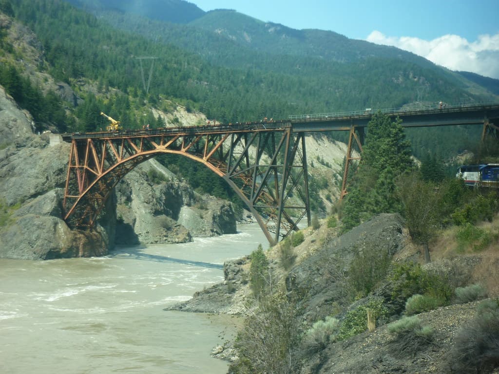
Cisco Bridges
Twin railway bridges where CPKC and CN swap sides of the Fraser River in a dramatic canyon 12 km south of Lytton, BC. One of Canada's most iconic railfan locations.
Argo Crossing (Seattle)
Argo Crossing is where Union Pacific's line crosses the BNSF Railway main line in Seattle's industrial south end, adjacent to UP's Argo Yard. This at-grade diamond sits at the junction of two Class I railroads, offering a front-row seat to intermodal freights, Amtrak Cascades, the Coast Starlight, and yard switching operations in the heart of the Georgetown neighborhood.
Scenic (Cascade Tunnel)
West portal of the 7.8-mile Cascade Tunnel on BNSF's Scenic Subdivision at Stevens Pass. Trains emerge from the longest railroad tunnel in the United States into dense Cascade Range forest, with up to 28-30 movements daily.
More Spots in British Columbia
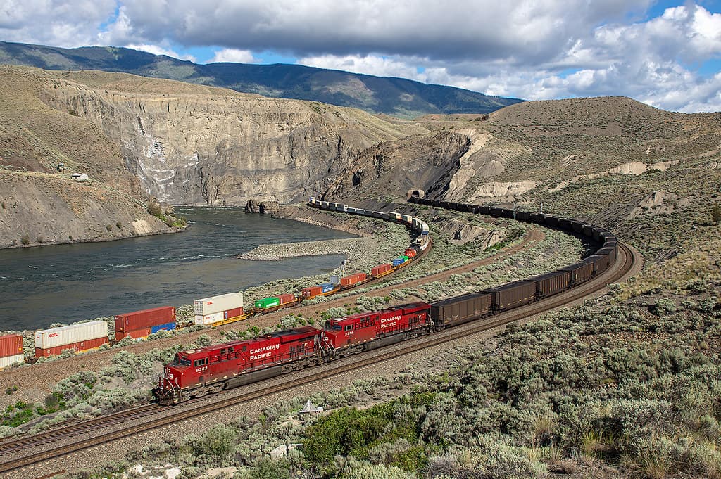
Ashcroft (Black Canyon)
A dramatic canyon on the Thompson River where CN and CPKC mainlines run on opposite sides, offering views of both railways' directional-running freight traffic through BC's desert interior.
Kamloops (Junction)
CN's Kamloops yard sits at the junction of the Ashcroft, Clearwater, and Okanagan subdivisions on the Vancouver–Edmonton mainline. Both CN and CPKC run over 50 trains per day combined through the Kamloops area, with VIA Rail and Rocky Mountaineer passenger services adding variety.
Revelstoke (CP Main)
CPKC division point in the Columbia River valley where 40+ daily freight movements navigate between the Selkirk and Monashee mountains. Home to the Revelstoke Railway Museum, a Virtual Railfan live webcam, and dramatic Columbia River bridge photography.
Spiral Tunnels (Kicking Horse)
Two 270-degree spiral tunnels where CPKC freight and passenger trains loop through Cathedral Mountain and Mount Ogden in Yoho National Park. Built in 1909 to replace the dangerous 4.5% Big Hill grade, 25-30 trains per day still navigate this century-old engineering marvel. Two Parks Canada viewpoints with interpretive panels offer safe, unobstructed views.
Prince George CN Yard
Major CN rail hub at the confluence of the Fraser and Nechako Rivers, where the east-west CN mainline meets the former BC Rail corridor south to Vancouver.
Related Experiences
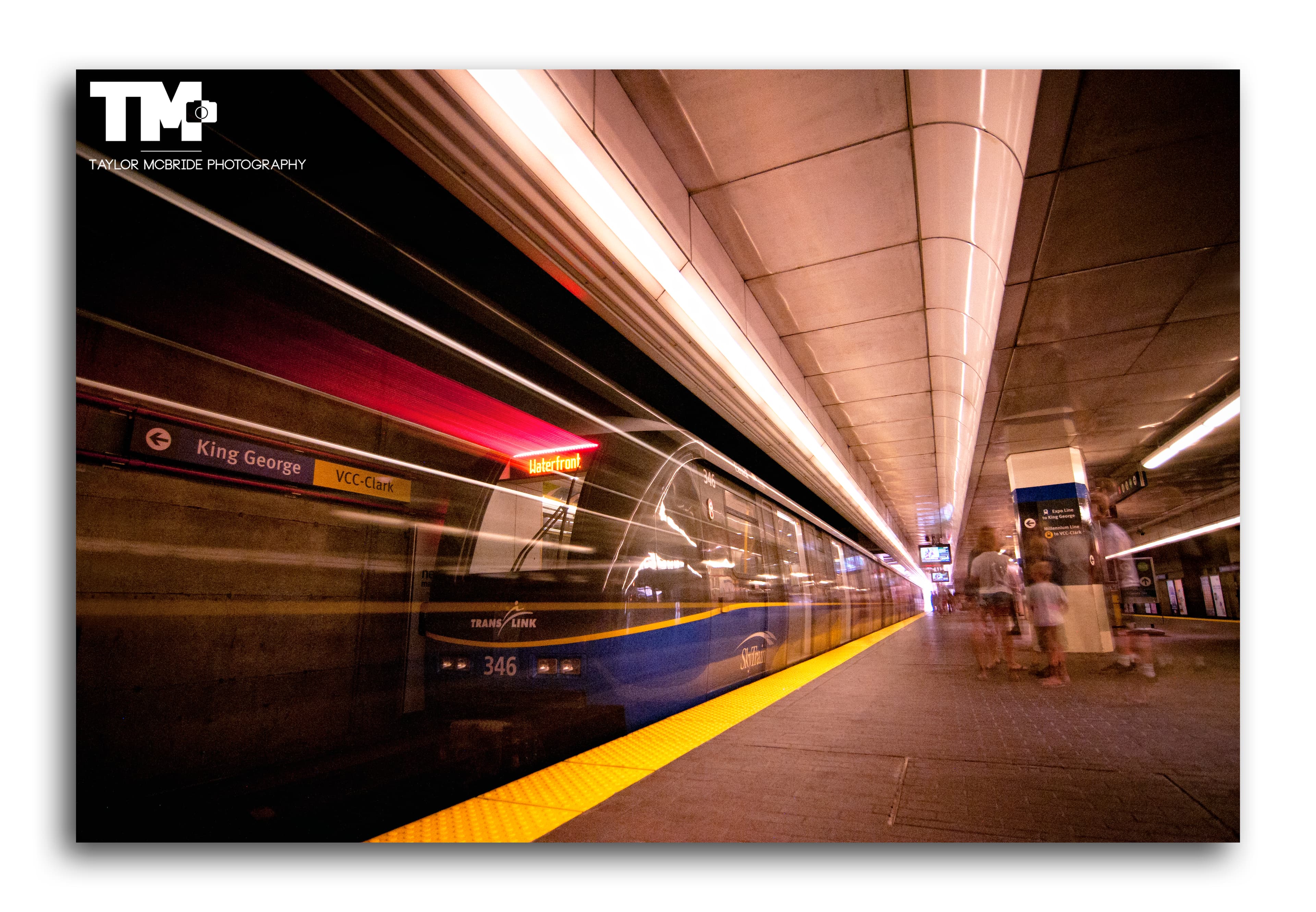
SkyTrain Expo Line (Vancouver)
An elevated rapid transit line offering panoramic city and mountain views as it soars above Vancouver via the iconic SkyBridge.
Revelstoke Railway Museum
Restored 1948 CPR Mikado steam locomotive No. 5468 anchors this Revelstoke museum of mountain railroading on the Canadian Pacific main line.
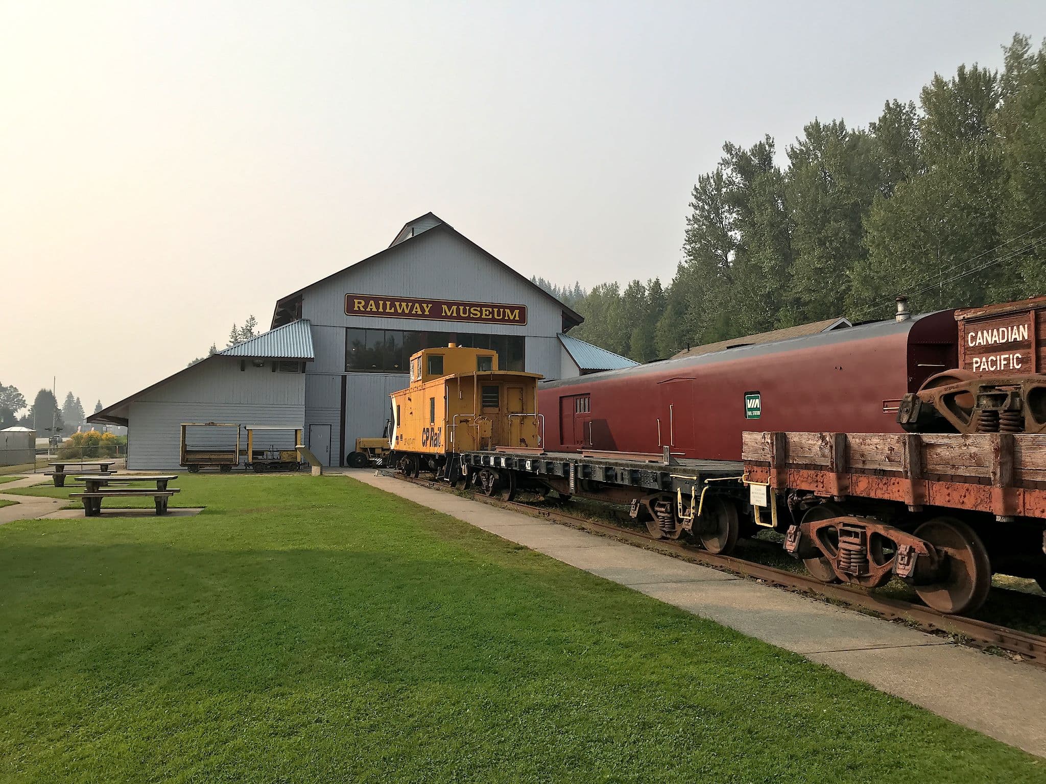
Canadian Museum of Rail Travel
One of North America's largest collections of early Canadian passenger railcars, in a historic CPR freight shed in Cranbrook, BC.
Related Journeys & Mega-Projects

California Zephyr
Chicago to San Francisco across the Rockies and Sierra Nevada

White Pass & Yukon Route — Summit Excursion
Climb 873 m from Skagway tidewater to the historic White Pass on a 914 mm narrow-gauge line built for the Klondike Gold Rush.

Brightline West
America's first true high-speed rail: Las Vegas to greater Los Angeles at 200 mph
Help improve this page
Spotted something out of date or incorrect? Let our community know.
Looking for more spots? Browse the complete list of train spotting locations.
Quick Information
Country
Canada
Region
British Columbia
City
White Rock
Spot Type
Coastal Route
Best Times
Mornings (7–10 AM) for front-lit northbound trains and the first Amtrak Cascades departures of the day. Mid-afternoon (2–5 PM) for southbound trains with sun behind the camera from east-end promenade positions. The promenade is open 24 hours; freight trains run at all hours with no published schedule.
Visit Duration
1–3 hours
Cost
Free entry to promenade; paid parking on Marine Drive via PayByPhone (free Nov 1–Jan 31).
Train Activity
Train Types
Frequency
~28 trains per day (4 Amtrak Cascades + ~24 BNSF freight)
Access & Amenities
Parking
Available
Shelter
Not available
Restrooms
Available