
Distance
64 km
Duration
2h30 – 2h45
Max altitude
880 m
Tunnels
2
Gauge
914 mm (3 ft)
A 40-mile (64 km) round trip from Skagway, Alaska, to the 873 m White Pass Summit on the original 1898–1900 alignment of the Klondike Gold Rush railway. Vintage cars, 914 mm narrow gauge, no passport required.
About This Journey
The Summit Excursion follows the original 1898–1900 alignment of the White Pass & Yukon Route, climbing 873 m (2,865 ft) from Skagway's tidewater piers to the international boundary at the top of the pass — a 40 mi (64 km) round trip that the railway estimates at 2h30 to 2h45. The line was driven through tide-soaked granite and glacier-scoured cliffs in twenty-six months by contractor Michael J. Heney, financed by London investors and finished with a last spike at Carcross on 29 July 1900.\n\nLeaving the Skagway depot, the train hugs the east shore of Skagway River before climbing past Rocky Point and Pitchfork Falls. By Milepost 11.5 it reaches Bridal Veil Falls, a cascade of up to 22 cataracts dropping into a gorge below the line. Above it, the train threads two short tunnels and the modern 1969 bypass replacing the original 215-foot (66 m) steel cantilever bridge over Dead Horse Gulch — completed in winter 1901 and once the tallest cantilever in the world. The summit itself sits exactly on the U.S.–Canada border at Milepost 20.4; the train switches direction here and returns to Skagway on the same alignment, so passengers stay aboard and no passport is required.
Why This Journey Is Iconic
Built in twenty-six months at a cost of $10 million during the Klondike Gold Rush, the White Pass & Yukon Route is now one of only a handful of original gold-rush railways still carrying passengers under its own name. The Summit Excursion is the segment most travellers ride: it concentrates the line's engineering drama — Inspiration Point, the Dead Horse Gulch span, twin tunnels, and the climb through Tormented Valley — into roughly two and a half hours. ASCE and the Canadian Society for Civil Engineering inscribed the railway as an International Historic Civil Engineering Landmark in 1994, putting it in the same engineering pantheon as the Eiffel Tower and the Panama Canal.
What to Expect
The Summit Excursion runs in vintage passenger coaches with open vestibules at each end and panoramic windows. Onboard guides commentate over the route's history; restrooms are in every car and complimentary bottled water is provided. The train climbs at sustained grades approaching 3.9% on switchback alignments with curves as sharp as 16 degrees. Stand on the vestibule for raw exhaust and air; sit on the left-hand side of the train going up (right-hand on the return) for the best views of the Skagway River gorge and Bridal Veil Falls. The Summit Excursion does not cross into Canada, so passports are not required for U.S. citizens.
History
The railway was born of the 1897 Klondike Gold Rush as a serious upgrade to the brutal Chilkoot and White Pass foot trails — the same passes where, in winter 1897–1898, more than 3,000 pack animals died and gave Dead Horse Gulch its name. Contractor Michael J. Heney and engineer Sir Thomas Tancrede signed off on the project after a chance meeting in Skagway in spring 1898. Construction reached the 873 m summit by mid-February 1899, Bennett, British Columbia, on 6 July 1899, and Carcross, Yukon, on 29 July 1900 — twenty-six months from groundbreaking. The line carried freight and passengers until 1982, when a collapse in mineral traffic closed it; tourist excursions reopened from Skagway in 1988. The current owner is Klondike Holdings, LLC, an investor group led by Survey Point Holdings with Carnival Corporation as a minority partner, which acquired the line on 1 August 2018.
Engineering Highlights
The Summit Excursion is built on textbook gold-rush engineering: 914 mm (3 ft) narrow gauge to minimise earthworks, curves up to 16 degrees, gradients near 3.9% sustained over twenty miles, and twin tunnels blasted through granite where no other alignment was possible. Two structures define the climb. Just south of the summit, the steel cantilever bridge over Dead Horse Gulch was completed in winter 1901, soaring 215 ft (66 m) above the White Horse Fork — at the time the tallest cantilever of its type in the world. It was retired and bypassed in autumn 1969 when a new tunnel and bridge took over the heavier post-war traffic; the original span is still visible from the train and is now known to railfans as the Ghost Bridge. The summit itself, at 873 m (2,865 ft) per the operator (Wikipedia gives 879 m / 2,885 ft), sits on the international border and is the operational reversal point for every Summit Excursion train.
Best Time to Travel
The Summit Excursion only operates from late April to early October. July and August are peak — and the busiest cruise-ship days in Skagway — with long daylight, average highs of 15–20 °C (60–70 °F) and full daily departures. Late May and early September trade some daylight for thinner crowds, occasional snow still clinging to the upper White Pass and, in September, gold-and-crimson alpine shrubs and birch. Book early for July weekends; this is one of the most-booked shore excursions in southeast Alaska, and the 2026 schedule already publishes blackout dates (May 2–4, Sep 26–27, Oct 1, 3–5).
Practical Tips
Book at least 24 hours in advance via wpyr.com to secure the published $155 fare; same-day walk-up rates are higher and seats often sell out on cruise-port days. The train is wheelchair accessible but lift cars are limited — call the Reservation Office at 1-800-343-7373 at least 48 hours ahead. No passport is required for the Summit Excursion (you stay aboard at the international boundary); a passport is mandatory for the Bennett, Carcross and Fraser services. Bring layered clothing — the summit is markedly colder and wetter than Skagway tidewater, even in July. Photographers should aim for vestibule positions on the river side of the train.
Route Stages
- km 00 m alt.15 min
Broadway Depot at 231 2nd Ave, Skagway — Milepost 0 at sea level. Tide-water depot alongside the cruise piers at the head of the Lynn Canal. A 10-minute walk from Skagway Airport and 100 m from the Klondike Gold Rush National Historical Park visitor centre.
Departure point. Cruise-pier dockside boarding for shore-excursion passengers.
- km 430 m alt.
Milepost 2.5. Final resting place of Klondike-era figures including Frank Reid and "Soapy" Smith, the Skagway crime boss whose 1898 shootout with Reid ended the town's lawless gold-rush phase. Train passes the cemetery on the left going north.
Burial site of Soapy Smith and Frank Reid (1898)
- km 9.3122 m alt.
Milepost 5.8 — historic siding at 402 ft (122 m) elevation. The settlement is now gone but the platform name persists in operator literature; the area marks the transition from the Skagway River delta to the start of the climb proper.
Start of the sustained climb toward the pass
- km 11.1194 m alt.
Milepost 6.9 at 637 ft (194 m). The line hugs a granite shoulder above the Skagway River; turning here on a 16-degree curve, the train opens its first sweeping view back over Skagway, the Lynn Canal and the cruise piers below.
First panoramic view back over Skagway and the Lynn Canal
- km 22.5570 m alt.
Milepost 14.0 at 1,871 ft (570 m). Wooden siding shelter mid-climb, used historically as a watering point for steam locomotives. The station overlooks the upper Skagway River valley and the glaciers from which it takes its name.
Mid-climb siding, historic watering stop
- km 27.4
Milepost 17.0. A signposted overlook on the south side of the train as it climbs. On a clear day the view sweeps down the entire Skagway valley to the Lynn Canal and out to the Chilkat Range — one of the most photographed spots on the line. (The carte officielle shows an "INSPIRATION POINT — 637 FT" label but the elevation appears inconsistent with the milepost profile and is left unset pending verification.)
Most-photographed viewpoint on the Summit Excursion
- km 28.2730 m alt.
Milepost 17.5. Named for the some 3,000 pack horses and mules that died of overwork and exposure on the original Klondike trail in winter 1897–98. The gulch is now spanned by the active 1969 bridge and tunnel; the original 1901 steel cantilever bridge (the "Ghost Bridge") is visible from the line.
3,000 pack animals perished here in 1897–98
- km 29.9780 m alt.
Milepost 18.6. The original 1901 cantilever bridge over White Horse Fork, 215 ft (66 m) high and once the tallest cantilever of its type in the world. Bypassed in autumn 1969 by a new tunnel and bridge; the span is still in place and visible from the active line on the east side of the train.
1901 steel cantilever, 215 ft / 66 m; tallest of its type in the world at construction
- km 31.1830 m alt.
Milepost 19.3. From here the train passes alongside the original Klondike Trail of 1898, the path stampeders climbed on foot when the railway didn't yet exist. Old boot- and hoof-prints worn into the granite are still visible from the line — a permanent reminder of the 3,000-plus people who attempted the pass on foot that first winter.
Original 1898 stampeder foot trail visible from the train
- km 32.8880 m alt.15 min
Milepost 20.4 at 2,888 ft (880 m) per the operator's carte. The train reaches its highest point and reverses on the wye loop ~1.5 km north of the international boundary between Alaska (U.S.) and British Columbia (Canada). Passengers stay aboard, no passport required. Construction reached this point in mid-February 1899, ten months after groundbreaking.
Reversal point; international boundary; operating high point of the Summit Excursion
Getting to Skagway
By Air
Skagway Airport (SGY) sits a 10-minute walk from the depot, with scheduled commuter flights from Juneau International (JNU, ~45 min). Juneau is the regional gateway for jet service from Seattle and Anchorage.
By Train
The White Pass & Yukon Route is an isolated 914 mm narrow-gauge system with no physical connection to any other railway. The nearest standard-gauge mainline is the Alaska Railroad, hundreds of kilometres north and not directly reachable by rail.
By Car
Skagway is the northern terminus of the Klondike Highway (Alaska Route 7 / Yukon Highway 2). Driving from Whitehorse, Yukon, takes about two hours and a passport is required at the Fraser/U.S. border post.
Parking
Several public lots within a short walk of the depot in downtown Skagway, plus cruise-ship terminal lots. Most cruise passengers board directly on the pier — there is a dedicated piggyback terminus alongside the docks.
Where to Stay
Find places to stay near White Pass Summit.
Accommodation results are provided by Stay22; we may earn a commission on bookings made through this map.
Videos
Photos
WPYR Steam train near Fraser
White Pass and Yukon Route August 7, 2019 (016)
Rotary snowplow, Yukon & White Pass Railway - August 2009
White Pass and Yukon Route August 7, 2019 (114)
White Pass and Yukon Route August 7, 2019 (062)
White Pass and Yukon Route August 7, 2019 (166)
External Resources
Official resources
Tourism info
Heritage & history
Frequently Asked Questions
Do I need a passport for the Summit Excursion?▾
How long does the Summit Excursion last?▾
Is the train wheelchair accessible?▾
Which side of the train has the best views?▾
When does the railway operate?▾
What is the difference between the Summit, Bennett and Carcross trips?▾
Can I still see the original Steel Cantilever Bridge?▾
Is the train diesel or steam?▾
Help improve this page
Spotted something out of date or incorrect? Let our community know.
Related on Spotatrain
Journeys Near This Route

California Zephyr
Chicago to San Francisco across the Rockies and Sierra Nevada

Grand Canyon Railway
A 65-mile heritage train journey from Williams, Arizona to the South Rim of the Grand Canyon

Cumbres & Toltec Scenic Railroad
America's longest and highest authentic steam railroad

Mount Washington Cog Railway
World's first mountain-climbing cog railway — 1869, 37.41% grade, climbs to 6,288 ft
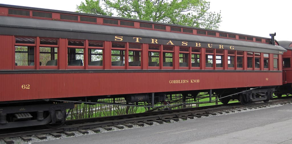
Strasburg Rail Road
America's oldest continuously operating standard-gauge railroad — a 45-minute steam ride through Amish farmland.

Trans-Siberian Railway
The world's longest railway — Moscow to the Pacific
More Journeys Worldwide

Glacier Express
The slowest express train in the world: 8 hours across the Swiss Alps

Bernina Express
From Swiss glaciers to Italian palm trees across a UNESCO alpine crossing 2
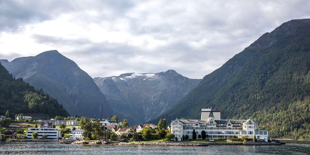
Flåmsbana
One of the world's most beautiful train journeys — 20 km, 866 m descent

Tramway du Mont-Blanc
France's highest railway, climbing from Le Fayet to the foot of the Mont Blanc on a 1909 Strub-rack line.
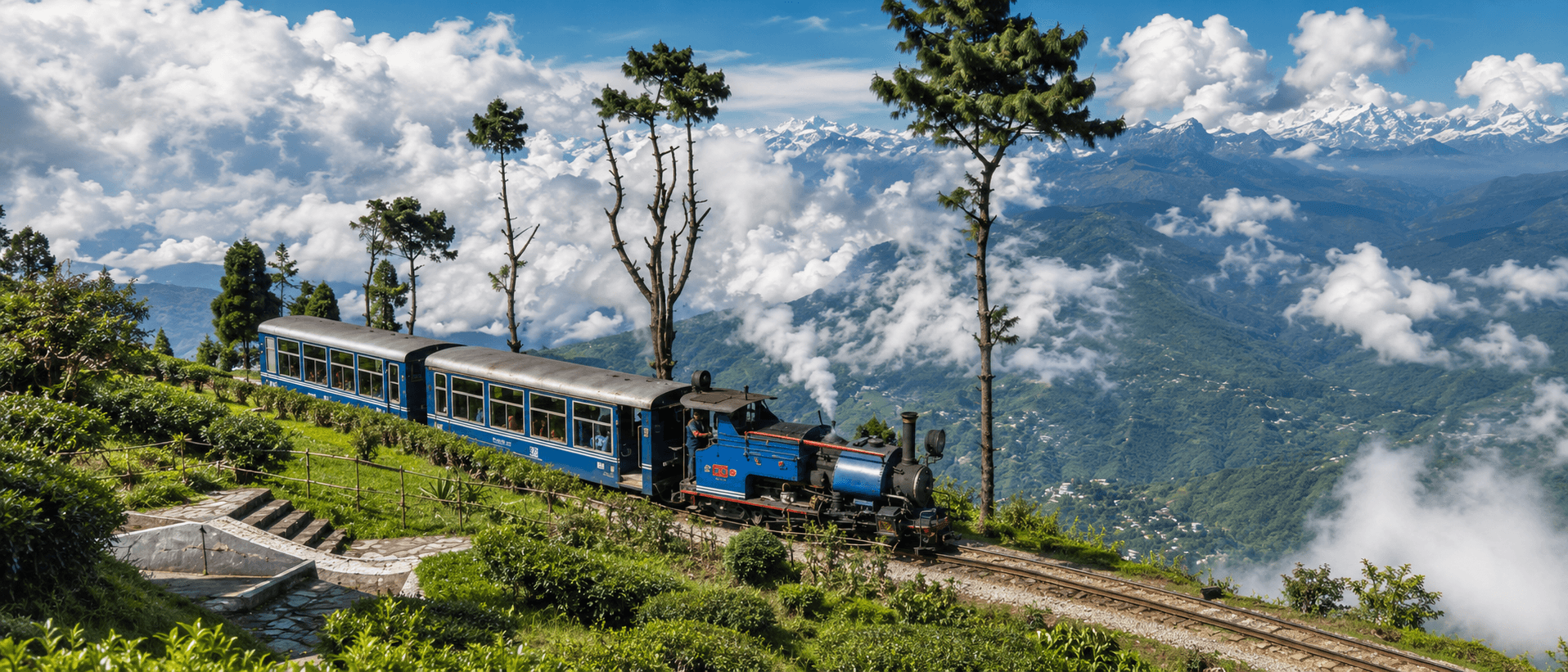
Darjeeling Himalayan Railway
India's UNESCO Toy Train climbing the Himalayas via loops and zig-zags since 1881

The Jacobite Steam Train
The real-life Hogwarts Express, crossing the Glenfinnan Viaduct on the world's most scenic railway
Spots Along the Route
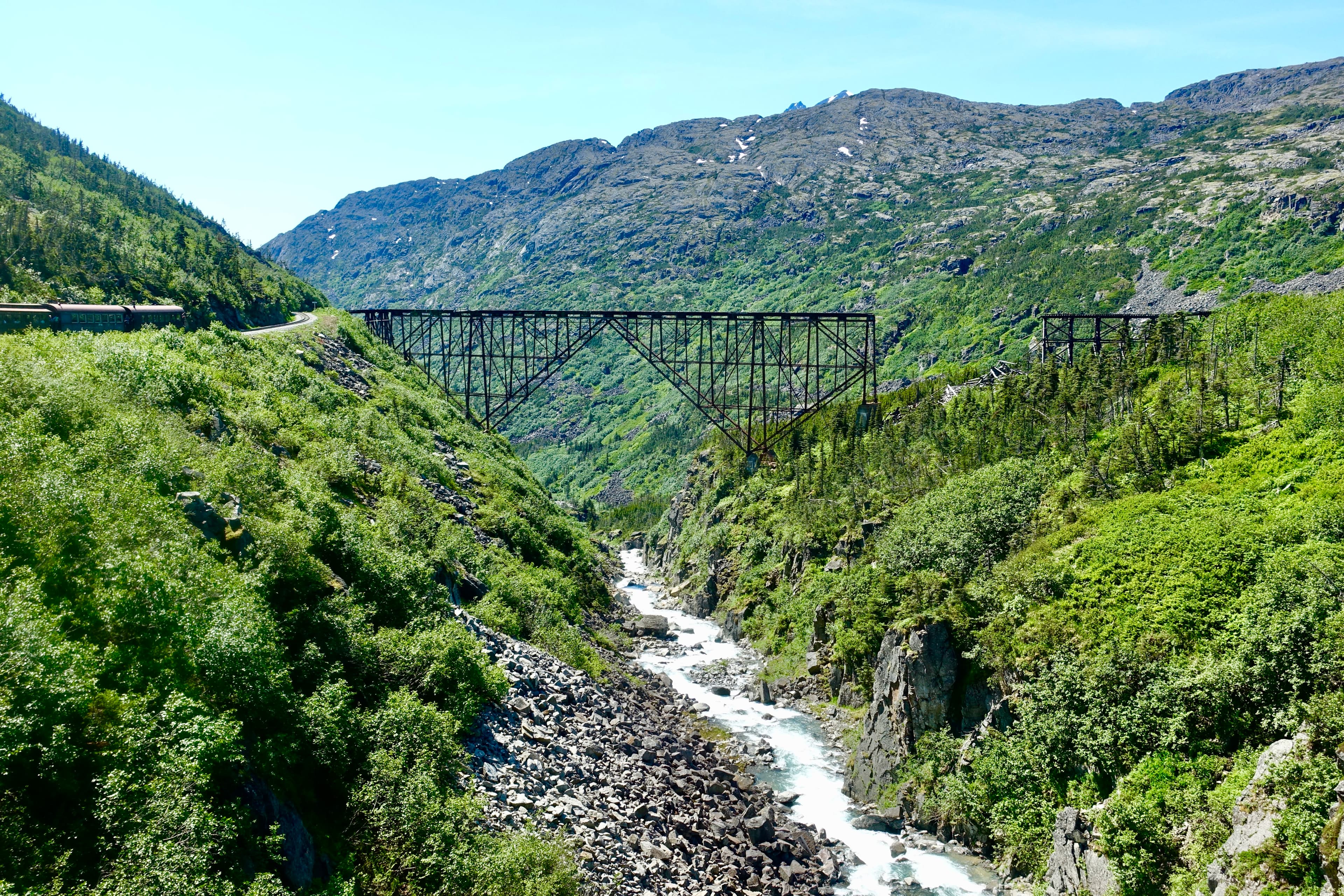
White Pass (WP&YR)
The White Pass & Yukon Route climbs 2,888 feet in 20 miles on 3-foot narrow-gauge track to the summit at Mile 20.4, crossing the 215-foot steel cantilever bridge over Dead Horse Gulch — one of the most dramatic heritage railway alignments in North America.
Beluga Point (Potter Creek)
Beluga Point is a scenic pullout at Milepost 110.5 on the Seward Highway, 20 miles south of Anchorage, where visitors watch Alaska Railroad trains curve along Turnagain Arm against a backdrop of the Chugach Mountains. The site offers paved parking, interpretive panels, and spotting scopes for viewing beluga whales during summer high tides and observing 4–6 daily trains during peak season.
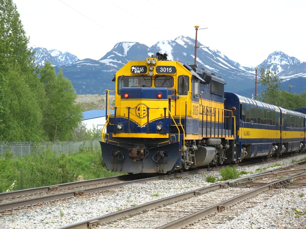
Anchorage (Ship Creek)
Watch Alaska Railroad trains cross Ship Creek at milepost 114.3 in downtown Anchorage, the exact spot where a 1915 tent city gave birth to Alaska's largest city.
Hurricane Gulch Bridge (ARR)
Alaska Railroad's tallest and longest bridge, a 918-foot steel arch spanning 296 feet above Hurricane Creek at milepost 284.2. Passenger and freight trains cross at reduced speed, offering extended viewing from the Parks Highway bridge nearby.
Fairbanks (ARR Yard)
Northern terminus of the Alaska Railroad at milepost 470. The Fairbanks yard includes a roundhouse, car shop, and freight operations serving the Eielson AFB and Fort Wainwright branches. Adjacent $22.5M depot opened in 2005.
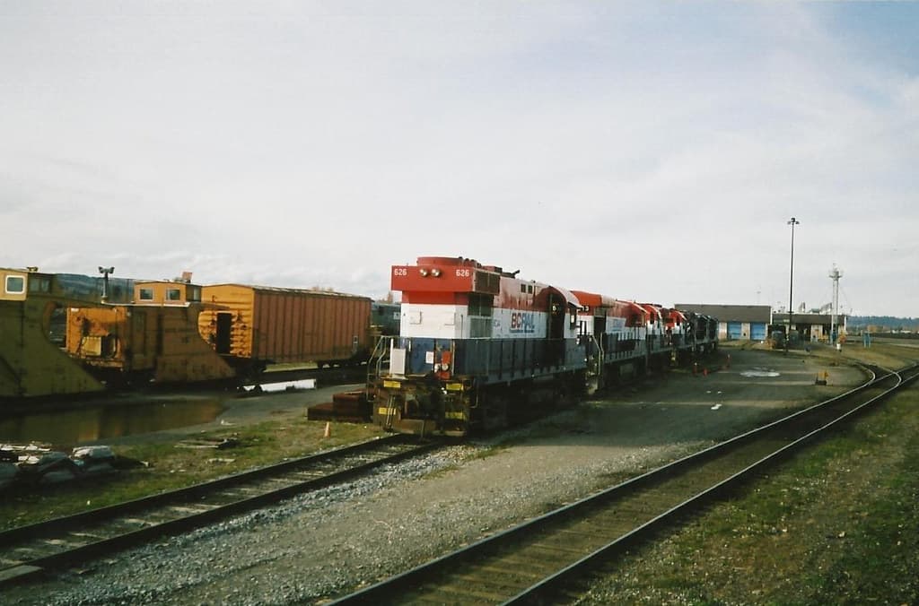
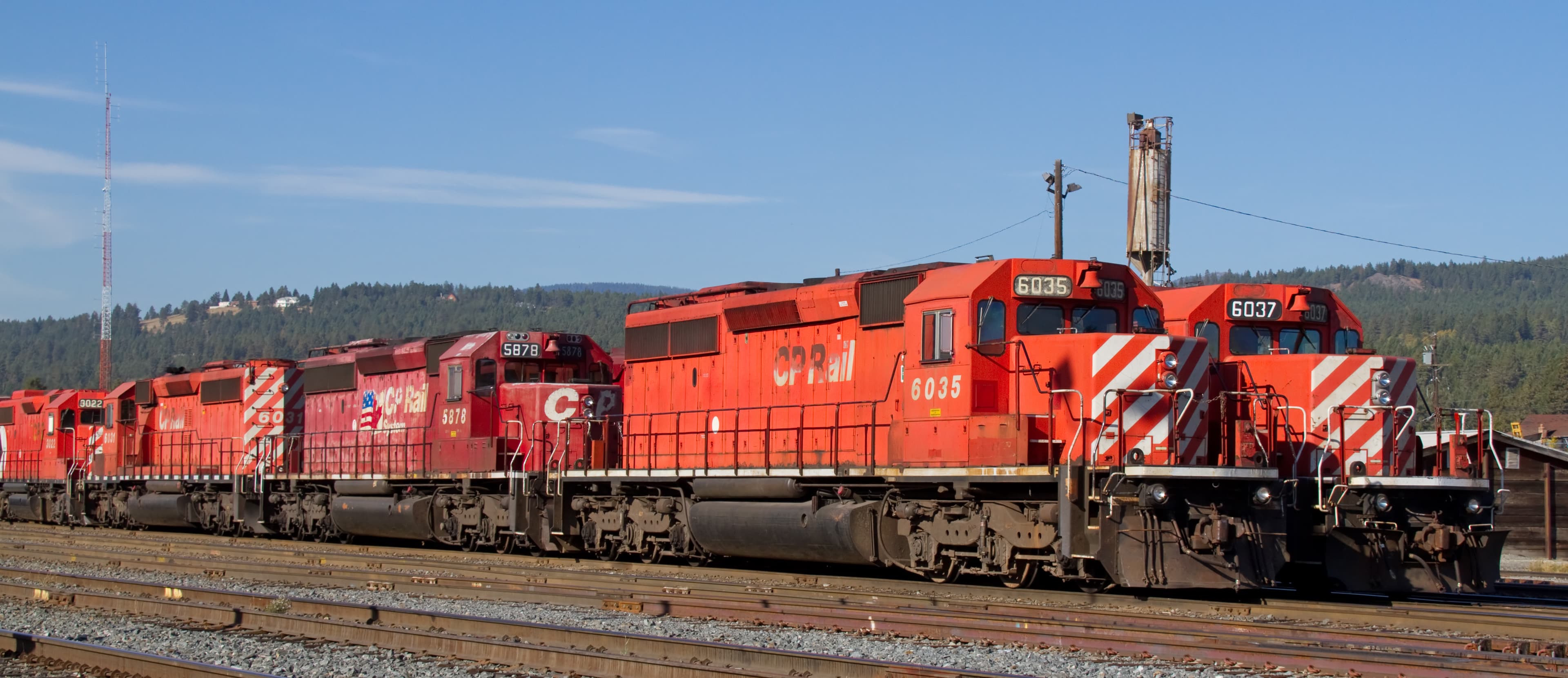
Prince George CN Yard
Major CN rail hub at the confluence of the Fraser and Nechako Rivers, where the east-west CN mainline meets the former BC Rail corridor south to Vancouver.
Related Experiences & Mega-Projects
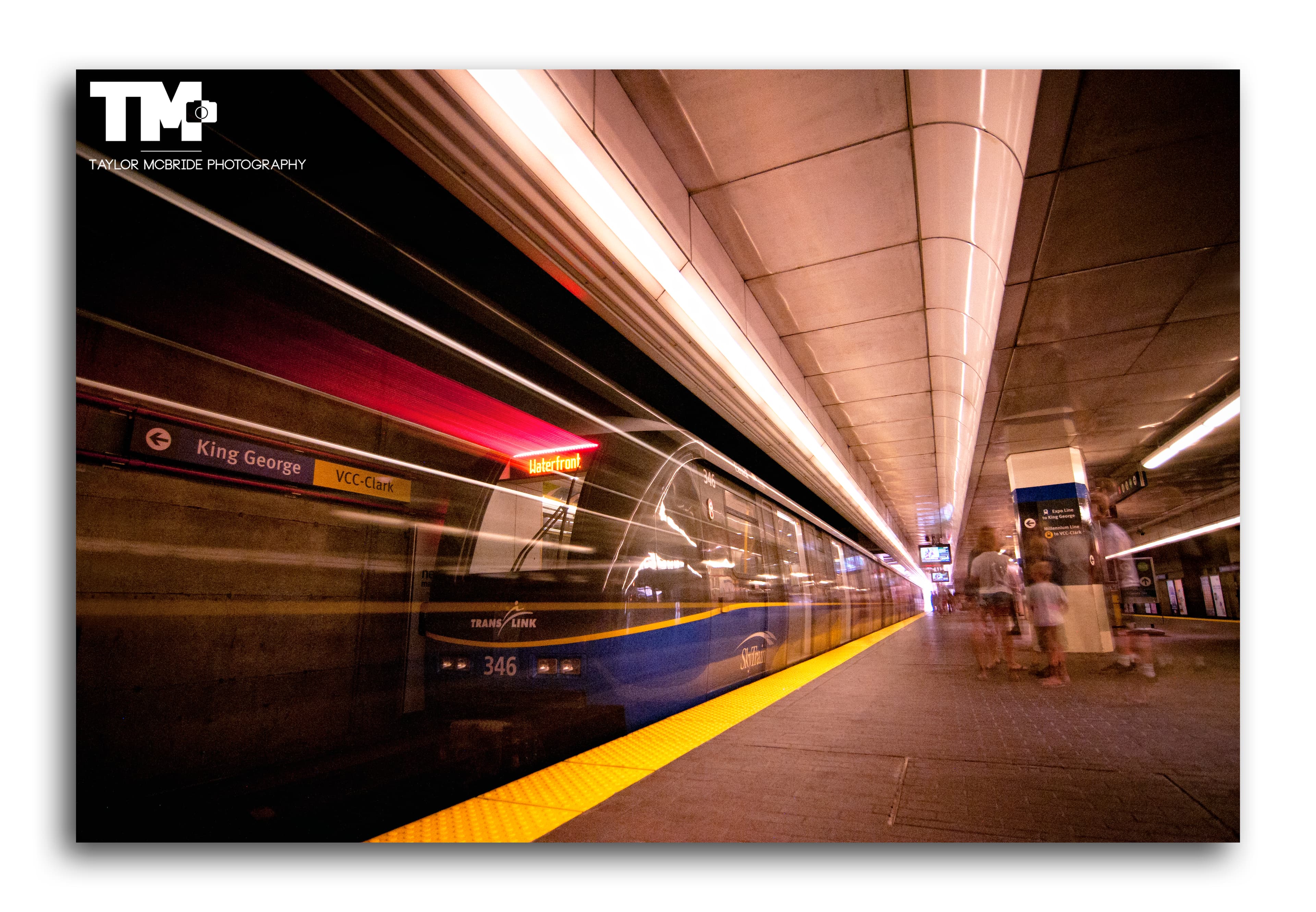
SkyTrain Expo Line (Vancouver)
An elevated rapid transit line offering panoramic city and mountain views as it soars above Vancouver via the iconic SkyBridge.
Revelstoke Railway Museum
Restored 1948 CPR Mikado steam locomotive No. 5468 anchors this Revelstoke museum of mountain railroading on the Canadian Pacific main line.
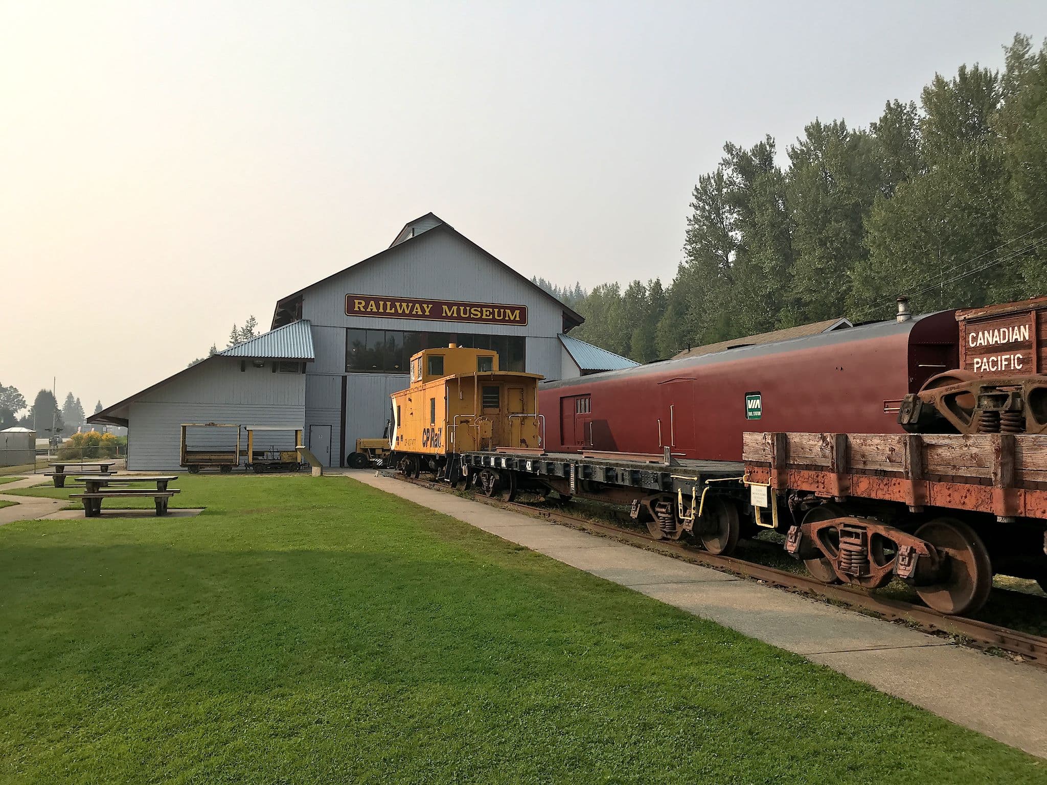
Canadian Museum of Rail Travel
One of North America's largest collections of early Canadian passenger railcars, in a historic CPR freight shed in Cranbrook, BC.