Spotting Location
Columbia River Gorge (Multnomah)
Union Pacific's Portland Subdivision runs directly below Multnomah Falls — Oregon's tallest waterfall at 620 feet — making this one of the rare spots where heavy Class I freight action meets a world-famous natural landmark. Access is via a pedestrian tunnel under both I-84 and the UP tracks at Exit 31.
Updated
Photos
No photos yet — be the first to share one!
Trainspotting Experience
The Multnomah Falls area places railfans remarkably close to Union Pacific's Portland Subdivision, a major Class I freight corridor running along the south bank of the Columbia River. Visitors reach the falls through a pedestrian tunnel that passes directly under both Interstate 84 and the UP tracks at I-84 Exit 31, emerging at the base of Oregon's tallest waterfall. From the paved area near the historic Multnomah Falls Lodge, trains pass at eye level just a short distance to the north. The single-track main line curves gently through the narrow gorge here, so approaching headlights and horn signals give several seconds of warning before a train rounds into view. Long intermodal stacks and unit grain trains can take two to three minutes to pass. Because the canyon walls are close together, locomotive exhaust and wheel noise echo dramatically — even a modest consist sounds like mountain railroading. The I-84 rest area parking lot offers an alternative vantage point on the north side of the tracks, where eastbound and westbound trains can be observed without the falls backdrop but with a clearer sightline up and down the corridor.
Landscape, Setting & Local Atmosphere
The Columbia River Gorge at Multnomah is a deep corridor cut through layers of Miocene-era Columbia River basalt. Steep canyon walls rise hundreds of feet on the Oregon side, draped in Douglas fir, western hemlock, and big-leaf maple that maintain a deep green canopy year-round. Multnomah Falls itself drops 620 feet in two major cascades — the upper plunge of 542 feet and a lower cascade of 69 feet, separated by the iconic Benson Bridge built in 1914. The elevation at track level sits near 100 feet above sea level, while the gorge rim towers far above. North across the river, the forested Washington shore rises steeply, with BNSF's Fallbridge Subdivision visible as a thin line hugging the far bank. The gorge acts as a natural wind tunnel, funneling Pacific air eastward, which can bring mist, fog, and gusts exceeding 30 mph even on otherwise calm days. This atmospheric drama — shifting light through fog, spray from the falls catching afternoon sun — makes the setting visually compelling in any season.
Type & Frequency of Train Activity
The UP Portland Subdivision carries approximately 22 to 30 freight trains daily through this section, predominantly eastbound and westbound. Traffic is overwhelmingly freight: unit grain trains bound for Pacific export terminals, unit soda ash from Wyoming, mixed manifest merchandise, and high-priority double-stack intermodal containers moving between Portland, Tacoma, Seattle, and Chicago-area hubs. The line is single track with passing sidings, which means meets between opposing trains create natural pauses and photo opportunities as one train holds while the other passes. Amtrak's Empire Builder does NOT use this track — it runs on BNSF's route along the north (Washington) bank of the river, so passenger train sightings on the UP side are limited to occasional inspection vehicles or special equipment moves. The Portland Subdivision was originally built by the Oregon Railway and Navigation Company, with tracks through the gorge opening in 1882 and the through line east to Huntington completed by November 1884.
Best Angles for Photos & What Railfans Enjoy Most
The premier shot combines a UP train in the foreground with Multnomah Falls cascading behind it. This is best captured from the paved area near the Lodge or from the I-84 rest area berm on the north side of the tracks, using a telephoto lens (135 to 200mm) to compress the train against the 620-foot waterfall. Late morning light (10 AM to noon) illuminates both the falls and westbound trains simultaneously. For a more elevated perspective, the trail toward Benson Bridge (when open) provides a higher vantage point looking down on the tracks, though the bridge itself has experienced periodic closures for repairs — check current status with the US Forest Service before planning this angle. The Historic Columbia River Highway pullouts west of the falls offer elevated positions above the tracks where a 70 to 200mm zoom captures long trains curving through the gorge with the river beyond. For eastbound trains, afternoon light from the west creates warm tones on locomotive noses. A polarizing filter helps cut glare from wet basalt and the river surface. In winter, low fog creates layered compositions where locomotives emerge from mist beneath the falls.
Historical or Cultural Relevance
The railroad through the Columbia River Gorge on the Oregon side was a transformative infrastructure project of the 1880s. Henry Villard assembled the Oregon Railway and Navigation Company in 1880 and pushed tracks east through the gorge, overcoming enormous engineering challenges including fluctuating river levels, marshlands, and massive basalt ridges requiring tunnels. Tracks reached through the gorge by 1882, and the full through line to Huntington opened on November 11, 1884, connecting Portland to the transcontinental system and ending reliance on river steamboats and portage roads. The company later reorganized as the Oregon-Washington Railroad and Navigation Company in 1910 under Union Pacific's E.H. Harriman, and ultimately became part of UP's modern Portland Subdivision. Paralleling the tracks, the Historic Columbia River Highway — opened in 1916 and designed by engineer Samuel Lancaster — was the first designated scenic highway in the United States and the first major paved road in the Pacific Northwest. At the falls, the Multnomah Falls Lodge was built in 1925 in the Cascadian architectural style, designed by noted Portland architect A.E. Doyle using timber and every type of rock found in the Gorge, at a cost of $40,000.
What Makes This Spot Different
Multnomah Falls stands 620 feet — significantly taller than Niagara Falls — and the UP main line passes directly at its base, creating what may be the most dramatic waterfall-and-railroad combination on any Class I railroad in North America. The pedestrian tunnel under both the interstate and the tracks gives visitors a safe, ADA-accessible way to reach a front-row position for both the falls and passing trains, with no remote hikes or questionable trespass required. The 1925 Lodge, the 1914 Benson Bridge, and the year-round US Forest Service staffing add infrastructure uncommon at railfan locations. The gorge itself hosts parallel railroads — UP on the Oregon shore and BNSF on the Washington shore — meaning on clear days you can watch trains on both sides of the river simultaneously. With over two million annual visitors, Multnomah Falls is the most-visited natural recreation site in the Pacific Northwest, which means the railfan audience here is largely incidental tourists who discover the trains as a bonus.
Frequently Asked Questions
QDo I need a permit to visit Multnomah Falls?
From late May through early September, a $2 timed-entry permit is required for vehicles using the I-84 Exit 31 parking lot between 9 AM and 6 PM. Permits are available at Recreation.gov 14 days in advance. Outside these hours and dates, access is free. Cyclists, hikers, and transit riders are exempt.
QWhich railroad runs past Multnomah Falls?
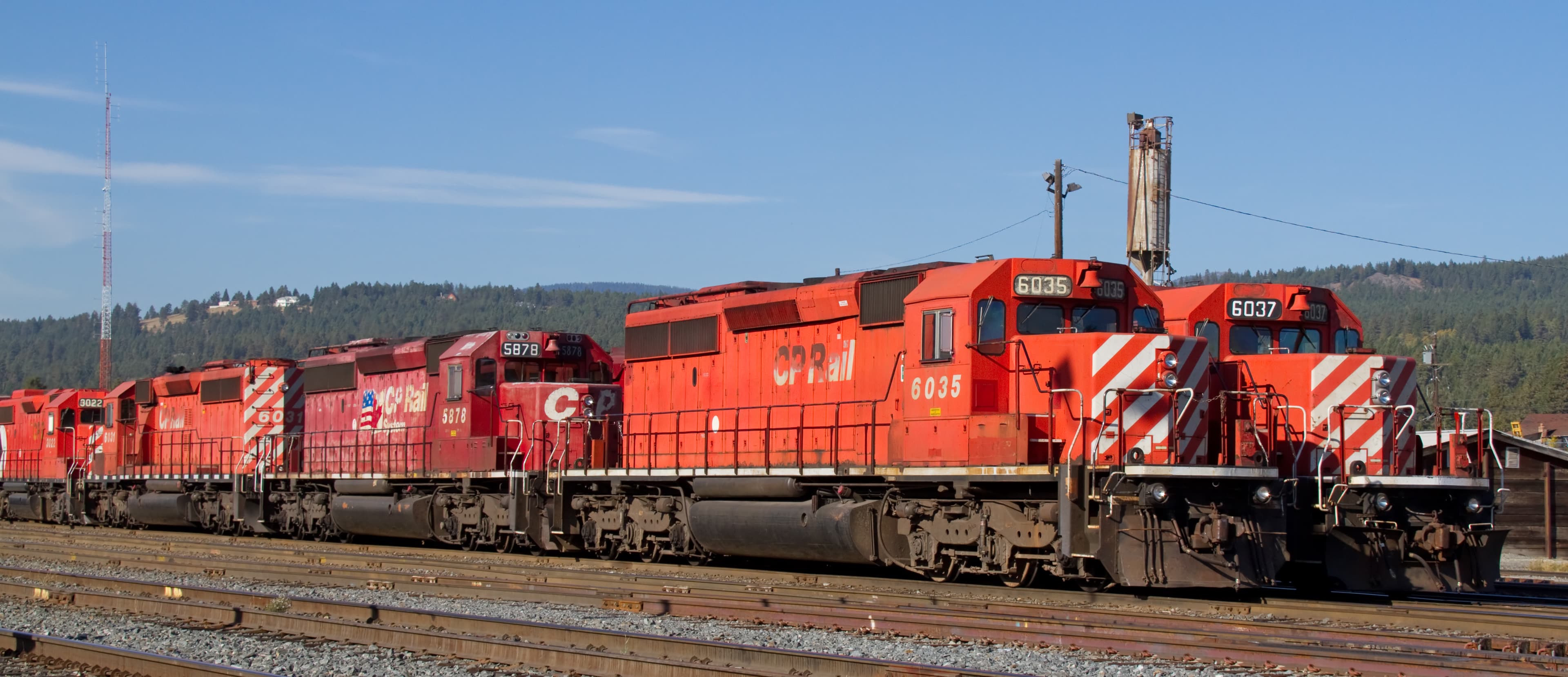
Union Pacific's Portland Subdivision runs on the Oregon (south) side of the Columbia River, directly below the falls. BNSF Railway operates on the Washington (north) bank across the river.
QHow many trains per day pass Multnomah Falls?
The UP Portland Subdivision carries approximately 22 to 30 freight trains per day through this section, mostly intermodal containers, grain, and manifest freight.
QDoes the Amtrak Empire Builder stop at Multnomah Falls?
No. The Empire Builder runs on BNSF's route along the north (Washington) bank of the Columbia River. It does not use the UP tracks on the Oregon side near Multnomah Falls.
QIs there safe access to watch trains?
Yes. A pedestrian tunnel at I-84 Exit 31 passes under both the highway and the railroad tracks, emerging near the Multnomah Falls Lodge. Never walk on or near the active UP tracks.
QIs the Benson Bridge at Multnomah Falls open?
The Benson Bridge has experienced periodic closures for repairs due to rockfall damage. Check the US Forest Service Columbia River Gorge website for current access status before visiting.
Safety Tips
The UP main line through the gorge is extremely active with trains running up to 50 mph through curves. Never attempt to cross or walk along the tracks — use only the designated pedestrian tunnel at Exit 31. Rockfall hazards exist on trails near the cliff faces, especially after rain. Winds through the gorge can gust over 30 mph, so secure camera gear on tripods. The mist from the falls can coat lenses; bring lens cloths.
Seasonal Information
Spring (April to June) brings the heaviest waterfall flow from snowmelt, creating dramatic backdrops for train photos. Summer offers long daylight hours but requires a $2 timed-entry permit (May to September) for I-84 Exit 31 parking between 9 AM and 6 PM. Fall foliage in October adds color to the canyon walls. Winter can bring fog and mist that diffuse light for moody shots, but access roads may occasionally close due to ice or rockfall.
Nearby Lodging
Find places to stay near Columbia River Gorge (Multnomah).
This lodging map is provided by Stay22, a third-party service that may set cookies. It loads only with your consent.
Accommodation results are provided by Stay22; we may earn a commission on bookings made through this map.
Nearby Attractions
35 miles / 56 km
Heritage railroad operating scenic excursions from Hood River through the Hood River Valley with views of Mount Hood and Mount Adams. Rides aboard original early 1900s cars.
30 miles / 48 km
Free museum in Portland housing three vintage steam locomotives including the famous Southern Pacific 4449 and Spokane, Portland and Seattle 700. Saturday passenger rides available.
3 miles / 4.8 km
Two short trails at a former lumber mill site: one to the two-tiered 120-foot Bridal Veil Falls, another with Columbia River panoramic views. Located at I-84 Exit 28.
9 miles / 14.5 km
Historic 1918 observatory perched 733 feet above the Columbia River offering panoramic gorge views. A landmark of the Historic Columbia River Highway.
10 miles / 16 km
Federal hydroelectric dam with free visitor center, underwater fish viewing windows, and adjacent fish hatchery. Watch salmon and steelhead navigate fish ladders seasonally.
15 miles / 24 km
Small museum housed in the original Troutdale railroad depot with a restored 1975 Union Pacific CA-10 caboose. Near the western gateway to the Columbia River Gorge.
Official Resources
Related on Spotatrain
Spots Near Bridal Veil
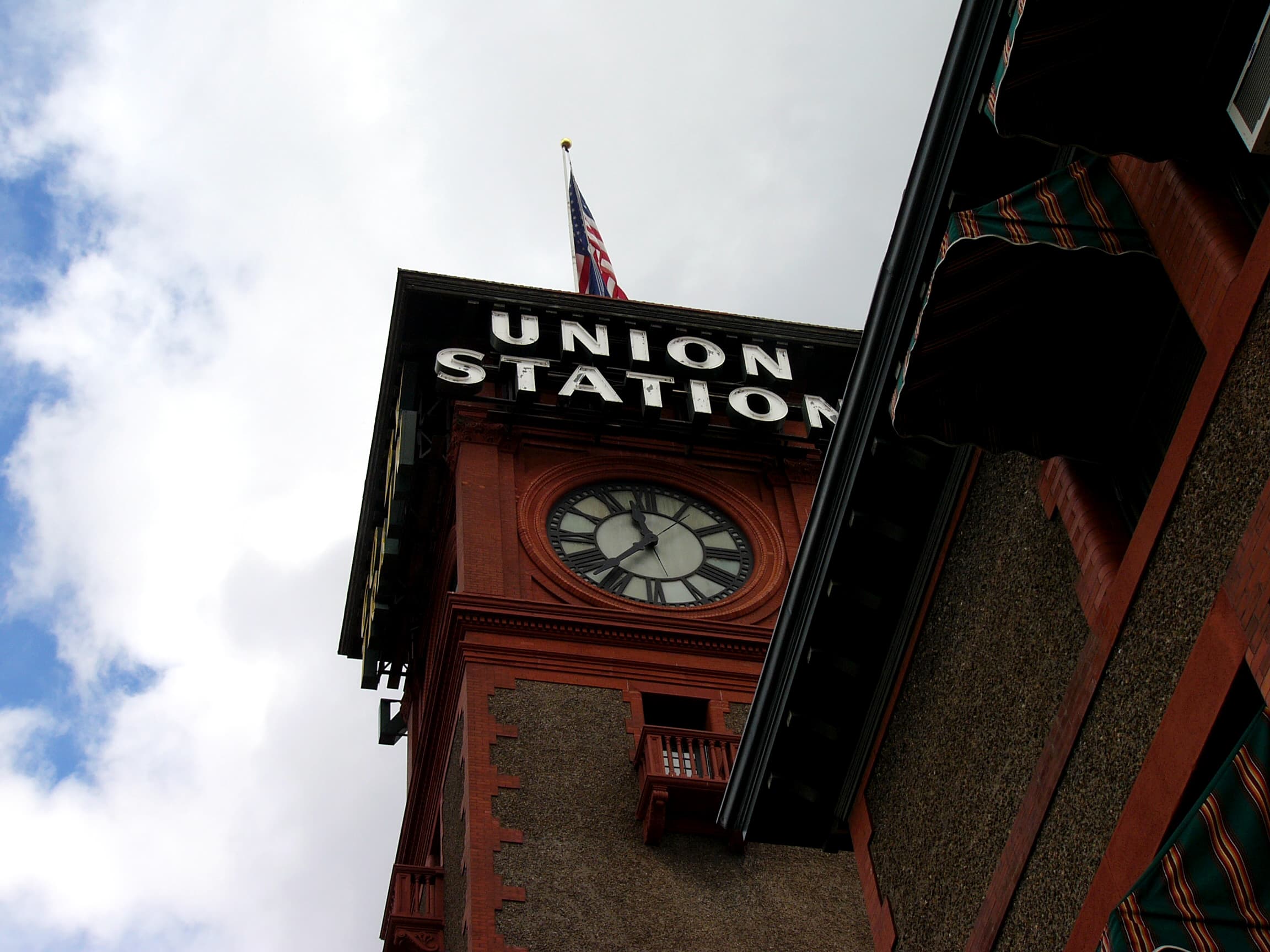
Portland (Union Station)
Portland Union Station, opened in 1896, is Oregon's oldest major passenger terminal. Its 150-foot Romanesque Revival clock tower with neon "Go By Train" signs is a Pacific Northwest icon. The station serves Amtrak Cascades, Coast Starlight, and Empire Builder routes alongside frequent Union Pacific and BNSF freight traffic.
Vancouver (Columbia R. Crossing)
BNSF Railway Bridge 9.6, the first railroad bridge across the lower Columbia River, carries BNSF, Union Pacific, and Amtrak trains between Portland and Vancouver, WA. The adjacent Amtrak station — set inside a wye of two BNSF subdivisions — ranks among the Pacific Northwest's finest railfan perches.
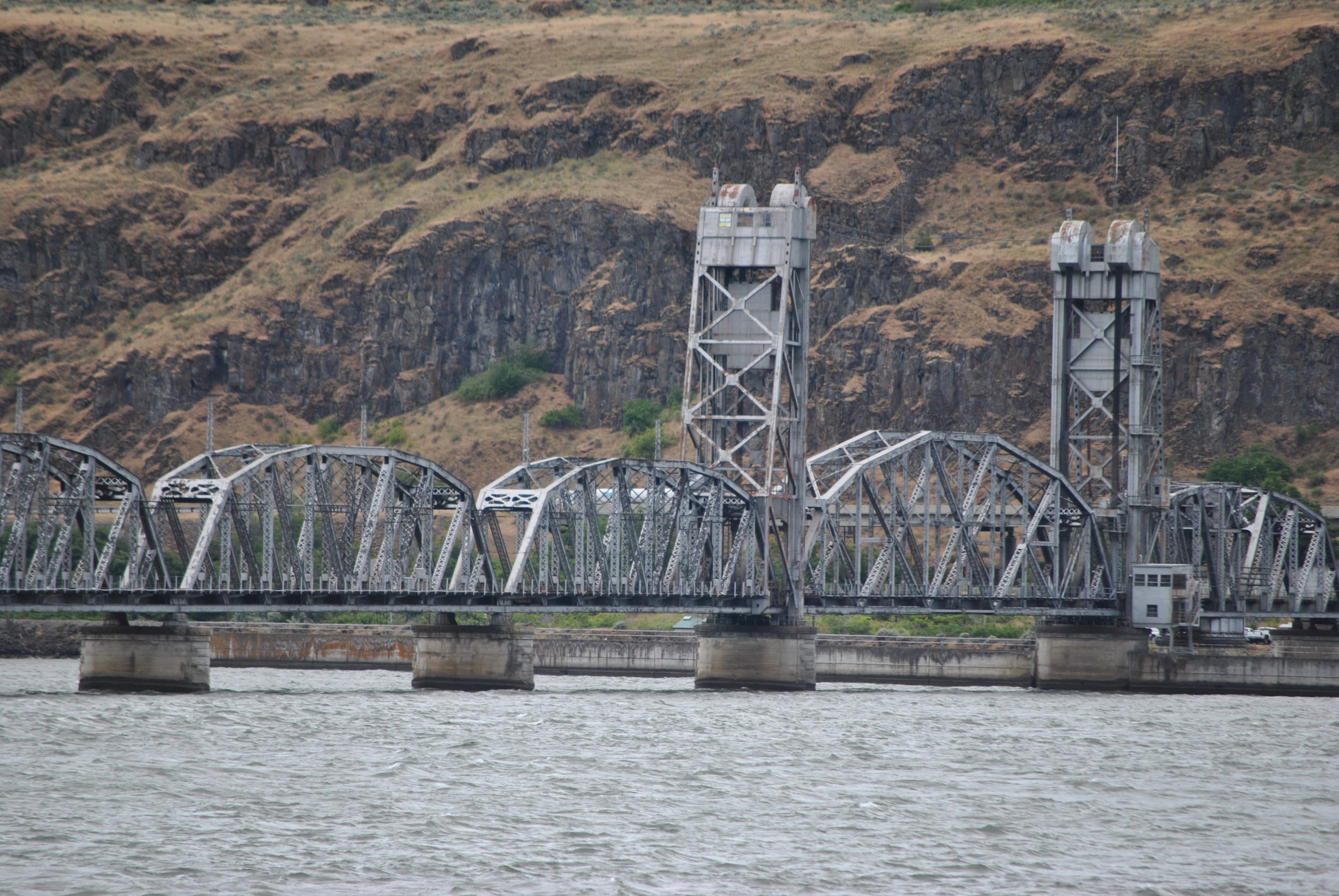
Wishram (BNSF Gorge)
Wishram sits at one of the Pacific Northwest's premier railfan junctions: the BNSF Fallbridge Subdivision threads the Columbia River Gorge on the Washington bank, while the Oregon Trunk Line diverges south over the 1912 Oregon Trunk Rail Bridge toward Bend, Oregon. With 40–45 BNSF freight trains daily, a visible Oregon Trunk sub, and Amtrak's Empire Builder Portland section stopping here, Wishram delivers continuous, high-tonnage railroading at the foot of striking basalt canyon walls.
Steilacoom (Puget Sound)
Steilacoom puts railfans trackside on BNSF's Seattle Subdivision where the former Northern Pacific main line runs alongside Puget Sound. A short walk north leads to Bridge 14 at Chambers Bay — the last Strauss direct-lift railroad bridge in active service in the United States, designed by the same engineer who later built the Golden Gate Bridge.
Point Defiance (Tacoma)
A freight-only BNSF mainline hugging the Puget Sound shoreline south of Point Defiance Park, offering trackside views of 30-40 daily trains passing through the historic Nelson Bennett Tunnel and under the Tacoma Narrows Bridge.
Argo Crossing (Seattle)
Argo Crossing is where Union Pacific's line crosses the BNSF Railway main line in Seattle's industrial south end, adjacent to UP's Argo Yard. This at-grade diamond sits at the junction of two Class I railroads, offering a front-row seat to intermodal freights, Amtrak Cascades, the Coast Starlight, and yard switching operations in the heart of the Georgetown neighborhood.
Related Experiences
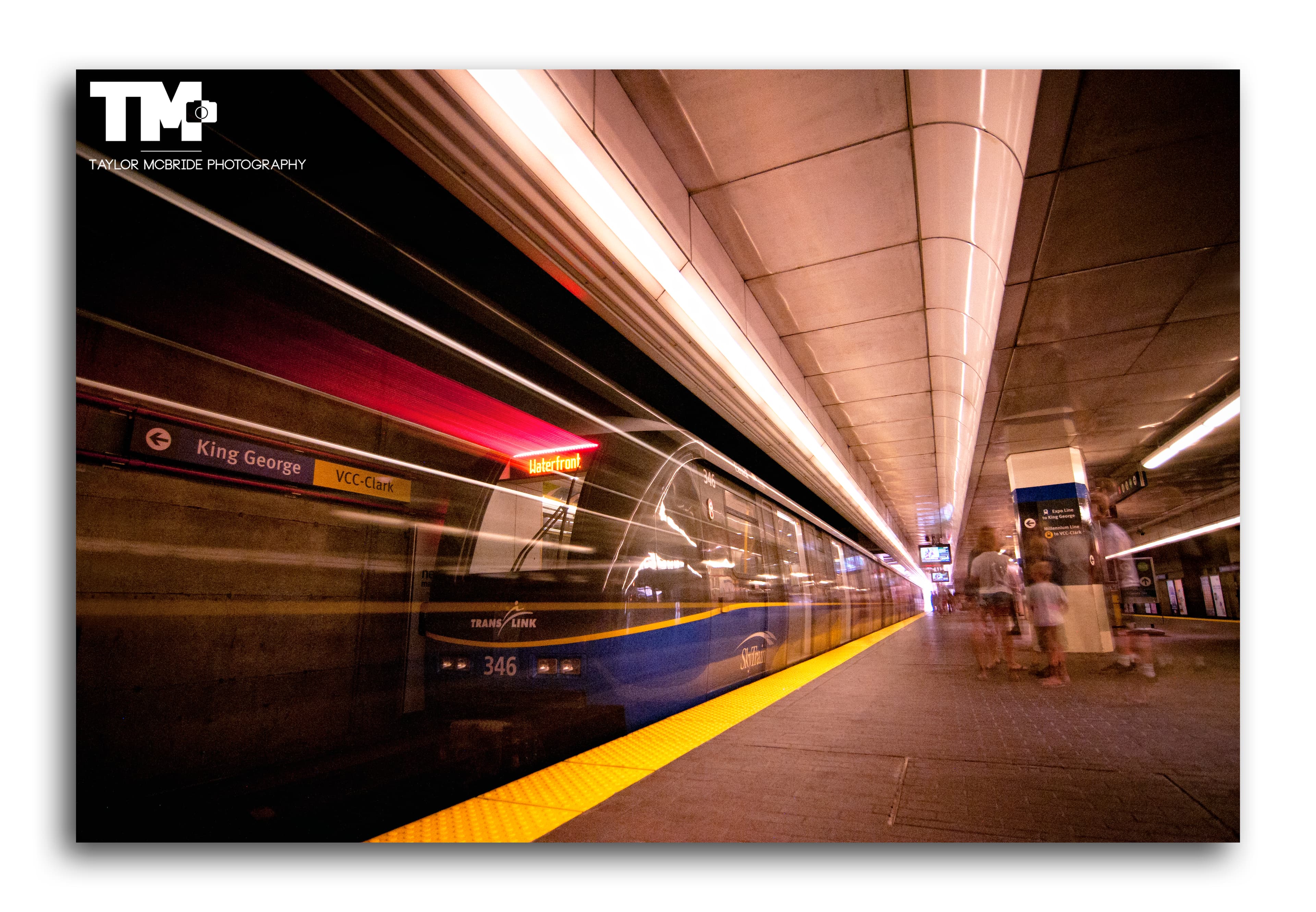
SkyTrain Expo Line (Vancouver)
An elevated rapid transit line offering panoramic city and mountain views as it soars above Vancouver via the iconic SkyBridge.
Canadian Museum of Rail Travel
One of North America's largest collections of early Canadian passenger railcars, in a historic CPR freight shed in Cranbrook, BC.
Revelstoke Railway Museum
Restored 1948 CPR Mikado steam locomotive No. 5468 anchors this Revelstoke museum of mountain railroading on the Canadian Pacific main line.
Related Journeys & Mega-Projects

California Zephyr
Chicago to San Francisco across the Rockies and Sierra Nevada

Brightline West
America's first true high-speed rail: Las Vegas to greater Los Angeles at 200 mph

Grand Canyon Railway
A 65-mile heritage train journey from Williams, Arizona to the South Rim of the Grand Canyon
Help improve this page
Spotted something out of date or incorrect? Let our community know.
Looking for more spots? Browse the complete list of train spotting locations.
Quick Information
Country
United States
Region
Oregon
City
Bridal Veil
Spot Type
Scenic Overlook
Best Times
Late morning (10 AM to noon) offers the best combination of train traffic and lighting on westbound trains, with the sun illuminating consists against the falls. Afternoon light favors eastbound photography. Summer weekdays avoid the heaviest tourist crowds at the falls area.
Visit Duration
1-3 hours
Cost
Free access year-round. Summer timed-entry parking permit: $2/vehicle (May to September, 9 AM to 6 PM). Alternative Historic Highway lot: up to $20.
Train Activity
Train Types
Frequency
Approximately 22-30 freight trains per day on the UP Portland Subdivision, predominantly intermodal and bulk commodity trains.
Access & Amenities
Parking
Available (Free parking at the I-84 Exit 31 rest area (limited spaces). A $2 timed-entry permit via Recreation.gov is required May through September, 9 AM to 6 PM. An alternative lot on the Historic Columbia River Highway charges up to $20.)
Shelter
Available
Restrooms
Available