
Updated
Distance
103 km
Duration
~7 hours (full 64-mi line, incl. Osier lunch)
Max altitude
3,053 m
Tunnels
2
Gauge
914mm
A 64-mile (103 km) narrow-gauge steam railroad over 10,015-ft (3,053 m) Cumbres Pass between Chama, New Mexico and Antonito, Colorado — North America's longest and highest authentic steam line.
About This Journey
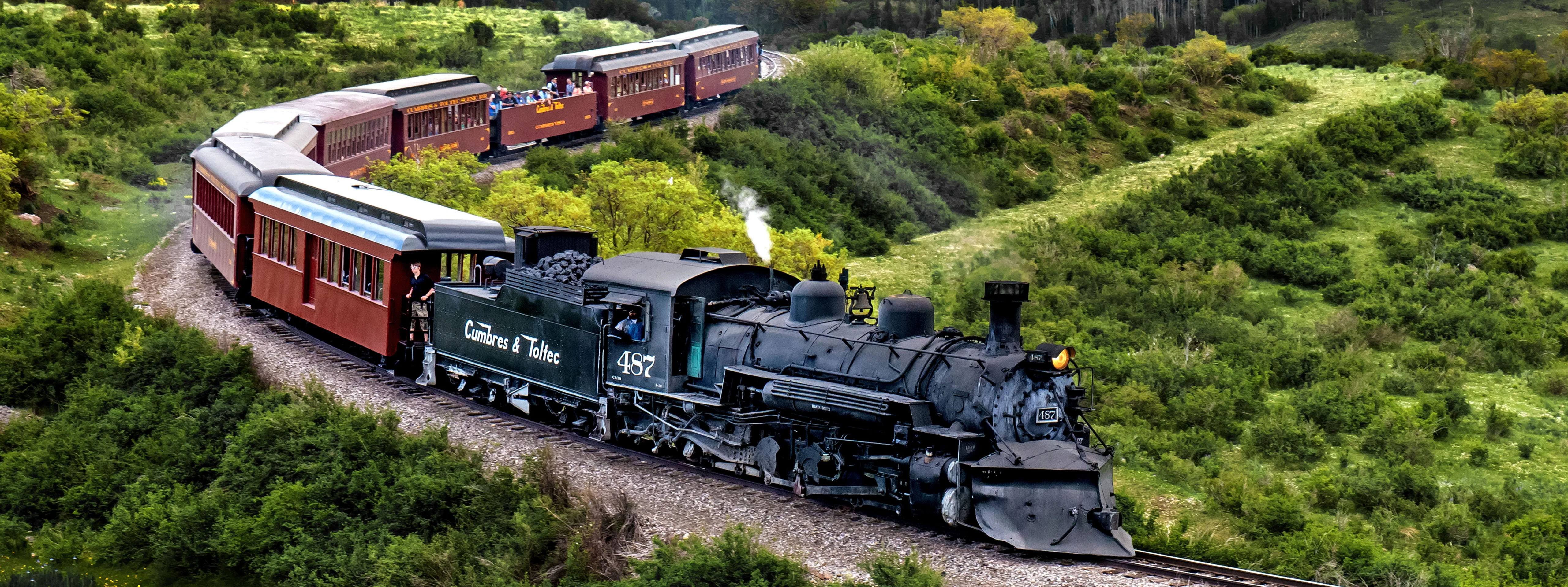
The Cumbres & Toltec Scenic Railroad climbs 64 miles (103 km) of three-foot (914 mm) narrow gauge through the San Juan Mountains, linking Chama, New Mexico (7,863 ft / 2,397 m) with Antonito, Colorado (7,888 ft / 2,404 m). Between them the line crests 10,015-ft (3,053 m) Cumbres Pass — the highest point reached by any rail line in the United States — and crosses the Colorado–New Mexico border 11 times.
The railroad is the best-preserved surviving segment of the Denver & Rio Grande's once-vast narrow-gauge network (its sister line is the Durango & Silverton). Trains are pulled by coal- and oil-fired steam locomotives from the 1900–1925 era, including the heavy K-36 class 2-8-2 'Mikados', past original 1880s depots, water tanks and the Chama yard, which still functions much as it did a century ago.
Out of Chama the engines attack a sustained 4% grade — one of the steepest sustained mainline grades in North America — often double-headed for extra power. The route then threads two tunnels (Mud Tunnel and Rock Tunnel), edges the 600-ft-deep Toltec Gorge above the Rio de los Pinos, loops through Tanglefoot Curve and crosses the 137-ft-high Cascade Creek Trestle, the tallest on the line. All trains meet at the remote Osier Station (9,637 ft / 2,937 m) for a hot lunch at the midpoint.
Why This Journey Is Iconic
For railfans the Cumbres & Toltec is a bucket-list pilgrimage: it is North America's longest and highest authentic steam railroad, and almost everything along its 64 miles — locomotives, rolling stock, depots, the Chama roundhouse and coal tipple — is original Denver & Rio Grande equipment, not reproduction. The line was designated a National Historic Landmark on October 16, 2012 and has been on the National Register of Historic Places since February 16, 1973.
It is also a feat of preservation politics: when the Rio Grande won approval to abandon the route in 1969, the states of Colorado and New Mexico jointly bought the 64-mile segment, nine steam locomotives and over 130 cars for $547,120 in 1970, then began hauling tourists in 1971. Today it is owned by both states and governed by the bi-state Cumbres & Toltec Scenic Railroad Commission, created by an act of Congress in 1974.
What to Expect
Riding the full line is an all-day affair of roughly seven hours, including the lunch stop at Osier. Because the 64 miles are too far to cover round-trip in a day, passengers ride one way by steam and return to their starting depot on a comfortable motorcoach — or split the trip over two days. Shorter options include the half-line 'Limited' trips that turn at Osier and the Express trips that sample the heights of Cumbres Pass in a few hours.
Every train carries an open-air gondola car free to all riders — the prime spot for 360-degree views, fresh mountain air and the sound of a working steam engine. Volunteer docents from the Friends of the Cumbres & Toltec narrate the geology and history. Classes of service run from Coach (padded bench seats, open windows) through Deluxe (café-style tables) to the 21-and-over Parlor and Parlor Observation cars, Victorian-style lounge cars with an attendant, morning pastry and afternoon snacks. Most tickets include the chef-prepared buffet lunch at Osier; a 7% Historic Preservation Fee is added to each ticket.
History
The line opened in 1880 as part of the Denver & Rio Grande Railroad's San Juan Extension, a 3-ft narrow-gauge route built to serve the silver-mining district of the San Juan Mountains in southwestern Colorado. After the 1893 repeal of the Sherman Silver Purchase Act, mining declined and the San Juan Extension never warranted conversion to standard gauge, leaving it frozen in 19th-century form.
In 1969 the Interstate Commerce Commission granted the Rio Grande permission to abandon its last narrow-gauge main line. Rather than lose it, Colorado and New Mexico jointly purchased the 64-mile Chama–Antonito segment, nine locomotives and more than 130 freight and work cars for $547,120 in 1970; tourist operations began the following year. The Cumbres & Toltec Scenic Railroad Commission, an interstate agency authorized by Congress in 1974, now sets policy, while the non-profit Cumbres & Toltec Operating LLC runs day-to-day service and the Friends of the C&TSRR (founded 1981) restore and interpret the historic fleet.
Engineering Highlights
The defining engineering challenge is altitude and grade. From Chama the railroad pulls a sustained 4% grade for some 14 miles up to Cumbres Pass at 10,015 ft (3,053 m), frequently requiring double-headed or helper steam locomotives. Just below the summit the track doubles back on itself at Tanglefoot Curve, a loop tight enough that the locomotive nearly faces its own train.
Descending toward Antonito, the line crosses the Cascade Creek Trestle, a 137-ft-high (42 m) structure that is the tallest on the route, then bores through two tunnels — Mud Tunnel and Rock Tunnel — as it clings to a ledge roughly 600 ft (180 m) above the Rio de los Pinos in Toltec Gorge. Other notable structures include the high Lobato Trestle over Wolf Creek near Chama. The motive power is equally historic: surviving Rio Grande steam includes the K-27, K-36 and K-37 2-8-2 'Mikado' classes, with five locomotives in active service.
Best Time to Travel
The railroad runs seasonally from late May through late October, operating Tuesday through Sunday. Summer (June–August) brings green alpine meadows, wildflowers and the fullest schedule, though afternoon mountain thunderstorms are common. Late September to mid-October is the signature window, when the aspen forests above Chama and along Cumbres Pass turn brilliant gold and the air is crisp and clear.
At these elevations — 7,800 ft at Chama up to 10,015 ft at the summit — weather changes quickly and mornings are cold even in summer, so dress in layers and bring sun protection for the open gondola car. Fall dates and the 21-and-over Parlor cars sell out earliest, so book well ahead for foliage season.
Practical Tips
Seats are assigned at purchase and trains frequently sell out, so reserve in advance, especially for fall foliage and the premium cars; same-day tickets are sometimes available but not guaranteed. Wheelchair lifts are offered on select coach cars and the motorcoaches, but ADA accommodations must be arranged at least 7 days ahead, and wheelchairs cannot roll between the historic cars.
Spend time in the free open-air gondola for the best photography, but expect cinders and soot — a UV filter protects your lens. Restrooms are on the train, the motorcoaches, both depots and the Osier dining hall. Pets are not allowed (service animals only) and smoking, including e-cigarettes, is banned on all railroad property. Changes are accepted up to 24 hours before departure; refunds require 48 hours' notice.
Route Stages
Getting to Chama
By Air
The most useful gateways are Albuquerque International Sunport (ABQ), about 165–175 miles and a 3-hour drive from the Chama depot, and Denver International Airport (DEN), roughly 260 miles / 4 hours to Antonito and about 310 miles / 5 hours to Chama. The closest option is the small San Luis Valley Regional Airport (ALS) in Alamosa, Colorado, with limited service from Denver and only about 30 miles / 30 minutes from Antonito. Rent a car at any of these airports — there is no scheduled bus or rail service to either depot town.
By Train
There is no scheduled passenger-rail or Amtrak connection to Chama or Antonito; the Cumbres & Toltec is itself a heritage excursion line, not part of the national network. Reach the depots by car or by flying into Albuquerque, Denver or Alamosa and driving the rest of the way.
By Car
Driving is the standard way to arrive. The Chama, NM depot sits on US Highway 64/84, about 47 miles (1 hour) east of Pagosa Springs, roughly 105–108 miles (2 hours) from Santa Fe and 110 miles (2 hours) from Durango. The Antonito, CO depot is on US Highway 285 at the junction with Colorado Highway 17, about 28–30 miles (30 minutes) south of Alamosa, 65 miles (1h15) from Taos and 115 miles (2 hours) from Santa Fe. Between the two depots, scenic Colorado/New Mexico Highway 17 climbs over Cumbres Pass — about 48 miles of winding mountain road, allow 1 to 1.5 hours. Check cotrip.org (Colorado) and nmroads.com (New Mexico) for road conditions.
Parking
Both depots provide free parking for ticketed passengers, with large lots that can accommodate RVs and trailers, including overnight parking for those doing the trip over two days.
Where to Stay
Find places to stay near Antonito.
This lodging map is provided by Stay22, a third-party service that may set cookies. It loads only with your consent.
Accommodation results are provided by Stay22; we may earn a commission on bookings made through this map.
Videos
Photos
Narrow Gage Train Cumbres and Toltec Chama New Mexico
Cumbres & Toltec Scenic, Los Pinos, Colo.
Narrow Gage Train Cumbres and Toltec Chama New Mexico
Narrow Gage Train Cumbres and Toltec Chama New Mexico
Narrow Gage Train Cumbres and Toltec Chama New Mexico
dscf0214
Cumbres & Toltec Scenic, Chama, N.M.
Cumbres and Toltec Narrow Gage
Cumbres & Toltec 2
Cumbres & Toltec Scenic Railroad excursion train headed by locomotive 484 in 2015
External Resources
Official resources
Tourism info
Frequently Asked Questions
How long does the full Cumbres & Toltec trip take?▾
Can I ride round-trip in a single day?▾
Do I need to book ahead, and are seats assigned?▾
Is lunch included?▾
What are the classes of service?▾
When does the railroad operate?▾
Is the train wheelchair accessible?▾
Can I bring pets?▾
Help improve this page
Spotted something out of date or incorrect? Let our community know.
Related on Spotatrain
Journeys Near This Route

California Zephyr
Chicago to San Francisco across the Rockies and Sierra Nevada

Grand Canyon Railway
A 65-mile heritage train journey from Williams, Arizona to the South Rim of the Grand Canyon

Strasburg Rail Road
America's oldest continuously operating standard-gauge railroad — a 45-minute steam ride through Amish farmland.

Mount Washington Cog Railway
World's first mountain-climbing cog railway — 1869, 37.41% grade, climbs to 6,288 ft

White Pass & Yukon Route — Summit Excursion
Climb 873 m from Skagway tidewater to the historic White Pass on a 914 mm narrow-gauge line built for the Klondike Gold Rush.

The Jacobite Steam Train
The real-life Hogwarts Express, crossing the Glenfinnan Viaduct on the world's most scenic railway
More Journeys Worldwide

Glacier Express
The slowest express train in the world: 8 hours across the Swiss Alps

Bernina Express
From Swiss glaciers to Italian palm trees across a UNESCO alpine crossing 2

Flåmsbana
One of the world's most beautiful train journeys — 20 km, 866 m descent

Tramway du Mont-Blanc
France's highest railway, climbing from Le Fayet to the foot of the Mont Blanc on a 1909 Strub-rack line.
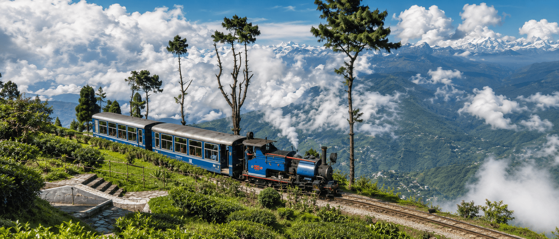
Darjeeling Himalayan Railway
India's UNESCO Toy Train climbing the Himalayas via loops and zig-zags since 1881

Venice Simplon-Orient-Express
London to Venice in 1920s Wagons-Lits splendour
Spots Along the Route
Toltec Gorge (C&TS Railroad)
Toltec Gorge is the most dramatic section of the Cumbres & Toltec Scenic Railroad's 64-mile narrow-gauge route, where K-36 2-8-2 steam locomotives cling to a ledge 600 feet above the Rio de los Pinos. A Forest Service overlook on FR 103 provides a bird's-eye view of trains rounding the canyon wall — accessible to railfans without buying a ticket.
Raton Pass
Historic mountain pass on BNSF's Raton Subdivision at the Colorado–New Mexico border, where Amtrak's Southwest Chief climbs grades up to 3.5% through the 1908 tunnel at 7,588 ft elevation.
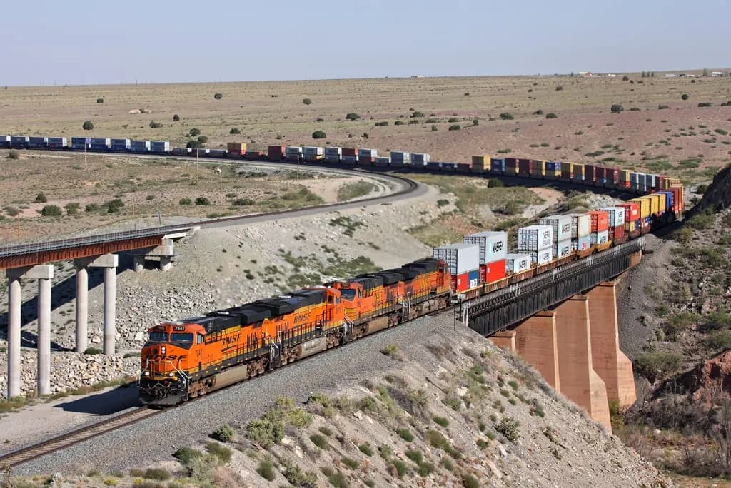
Gallup (Transcon)
Downtown Gallup sits on the BNSF Gallup Subdivision of the Southern Transcon, where 100+ freight trains and two daily Amtrak Southwest Chiefs pass the 1918 Mission Revival depot along historic Route 66.
Palmer Lake (Joint Line)
Palmer Lake marks the 7,225-foot summit of the Palmer Divide on the BNSF/UP Joint Line between Denver and Pueblo. This pinch point where double track transitions to single track funnels 25-35 daily freight trains into dramatic grade-climbing action against a Pikes Peak backdrop.
Belen (Transcon Junction)
Belen is the heart of BNSF's Southern Transcon, where three subdivisions converge at one of the Southwest's largest rail yards. With 80-110 trains daily plus Rail Runner commuter service, this small New Mexico town delivers non-stop freight action alongside the historic Harvey House Museum.
Abo Canyon (BNSF)
Abo Canyon, located in New Mexico, is a renowned train observation spot along the BNSF Railway. This scenic area features a series of bridges and tunnels that navigate through rugged terrain, offering train enthusiasts a unique vantage point to witness the impressive engineering and frequent train traffic.
Related Experiences & Mega-Projects
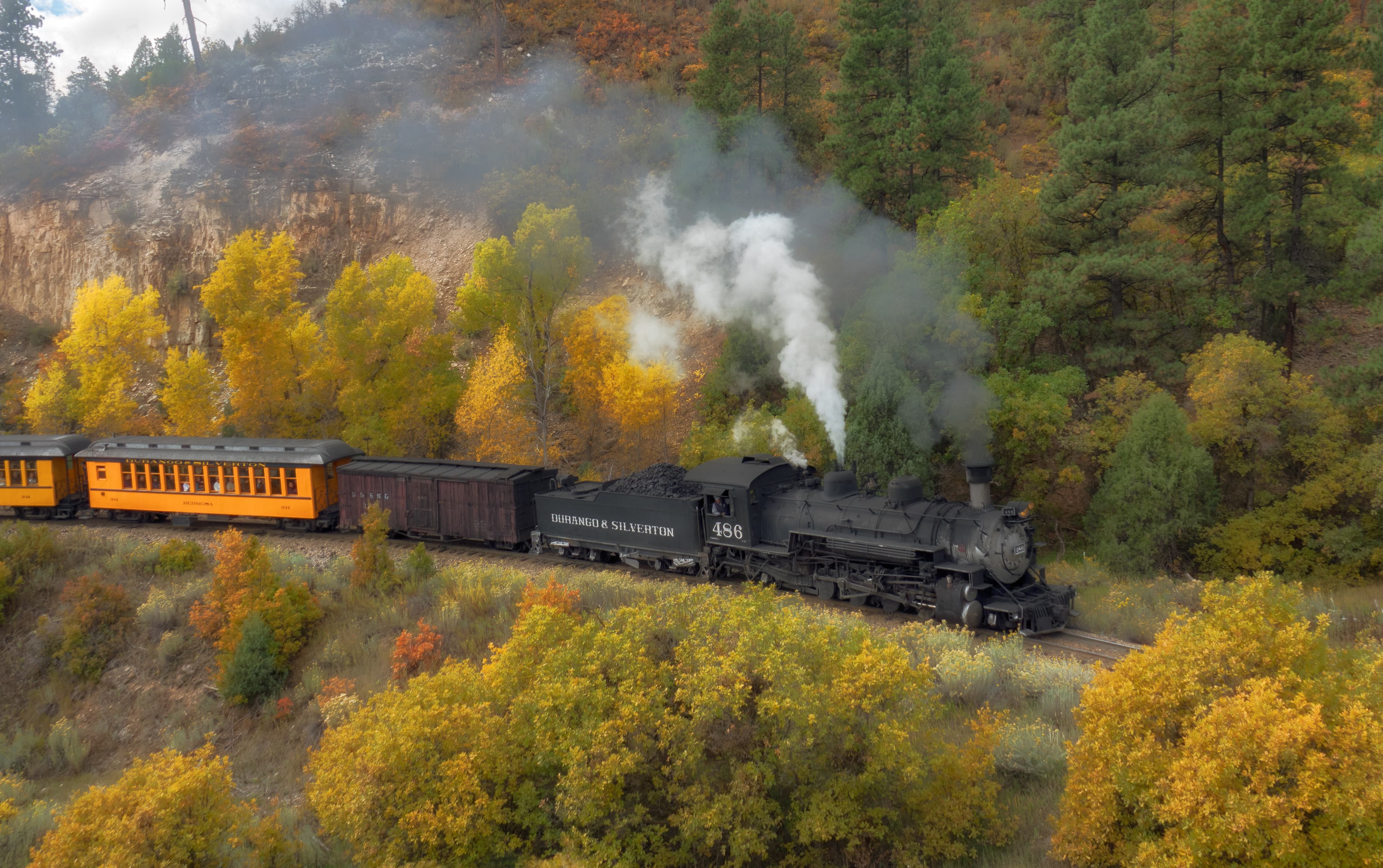
Durango & Silverton Narrow Gauge Railroad
A historic 19th-century steam railway climbing through Colorado’s San Juan Mountains on a narrow-gauge line.
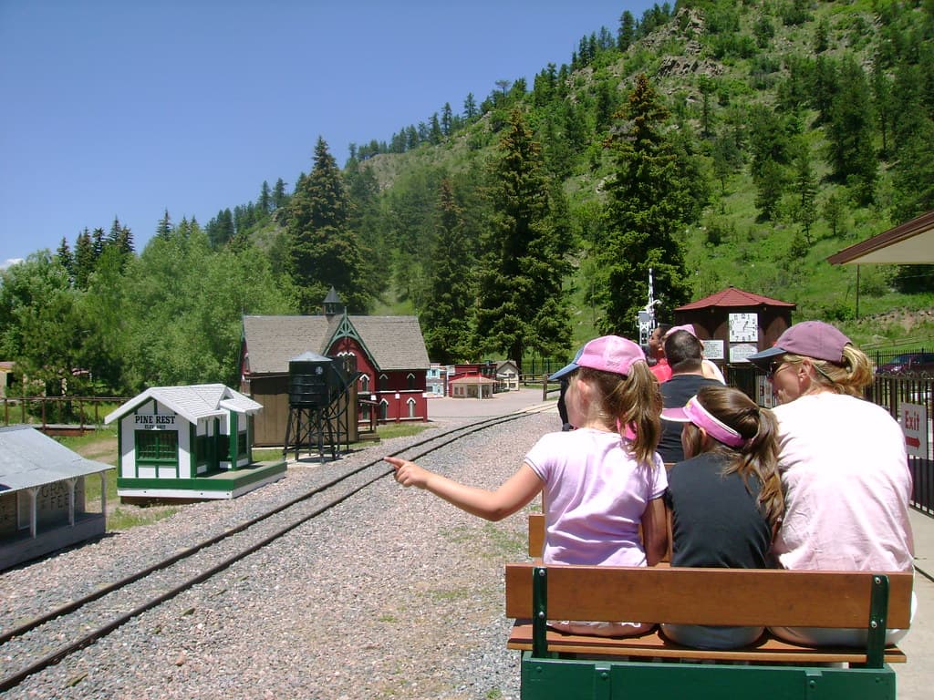
Tiny Town & Railroad
A 1/6-scale village of 100+ buildings circled by a 15-inch-gauge steam miniature railway near Morrison, Colorado.
Golden Spike Tower & Visitor Center
An eight-story observation tower over Union Pacific's Bailey Yard, the world's largest railroad classification yard.